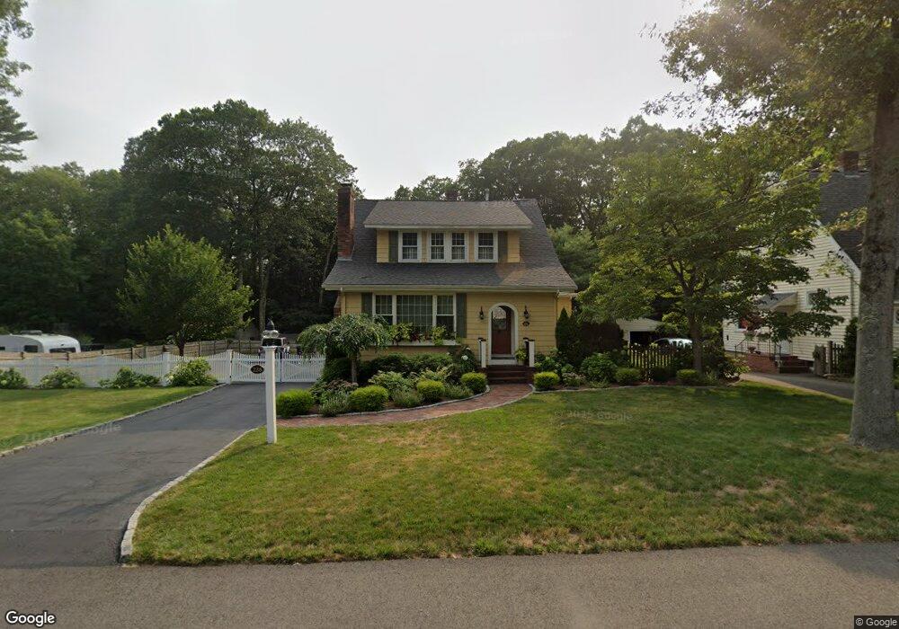
228 Lincoln St Franklin, MA 02038
Estimated Value: $663,000 - $796,000
5
Beds
4
Baths
2,335
Sq Ft
$316/Sq Ft
Est. Value
About This Home
This home is located at 228 Lincoln St, Franklin, MA 02038 and is currently estimated at $738,851, approximately $316 per square foot. 228 Lincoln St is a home located in Norfolk County with nearby schools including Oak Street Elementary School, Horace Mann Middle School, and Franklin High School.
Ownership History
Date
Name
Owned For
Owner Type
Purchase Details
Closed on
Jul 25, 2017
Sold by
Lucier Gary A and Lucier Melissa A
Bought by
Lucier Gary A
Current Estimated Value
Purchase Details
Closed on
Apr 2, 1998
Sold by
Rice Rita F
Bought by
Lucier Gary A and Lucier Melissa A
Home Financials for this Owner
Home Financials are based on the most recent Mortgage that was taken out on this home.
Original Mortgage
$143,550
Interest Rate
6.89%
Mortgage Type
Purchase Money Mortgage
Create a Home Valuation Report for This Property
The Home Valuation Report is an in-depth analysis detailing your home's value as well as a comparison with similar homes in the area
Home Values in the Area
Average Home Value in this Area
Purchase History
| Date | Buyer | Sale Price | Title Company |
|---|---|---|---|
| Lucier Gary A | -- | -- | |
| Lucier Gary A | $159,500 | -- |
Source: Public Records
Mortgage History
| Date | Status | Borrower | Loan Amount |
|---|---|---|---|
| Previous Owner | Lucier Gary A | $275,000 | |
| Previous Owner | Lucier Gary A | $143,550 |
Source: Public Records
Tax History Compared to Growth
Tax History
| Year | Tax Paid | Tax Assessment Tax Assessment Total Assessment is a certain percentage of the fair market value that is determined by local assessors to be the total taxable value of land and additions on the property. | Land | Improvement |
|---|---|---|---|---|
| 2025 | $6,873 | $591,500 | $242,800 | $348,700 |
| 2024 | $6,565 | $556,800 | $242,800 | $314,000 |
| 2023 | $6,357 | $505,300 | $253,300 | $252,000 |
| 2022 | $6,067 | $431,800 | $209,300 | $222,500 |
| 2021 | $5,627 | $384,100 | $205,300 | $178,800 |
| 2020 | $5,669 | $390,700 | $220,600 | $170,100 |
| 2019 | $5,418 | $369,600 | $199,500 | $170,100 |
| 2018 | $5,302 | $361,900 | $209,100 | $152,800 |
| 2017 | $5,024 | $344,600 | $191,800 | $152,800 |
| 2016 | $4,936 | $340,400 | $204,700 | $135,700 |
| 2015 | $4,698 | $316,600 | $180,900 | $135,700 |
| 2014 | $4,426 | $306,300 | $170,600 | $135,700 |
Source: Public Records
Map
Nearby Homes
- 204 Lincoln St
- 17 Longhill Rd
- 48 Pinehurst St
- 150 Pleasant St
- 266 Pleasant St
- 2 Kayla Dr
- 324 Pleasant St
- 14 Pleasant St Unit A
- 336 Maple St
- 0 Upper Union St Unit 73230551
- 76 Dean Ave
- 41 Kimberlee Ave
- 120 Union St Unit 1
- 57 Raymond St Unit 2
- 31 Highwood Dr
- 66 Highwood Dr
- 6 Buena Vista Dr
- 83 Highwood Dr Unit 83
- 67 Milliken Ave Unit 22
- 159 Highwood Dr