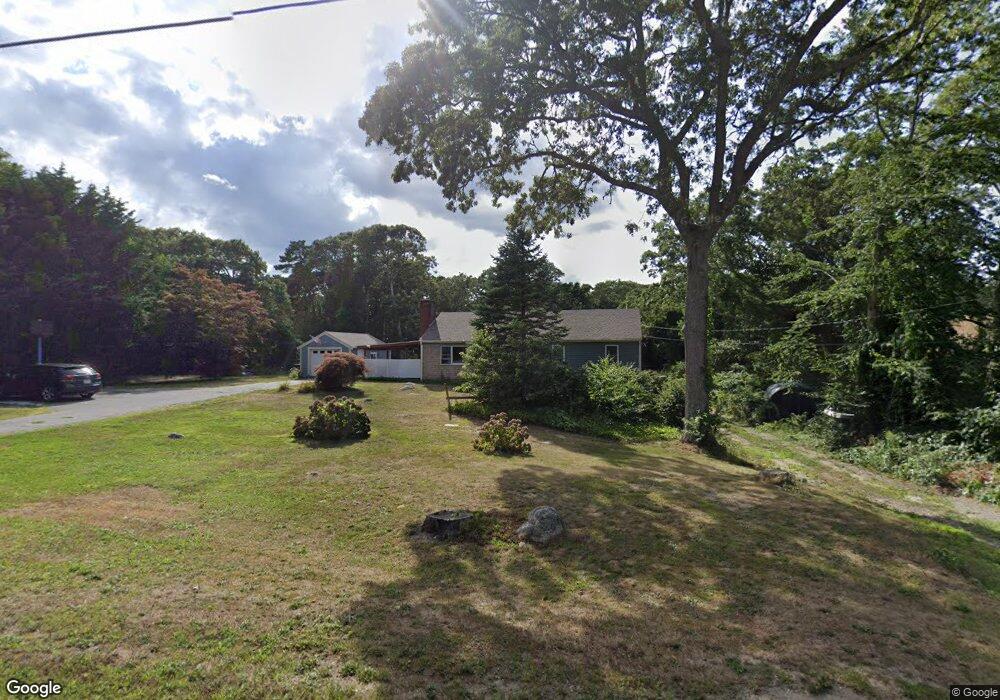
228 Underpass Rd Brewster, MA 02631
Estimated Value: $674,000 - $727,000
3
Beds
2
Baths
1,196
Sq Ft
$585/Sq Ft
Est. Value
About This Home
This home is located at 228 Underpass Rd, Brewster, MA 02631 and is currently estimated at $700,124, approximately $585 per square foot. 228 Underpass Rd is a home located in Barnstable County with nearby schools including Stony Brook Elementary School, Eddy Elementary School, and Nauset Regional Middle School.
Ownership History
Date
Name
Owned For
Owner Type
Purchase Details
Closed on
Apr 20, 2021
Sold by
Mooney Ft and Harris
Bought by
Harris Kimberly J and Harris Shawn D
Current Estimated Value
Home Financials for this Owner
Home Financials are based on the most recent Mortgage that was taken out on this home.
Original Mortgage
$205,000
Outstanding Balance
$183,636
Interest Rate
3.05%
Mortgage Type
New Conventional
Estimated Equity
$516,488
Purchase Details
Closed on
Apr 12, 1996
Sold by
Roy James Mg
Bought by
Mooney Kevin J and Mooney Sandra A
Home Financials for this Owner
Home Financials are based on the most recent Mortgage that was taken out on this home.
Original Mortgage
$92,000
Interest Rate
7.39%
Mortgage Type
Purchase Money Mortgage
Create a Home Valuation Report for This Property
The Home Valuation Report is an in-depth analysis detailing your home's value as well as a comparison with similar homes in the area
Home Values in the Area
Average Home Value in this Area
Purchase History
| Date | Buyer | Sale Price | Title Company |
|---|---|---|---|
| Harris Kimberly J | -- | None Available | |
| Harris Kimberly J | -- | None Available | |
| Mooney Kevin J | $115,000 | -- | |
| Mooney Kevin J | $115,000 | -- |
Source: Public Records
Mortgage History
| Date | Status | Borrower | Loan Amount |
|---|---|---|---|
| Open | Harris Kimberly J | $205,000 | |
| Closed | Harris Kimberly J | $205,000 | |
| Previous Owner | Mooney Kevin J | $10,387 | |
| Previous Owner | Mooney Kevin J | $92,000 |
Source: Public Records
Tax History
| Year | Tax Paid | Tax Assessment Tax Assessment Total Assessment is a certain percentage of the fair market value that is determined by local assessors to be the total taxable value of land and additions on the property. | Land | Improvement |
|---|---|---|---|---|
| 2025 | $3,787 | $550,500 | $276,500 | $274,000 |
| 2024 | $3,568 | $524,000 | $260,900 | $263,100 |
| 2023 | $3,094 | $442,600 | $207,000 | $235,600 |
| 2022 | $2,928 | $373,000 | $172,400 | $200,600 |
| 2021 | $2,748 | $320,300 | $149,900 | $170,400 |
| 2020 | $2,707 | $314,000 | $149,900 | $164,100 |
| 2019 | $2,752 | $320,700 | $162,300 | $158,400 |
| 2018 | $2,618 | $317,000 | $162,300 | $154,700 |
| 2017 | $2,494 | $297,300 | $162,300 | $135,000 |
| 2016 | $2,477 | $293,800 | $159,200 | $134,600 |
| 2015 | $2,231 | $270,100 | $138,700 | $131,400 |
Source: Public Records
Map
Nearby Homes
- 103 Trevor Ln Unit 103
- 2019 Main St
- 81 Fletcher Ln Unit H
- 81 Fletcher Ln Unit H
- 87 N Pond Dr
- 39 Spruce Run Dr
- 100 Fletcher Ln Unit E
- 0 Old Chatham Rd
- 235 Old Chatham Rd
- 958 Long Pond Rd
- 1861 Main St
- 398 Lund Farm Way
- 204 Eaton Ln Unit 204
- 14 Howland Cir Unit 14
- 16 Commons Way
- 0 Commons Way Unit 22504099
- 1580 Main St
- 184 Barons Way
- 274 Commons Way
- 337 Jonathans Way
- 238 Underpass Rd
- 238 N Underpass
- 217 Underpass Rd
- 235 Underpass Rd
- 250 Underpass Rd
- 252 Underpass Rd
- 252 Underpass Rd Unit 250UP
- 252 Underpass Rd Unit 252UP
- 239 Underpass Rd
- 198 Underpass Rd
- 9 Sara Ann Ln
- 23 Independence Way
- 280-282 Underpass Rd
- 0 Independence Way L:7
- 0 Independence Way
- 215 Underpass Rd
- 32 Sara Ann Ln
- 260 Underpass Rd
- 1 Independence Way
- 43 Independence Way
Your Personal Tour Guide
Ask me questions while you tour the home.