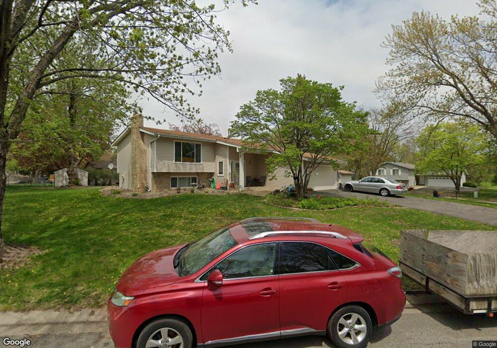
2289 Clark St Saint Paul, MN 55122
Estimated Value: $376,000 - $419,805
4
Beds
2
Baths
1,172
Sq Ft
$343/Sq Ft
Est. Value
About This Home
This home is located at 2289 Clark St, Saint Paul, MN 55122 and is currently estimated at $401,701, approximately $342 per square foot. 2289 Clark St is a home located in Dakota County with nearby schools including William Byrne Elementary School, Burnsville High School, and Gateway STEM Academy.
Ownership History
Date
Name
Owned For
Owner Type
Purchase Details
Closed on
Oct 27, 2005
Sold by
Edrington Kimberly and Edrington James Robert
Bought by
Aung Kyaw Soe and Aung Phyu
Current Estimated Value
Purchase Details
Closed on
Sep 3, 2002
Sold by
Kummer Meghan J and Kummer Charlie
Bought by
Edrington Kimberly and Edrington Robert
Purchase Details
Closed on
Jul 31, 1998
Sold by
Bond Barbara J
Bought by
Quinn Meghan J
Create a Home Valuation Report for This Property
The Home Valuation Report is an in-depth analysis detailing your home's value as well as a comparison with similar homes in the area
Home Values in the Area
Average Home Value in this Area
Purchase History
| Date | Buyer | Sale Price | Title Company |
|---|---|---|---|
| Aung Kyaw Soe | $255,440 | -- | |
| Edrington Kimberly | $226,000 | -- | |
| Quinn Meghan J | $145,000 | -- |
Source: Public Records
Tax History
| Year | Tax Paid | Tax Assessment Tax Assessment Total Assessment is a certain percentage of the fair market value that is determined by local assessors to be the total taxable value of land and additions on the property. | Land | Improvement |
|---|---|---|---|---|
| 2024 | $3,342 | $345,900 | $90,600 | $255,300 |
| 2023 | $3,342 | $354,900 | $90,800 | $264,100 |
| 2022 | $2,964 | $339,200 | $90,600 | $248,600 |
| 2021 | $2,930 | $303,100 | $78,700 | $224,400 |
| 2020 | $3,060 | $283,500 | $75,000 | $208,500 |
| 2019 | $2,968 | $284,300 | $71,400 | $212,900 |
| 2018 | $2,817 | $265,600 | $68,000 | $197,600 |
| 2017 | $2,571 | $243,700 | $64,800 | $178,900 |
| 2016 | $2,622 | $224,100 | $61,700 | $162,400 |
| 2015 | $2,425 | $202,015 | $56,785 | $145,230 |
| 2014 | -- | $193,295 | $54,835 | $138,460 |
| 2013 | -- | $183,812 | $49,397 | $134,415 |
Source: Public Records
Map
Nearby Homes
- 4165 Old Sibley Hwy
- 11036 27th Ave S
- 11017 27th Ave S
- 2216 Water Lilly Ln Unit 607
- 4247 Limestone Dr
- 3108 Red Oak Cir N
- 3309 Red Oak Cir N
- 2079 Garnet Ln
- 2001 Woods Ln
- 2209 E 117th St Unit 109
- 2404 Hayes Ct
- 11900 Highland View Cir
- 2008 Zircon Ln
- 10931 Territorial Dr
- 2200 Horizon Rd
- 4035 River Valley Way
- 1601 Raleigh Dr
- 2093 Vienna Ln
- 4002 Cedar Grove Ln
- 1917 Jan Echo Trail