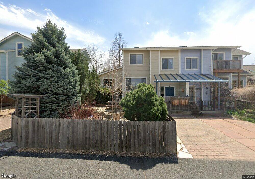
2289 Shooting Star Ln Fort Collins, CO 80521
Estimated Value: $444,305 - $537,000
3
Beds
3
Baths
1,234
Sq Ft
$414/Sq Ft
Est. Value
About This Home
This home is located at 2289 Shooting Star Ln, Fort Collins, CO 80521 and is currently estimated at $511,326, approximately $414 per square foot. 2289 Shooting Star Ln is a home located in Larimer County with nearby schools including Irish Elementary School, Lincoln Middle School, and Poudre High School.
Ownership History
Date
Name
Owned For
Owner Type
Purchase Details
Closed on
Aug 29, 2008
Sold by
Anderson Newton Gabriel T
Bought by
Gregory Daniel I and Gregory Katharine P
Current Estimated Value
Home Financials for this Owner
Home Financials are based on the most recent Mortgage that was taken out on this home.
Original Mortgage
$120,000
Outstanding Balance
$80,349
Interest Rate
6.66%
Mortgage Type
Purchase Money Mortgage
Estimated Equity
$430,977
Purchase Details
Closed on
Aug 24, 2006
Sold by
Gregory Daniel Ingersoll and Gregory Katharine Porter
Bought by
Anderson Newton Gabriel T
Home Financials for this Owner
Home Financials are based on the most recent Mortgage that was taken out on this home.
Original Mortgage
$52,000
Interest Rate
6.39%
Mortgage Type
Stand Alone Second
Purchase Details
Closed on
Mar 1, 1996
Sold by
Fort Collins Cohousing Community Llc
Bought by
Gregory Katharine Porter
Create a Home Valuation Report for This Property
The Home Valuation Report is an in-depth analysis detailing your home's value as well as a comparison with similar homes in the area
Home Values in the Area
Average Home Value in this Area
Purchase History
| Date | Buyer | Sale Price | Title Company |
|---|---|---|---|
| Gregory Daniel I | $280,257 | Land Title Guarantee Company | |
| Anderson Newton Gabriel T | $260,000 | Land Title Guarantee Company | |
| Gregory Katharine Porter | $166,500 | -- |
Source: Public Records
Mortgage History
| Date | Status | Borrower | Loan Amount |
|---|---|---|---|
| Open | Gregory Daniel I | $120,000 | |
| Previous Owner | Anderson Newton Gabriel T | $52,000 | |
| Previous Owner | Anderson Newton Gabriel T | $208,000 |
Source: Public Records
Tax History Compared to Growth
Tax History
| Year | Tax Paid | Tax Assessment Tax Assessment Total Assessment is a certain percentage of the fair market value that is determined by local assessors to be the total taxable value of land and additions on the property. | Land | Improvement |
|---|---|---|---|---|
| 2025 | $1,187 | $22,592 | $3,216 | $19,376 |
| 2024 | $1,130 | $22,592 | $3,216 | $19,376 |
| 2022 | $1,359 | $21,184 | $3,336 | $17,848 |
| 2021 | $2,040 | $21,793 | $3,432 | $18,361 |
| 2020 | $2,273 | $24,081 | $3,432 | $20,649 |
| 2019 | $2,284 | $24,081 | $3,432 | $20,649 |
| 2018 | $2,085 | $22,680 | $3,456 | $19,224 |
| 2017 | $2,078 | $22,680 | $3,456 | $19,224 |
| 2016 | $1,838 | $19,964 | $3,821 | $16,143 |
| 2015 | $1,825 | $19,960 | $3,820 | $16,140 |
| 2014 | $1,616 | $17,560 | $3,820 | $13,740 |
Source: Public Records
Map
Nearby Homes
- 2121 Liberty Dr
- 2205 Stonecrest Dr
- 1340 N Taft Hill Rd
- 1361 Bubbling Brook Ct
- 508 N Sunset St
- 241 N Taft Hill Rd
- 329 N Sunset St
- 2810 Cherry Ln
- 123 County Road 19
- 209 N Taft Hill Rd
- 2028 Laporte Ave
- 2704 Laporte Ave
- 2708 Laporte Ave
- 3075 Headwater Dr
- 1392 Cherry St
- 100 Grandview Ave
- 1255 Alameda St
- 410 High Ct
- 1225 Alameda St
- 1213 Pomona St
- 2295 Shooting Star Ln
- 2283 Shooting Star Ln
- 2277 Shooting Star Ln
- 966 Wild Cherry Ln
- 2271 Shooting Star Ln
- 960 Wild Cherry Ln
- 924 Wild Cherry Ln
- 918 Wild Cherry Ln
- 930 Wild Cherry Ln
- 936 Wild Cherry Ln
- 912 Wild Cherry Ln
- 957 Wild Cherry Ln
- 957 Wild Cherry Ln
- 906 Wild Cherry Ln
- 951 Wild Cherry Ln
- 900 Wild Cherry Ln
- 945 Wild Cherry Ln
- 2232 Sun Rose Way
- 2226 Sun Rose Way
- 2238 Sun Rose Way