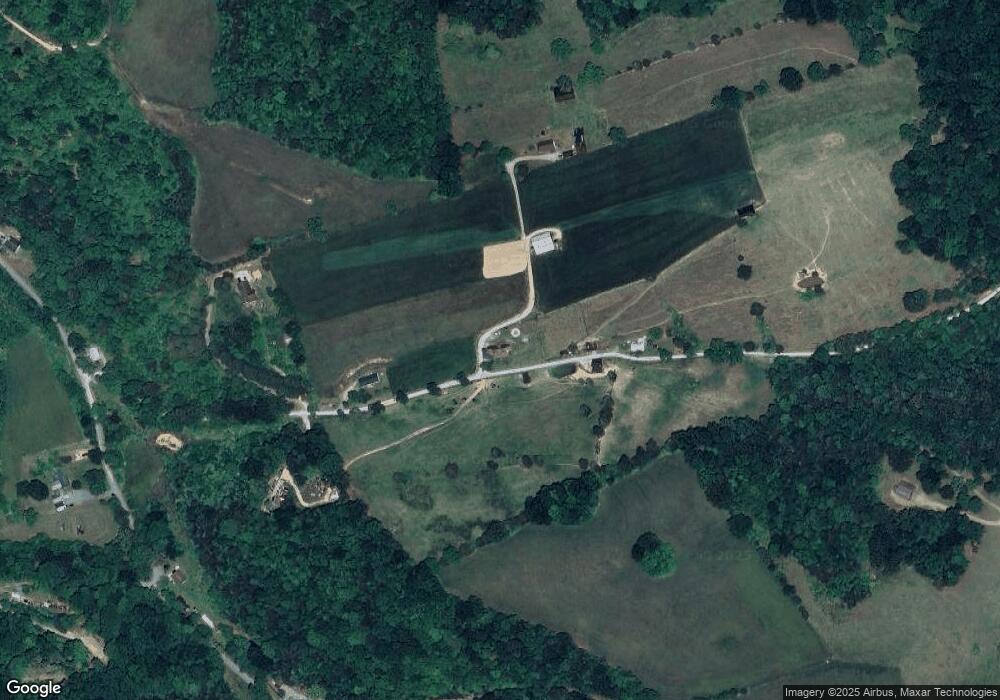
229 Brantley Rd Harrogate, TN 37752
Estimated Value: $341,349 - $411,000
--
Bed
3
Baths
2,400
Sq Ft
$157/Sq Ft
Est. Value
About This Home
This home is located at 229 Brantley Rd, Harrogate, TN 37752 and is currently estimated at $376,337, approximately $156 per square foot. 229 Brantley Rd is a home located in Claiborne County with nearby schools including Tri-State Christian Academy.
Ownership History
Date
Name
Owned For
Owner Type
Purchase Details
Closed on
Jul 16, 2020
Sold by
Massengill Brenda Carol
Bought by
Massengill Steven Michael
Current Estimated Value
Purchase Details
Closed on
Jun 5, 1997
Sold by
Carmon Dan and Carmon Ollie L
Bought by
Massengill Mike
Home Financials for this Owner
Home Financials are based on the most recent Mortgage that was taken out on this home.
Original Mortgage
$37,500
Outstanding Balance
$5,380
Interest Rate
8.01%
Estimated Equity
$370,957
Purchase Details
Closed on
Sep 23, 1991
Bought by
Carmon Dan and Carmon Ollie L
Purchase Details
Closed on
Jan 1, 1972
Bought by
Carmon Dan and Carmon Ollie
Create a Home Valuation Report for This Property
The Home Valuation Report is an in-depth analysis detailing your home's value as well as a comparison with similar homes in the area
Home Values in the Area
Average Home Value in this Area
Purchase History
| Date | Buyer | Sale Price | Title Company |
|---|---|---|---|
| Massengill Steven Michael | -- | None Available | |
| Massengill Mike | $25,000 | -- | |
| Carmon Dan | -- | -- | |
| Carmon Dan | -- | -- |
Source: Public Records
Mortgage History
| Date | Status | Borrower | Loan Amount |
|---|---|---|---|
| Open | Carmon Dan | $37,500 |
Source: Public Records
Tax History Compared to Growth
Tax History
| Year | Tax Paid | Tax Assessment Tax Assessment Total Assessment is a certain percentage of the fair market value that is determined by local assessors to be the total taxable value of land and additions on the property. | Land | Improvement |
|---|---|---|---|---|
| 2024 | $1,523 | $65,075 | $3,125 | $61,950 |
| 2023 | $1,523 | $65,075 | $3,125 | $61,950 |
| 2022 | $1,302 | $65,075 | $3,125 | $61,950 |
| 2021 | $1,238 | $48,025 | $2,750 | $45,275 |
| 2020 | $1,238 | $48,025 | $2,750 | $45,275 |
| 2019 | $1,238 | $48,025 | $2,750 | $45,275 |
| 2018 | $1,238 | $48,025 | $2,750 | $45,275 |
| 2017 | $1,238 | $48,025 | $2,750 | $45,275 |
| 2016 | $1,226 | $47,525 | $2,750 | $44,775 |
| 2015 | $1,179 | $47,525 | $2,750 | $44,775 |
| 2014 | $1,179 | $47,536 | $0 | $0 |
Source: Public Records
Map
Nearby Homes
- 129 Norfolk Cir
- 135 Osborne Ln
- 257 Parliament Rd
- 154 Stonehenge St
- 185 River Rd
- 696 Forge Ridge Rd
- 000 Forge Ridge Rd
- Lot 18 Danielle Ct
- 157 Danielle Ct
- Lot 17 Danielle Ct
- Lot 29 Zachary Ct
- Lot 30 Robbins Ln
- 262 Cresent St
- 262 Oxford Cir
- 0 Tower St
- 254 Cumberland Dr
- 187 Oxford Cir
- 253 Lincoln Dr
- 127 Carlyle Ave
- 222 Lincoln Dr
- 237 Brantley Rd
- 185 Brantley Rd
- 169 Brantley Rd
- 271 Brantley Rd
- 170 Brantley Rd
- 166 Brantley Rd
- 105 Brantley Rd
- 729 River Rd
- 855 Pump Springs Rd
- 726 River Rd
- 657 River Rd
- 109 Libby Ln
- 179 Brock Ln
- 324 Mockingbird Cir
- 704 Pump Springs Rd
- 379 Mockingbird Cir
- 185 Libby Ln
- 994 Pump Springs Rd
- 293 Mockingbird Cir
- 593 River Rd
