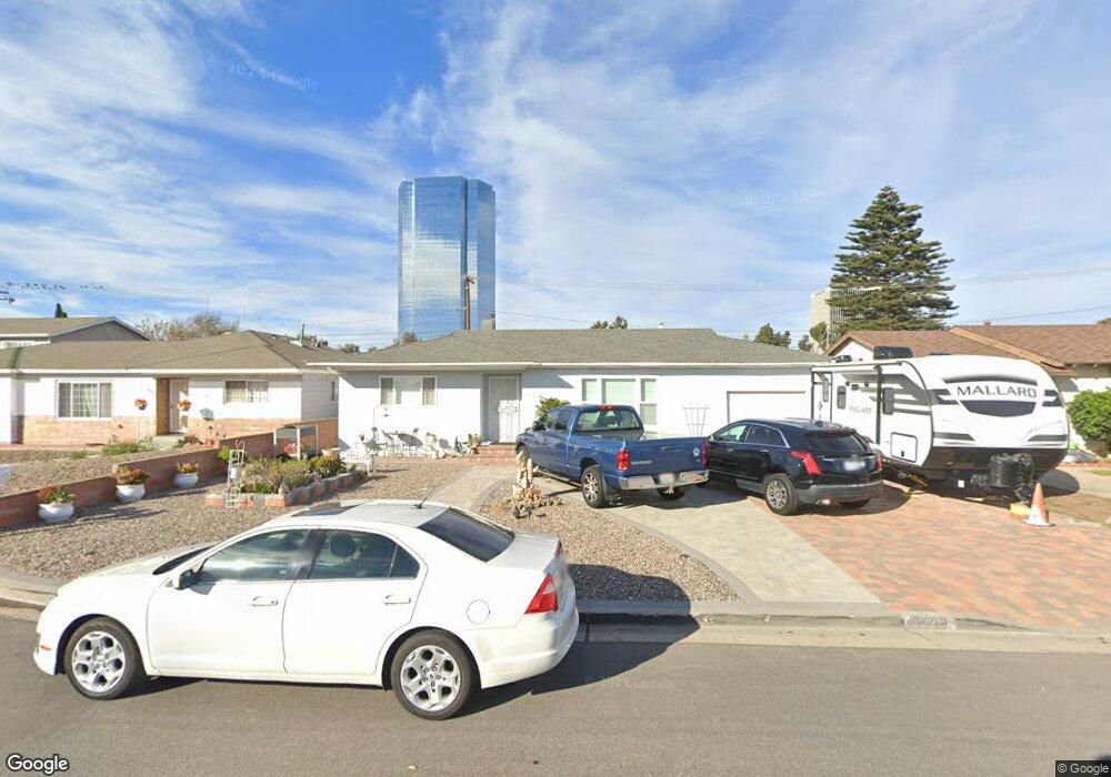
229 Occidental Dr Oxnard, CA 93036
Rio Lindo NeighborhoodEstimated Value: $526,000 - $654,000
3
Beds
1
Bath
1,086
Sq Ft
$544/Sq Ft
Est. Value
About This Home
This home is located at 229 Occidental Dr, Oxnard, CA 93036 and is currently estimated at $590,770, approximately $543 per square foot. 229 Occidental Dr is a home located in Ventura County with nearby schools including Rio Lindo Elementary School, Rio Del Valle Middle School, and Pacifica High School.
Ownership History
Date
Name
Owned For
Owner Type
Purchase Details
Closed on
Jun 8, 2017
Sold by
Jay Terry Lee and Jay Lori L
Bought by
Jay Terry Lee and Jay Lori Louise
Current Estimated Value
Purchase Details
Closed on
Mar 22, 2000
Sold by
Vader Lawrence A and Vader Mary A
Bought by
Jay Terry Lee and Jay Lori L
Home Financials for this Owner
Home Financials are based on the most recent Mortgage that was taken out on this home.
Original Mortgage
$188,712
Outstanding Balance
$63,726
Interest Rate
8.24%
Mortgage Type
FHA
Estimated Equity
$527,044
Create a Home Valuation Report for This Property
The Home Valuation Report is an in-depth analysis detailing your home's value as well as a comparison with similar homes in the area
Home Values in the Area
Average Home Value in this Area
Purchase History
| Date | Buyer | Sale Price | Title Company |
|---|---|---|---|
| Jay Terry Lee | -- | None Available | |
| Jay Terry Lee | $190,000 | Lawyers Title Company |
Source: Public Records
Mortgage History
| Date | Status | Borrower | Loan Amount |
|---|---|---|---|
| Open | Jay Terry Lee | $188,712 |
Source: Public Records
Tax History
| Year | Tax Paid | Tax Assessment Tax Assessment Total Assessment is a certain percentage of the fair market value that is determined by local assessors to be the total taxable value of land and additions on the property. | Land | Improvement |
|---|---|---|---|---|
| 2025 | $3,297 | $292,000 | $199,796 | $92,204 |
| 2024 | $3,297 | $286,275 | $195,878 | $90,397 |
| 2023 | $3,216 | $280,662 | $192,037 | $88,625 |
| 2022 | $3,122 | $275,159 | $188,271 | $86,888 |
| 2021 | $3,129 | $269,764 | $184,579 | $85,185 |
| 2020 | $4,604 | $267,000 | $182,688 | $84,312 |
| 2019 | $4,467 | $261,765 | $179,106 | $82,659 |
| 2018 | $4,353 | $256,634 | $175,595 | $81,039 |
| 2017 | $2,875 | $251,602 | $172,152 | $79,450 |
| 2016 | $2,750 | $246,670 | $168,777 | $77,893 |
| 2015 | $2,793 | $242,967 | $166,243 | $76,724 |
| 2014 | $2,669 | $238,210 | $162,988 | $75,222 |
Source: Public Records
Map
Nearby Homes
- 209 Lafayette Dr
- 2160 Blackberry Cir
- 2016 Blackberry Cir
- 2005 Blackberry Cir
- 2041 Blackberry Cir
- 2225 Edelweiss St Unit 43
- 2408 Apple Ln Unit 154
- 2250 Mono St
- 2475 Apple Ln Unit 129
- 550 Holly Ave
- 2455 Blueberry Dr Unit 120
- 650 Bluebell Place
- 643 Holly Ave
- 2701 Alvarado St
- 620 W Gonzales Rd
- 620 W Gonzales Rd Unit B
- 620 W Gonzales Rd Unit C
- 620 W Gonzales Rd Unit D
- 620 W Gonzales Rd Unit A
- 901 Indigo Place
- 235 Occidental Dr
- 223 Occidental Dr
- 241 Occidental Dr
- 198 Saint Marys Dr
- 206 Saint Marys Dr
- 190 Saint Marys Dr
- 161 Purdue St
- 216 Saint Marys Dr
- 247 Occidental Dr
- 228 Purdue St
- 180 St Marys Dr
- 180 Saint Marys Dr
- 234 Occidental Dr
- 139 Purdue St
- 224 Saint Marys Dr
- 240 Occidental Dr
- 174 Stanford Ave
- 162 Stanford Ave
- 253 Occidental Dr
- 186 Stanford Ave
Your Personal Tour Guide
Ask me questions while you tour the home.