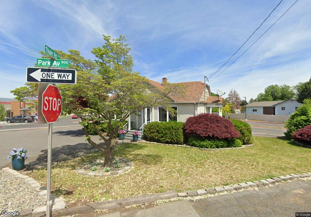
229 Thain Rd Lewiston, ID 83501
Estimated Value: $246,000 - $383,000
Studio
--
Bath
1,640
Sq Ft
$183/Sq Ft
Est. Value
About This Home
This home is located at 229 Thain Rd, Lewiston, ID 83501 and is currently estimated at $299,887, approximately $182 per square foot. 229 Thain Rd is a home located in Nez Perce County with nearby schools including Orchards Elementary School, Lewiston High School, and All Saints Catholic School.
Ownership History
Date
Name
Owned For
Owner Type
Purchase Details
Closed on
Jul 17, 2025
Sold by
Rising Phoenix Rentals Llc
Bought by
Roanoke Rentals Llc
Current Estimated Value
Home Financials for this Owner
Home Financials are based on the most recent Mortgage that was taken out on this home.
Original Mortgage
$277,500
Outstanding Balance
$277,026
Interest Rate
6.81%
Mortgage Type
New Conventional
Estimated Equity
$22,861
Purchase Details
Closed on
Oct 10, 2018
Sold by
Brewer John and Brewer Melba
Bought by
Wold Tim and Wold Jean
Create a Home Valuation Report for This Property
The Home Valuation Report is an in-depth analysis detailing your home's value as well as a comparison with similar homes in the area
Purchase History
| Date | Buyer | Sale Price | Title Company |
|---|---|---|---|
| Roanoke Rentals Llc | -- | Flying S Title | |
| Wold Tim | -- | Land Title |
Source: Public Records
Mortgage History
| Date | Status | Borrower | Loan Amount |
|---|---|---|---|
| Open | Roanoke Rentals Llc | $277,500 |
Source: Public Records
Tax History
| Year | Tax Paid | Tax Assessment Tax Assessment Total Assessment is a certain percentage of the fair market value that is determined by local assessors to be the total taxable value of land and additions on the property. | Land | Improvement |
|---|---|---|---|---|
| 2025 | $3,475 | $245,779 | $144,279 | $101,500 |
| 2024 | $35 | $236,522 | $131,422 | $105,100 |
| 2023 | $3,303 | $215,212 | $93,912 | $121,300 |
| 2022 | $3,503 | $208,277 | $85,477 | $122,800 |
| 2021 | $3,313 | $168,204 | $77,604 | $90,600 |
| 2020 | $2,914 | $147,482 | $67,482 | $80,000 |
| 2019 | $3,196 | $147,482 | $67,482 | $80,000 |
| 2018 | $3,223 | $147,482 | $67,482 | $80,000 |
| 2017 | $2,864 | $0 | $0 | $0 |
| 2016 | $2,864 | $0 | $0 | $0 |
| 2015 | $2,851 | $0 | $0 | $0 |
| 2014 | $2,818 | $142,482 | $67,482 | $75,000 |
Source: Public Records
Map
Nearby Homes
- 930 Preston Ave
- 935 Preston Ave
- 928 Warner Ave Unit 8
- 0000 Warner Ave
- 819 Park Ave
- 3215 Blackhawk Ct
- 3213 Blackhawk Ct
- 3217 Blackhawk Ct
- 812 Preston Ave
- 930 Cypress Ct Unit A
- 925 Hawthorne St Unit A
- 935 Cypress Ct
- 709 Park Ave
- 3415 11th St
- 1719 Pathway Ct
- 2942 Spruce St
- 1009 Burrell Ave
- 837 Burrell
- 733 Airway Ave
- 1129 Bryden Ave
- 227 Thain Rd
- 2210 Hemlock Ave
- 2220 Hemlock Ave
- 927 Park Ave
- 234 Thain Rd
- 224 Thain Rd
- 929 Park Ave
- 916 Park Ave
- 916 Park Ave
- 243 Thain Rd
- 931 Park Ave
- 914 Park Ave
- 238 Thain Rd Unit Due NW of Strike n S
- 3210 10th St
- 236 Thain Rd Unit Presently a race tra
- 236 Thain Rd
- 245 Thain Rd
- 932 Park Ave
- 912 Park Ave
- 920 Preston Ave
Your Personal Tour Guide
Ask me questions while you tour the home.