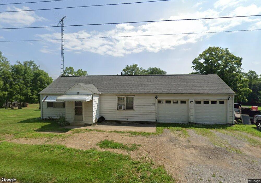
2293 State Route 179 Loudonville, OH 44842
Estimated Value: $147,000 - $202,000
3
Beds
1
Bath
1,249
Sq Ft
$138/Sq Ft
Est. Value
About This Home
This home is located at 2293 State Route 179, Loudonville, OH 44842 and is currently estimated at $171,840, approximately $137 per square foot. 2293 State Route 179 is a home located in Ashland County with nearby schools including Hillsdale Elementary School, Hillsdale Middle School, and Hillsdale High School.
Ownership History
Date
Name
Owned For
Owner Type
Purchase Details
Closed on
Jul 22, 2023
Sold by
Croskey Family Trust
Bought by
Coffman Brent Steven
Current Estimated Value
Purchase Details
Closed on
Aug 4, 2015
Sold by
Zehner Randy L
Bought by
Croskey Richard A Te and Croskey Sharon L Te
Purchase Details
Closed on
Aug 11, 2009
Sold by
Zehner Ruth A
Bought by
Croskey Richard A and Croskey Sharon L
Purchase Details
Closed on
Apr 21, 2008
Bought by
Zehner Ruth A
Purchase Details
Closed on
Jan 1, 1990
Bought by
Zehner Bradley E
Create a Home Valuation Report for This Property
The Home Valuation Report is an in-depth analysis detailing your home's value as well as a comparison with similar homes in the area
Home Values in the Area
Average Home Value in this Area
Purchase History
| Date | Buyer | Sale Price | Title Company |
|---|---|---|---|
| Coffman Brent Steven | $45,000 | None Listed On Document | |
| Croskey Richard A Te | $50,000 | -- | |
| Croskey Richard A | $50,000 | -- | |
| Zehner Ruth A | -- | -- | |
| Zehner Bradley E | -- | -- |
Source: Public Records
Tax History Compared to Growth
Tax History
| Year | Tax Paid | Tax Assessment Tax Assessment Total Assessment is a certain percentage of the fair market value that is determined by local assessors to be the total taxable value of land and additions on the property. | Land | Improvement |
|---|---|---|---|---|
| 2024 | $1,277 | $35,490 | $2,790 | $32,700 |
| 2023 | $1,216 | $35,490 | $2,790 | $32,700 |
| 2022 | $1,132 | $25,360 | $2,000 | $23,360 |
| 2021 | $1,133 | $25,360 | $2,000 | $23,360 |
| 2020 | $1,067 | $25,360 | $2,000 | $23,360 |
| 2019 | $972 | $22,530 | $1,970 | $20,560 |
| 2018 | $945 | $22,530 | $1,970 | $20,560 |
| 2017 | $855 | $22,530 | $1,970 | $20,560 |
| 2016 | $855 | $20,490 | $1,800 | $18,690 |
| 2015 | $845 | $20,490 | $1,800 | $18,690 |
| 2013 | $1,050 | $23,380 | $1,800 | $21,580 |
Source: Public Records
Map
Nearby Homes
- 2057 State Route 89
- 112 Ohio 95
- 560 Township Road 2402
- 0 Ashland County Road 2175
- 0 Ashland County Road 2175
- 609 Ohio 95
- 150 E Main St
- 14 E South St
- 7241 S Funk Rd
- 1845 County Road 655
- 2818 Township Road 2812
- 820 County Road 30a
- 1406 Pearl Dr
- 0 Township Road 925
- 500 Stone Meadow Cir
- 2445 S Elyria Rd
- 518 Snyder Dr
- 723 Pearl Dr
- 524 N Union St
- 2296 State Route 179
- 2299 Ohio 179
- 2289 State Route 179
- 2290 State Route 179
- 2290 Ohio 179
- 2298 State Route 179
- 2299 State Route 179
- 336 State Route 95
- 340 State Route 95
- 2300 Ohio 179
- 2288 County Road 377
- 2288 Cr 377
- 2288 County Road 377
- 2288 County Road 377
- 2288 County Road 377
- 332 State Route 95
- 330 State Route 95
- 333 State Route 95
- 331 State Route 95
- 301 State Route 95