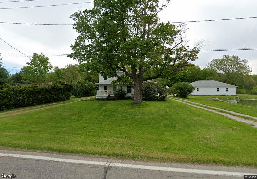
2297 Dock Rd Madison, OH 44057
Estimated Value: $186,000 - $288,000
3
Beds
2
Baths
1,039
Sq Ft
$235/Sq Ft
Est. Value
About This Home
This home is located at 2297 Dock Rd, Madison, OH 44057 and is currently estimated at $243,690, approximately $234 per square foot. 2297 Dock Rd is a home located in Lake County with nearby schools including South Elementary School, Madison Middle School, and Madison High School.
Ownership History
Date
Name
Owned For
Owner Type
Purchase Details
Closed on
Nov 26, 2021
Sold by
Selwyn June A and Selwyn John
Bought by
Selwyn June A and Selwyn John
Current Estimated Value
Purchase Details
Closed on
Dec 8, 1997
Sold by
Fox Debra Ann Nilsen
Bought by
Selwyn June A
Home Financials for this Owner
Home Financials are based on the most recent Mortgage that was taken out on this home.
Original Mortgage
$99,000
Interest Rate
7.32%
Purchase Details
Closed on
Aug 27, 1993
Bought by
Fox Deborah Ann Nilsen
Create a Home Valuation Report for This Property
The Home Valuation Report is an in-depth analysis detailing your home's value as well as a comparison with similar homes in the area
Home Values in the Area
Average Home Value in this Area
Purchase History
| Date | Buyer | Sale Price | Title Company |
|---|---|---|---|
| Selwyn June A | -- | Conway Neil J | |
| Selwyn June A | $110,000 | Commonwealth Land Title Agen | |
| Fox Deborah Ann Nilsen | $67,000 | -- |
Source: Public Records
Mortgage History
| Date | Status | Borrower | Loan Amount |
|---|---|---|---|
| Previous Owner | Selwyn June A | $99,000 |
Source: Public Records
Tax History
| Year | Tax Paid | Tax Assessment Tax Assessment Total Assessment is a certain percentage of the fair market value that is determined by local assessors to be the total taxable value of land and additions on the property. | Land | Improvement |
|---|---|---|---|---|
| 2025 | -- | $85,950 | $22,750 | $63,200 |
| 2024 | -- | $85,950 | $22,750 | $63,200 |
| 2023 | $6,419 | $57,750 | $14,690 | $43,060 |
| 2022 | $3,547 | $57,750 | $14,690 | $43,060 |
| 2021 | $3,553 | $57,750 | $14,690 | $43,060 |
| 2020 | $3,471 | $49,790 | $12,660 | $37,130 |
| 2019 | $3,473 | $49,790 | $12,660 | $37,130 |
| 2018 | $3,515 | $52,750 | $14,760 | $37,990 |
| 2017 | $3,673 | $52,750 | $14,760 | $37,990 |
| 2016 | $3,334 | $52,750 | $14,760 | $37,990 |
| 2015 | $3,178 | $52,750 | $14,760 | $37,990 |
| 2014 | $3,250 | $52,750 | $14,760 | $37,990 |
| 2013 | $3,257 | $52,750 | $14,760 | $37,990 |
Source: Public Records
Map
Nearby Homes
- 6535 N Ridge Rd W
- 6835 Shelly Dr
- 1478 Bennett Rd
- 6728 Bayside Dr Unit 21
- 20 Eddie Rd
- 1403 Dorchester Dr
- 50 Eddie Rd
- 32 Eddy Rd
- 153 Marilyn Dr
- 7561 Lake Rd
- 1180 N County Line Rd
- 1268 Oxford Dr
- 1180 Hearn Dr
- 7084 Lake Rd E
- 1826 Hubbard Rd
- 0 Walter Main
- 7911 S Ridge Rd
- V/L 20 Norton Dr
- V/L 11 Norton Dr
- V/L Magnolia #11 Dr
Your Personal Tour Guide
Ask me questions while you tour the home.