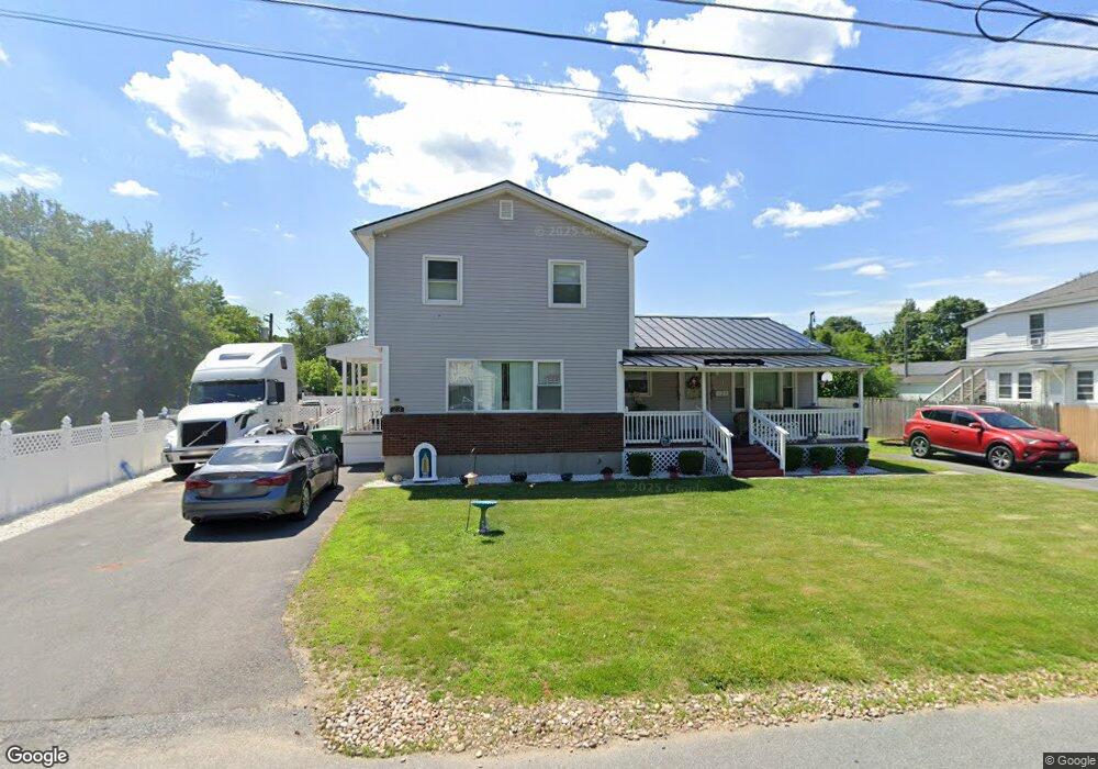
23 Benson Ave Unit 9697 Nashua, NH 03060
Southeast Nashua NeighborhoodEstimated Value: $532,000 - $571,000
--
Bed
2
Baths
1,920
Sq Ft
$289/Sq Ft
Est. Value
About This Home
This home is located at 23 Benson Ave Unit 9697, Nashua, NH 03060 and is currently estimated at $554,654, approximately $288 per square foot. 23 Benson Ave Unit 9697 is a home located in Hillsborough County with nearby schools including Dr. Norman W. Crisp Elementary School, Elm Street Middle School, and Nashua High School North.
Ownership History
Date
Name
Owned For
Owner Type
Purchase Details
Closed on
Nov 16, 2018
Sold by
Fernandez Wilman
Bought by
Bueno Inocenzio and Bueno Adriana
Current Estimated Value
Home Financials for this Owner
Home Financials are based on the most recent Mortgage that was taken out on this home.
Original Mortgage
$284,747
Outstanding Balance
$249,866
Interest Rate
4.7%
Mortgage Type
FHA
Estimated Equity
$304,788
Purchase Details
Closed on
Jun 24, 2005
Sold by
Gorveatt Floyd W
Bought by
Fernandez Wilman
Home Financials for this Owner
Home Financials are based on the most recent Mortgage that was taken out on this home.
Original Mortgage
$335,484
Interest Rate
5.82%
Mortgage Type
Purchase Money Mortgage
Create a Home Valuation Report for This Property
The Home Valuation Report is an in-depth analysis detailing your home's value as well as a comparison with similar homes in the area
Home Values in the Area
Average Home Value in this Area
Purchase History
| Date | Buyer | Sale Price | Title Company |
|---|---|---|---|
| Bueno Inocenzio | $290,000 | -- | |
| Fernandez Wilman | $340,800 | -- |
Source: Public Records
Mortgage History
| Date | Status | Borrower | Loan Amount |
|---|---|---|---|
| Open | Bueno Inocenzio | $284,747 | |
| Previous Owner | Fernandez Wilman | $309,191 | |
| Previous Owner | Fernandez Wilman | $335,484 |
Source: Public Records
Tax History Compared to Growth
Tax History
| Year | Tax Paid | Tax Assessment Tax Assessment Total Assessment is a certain percentage of the fair market value that is determined by local assessors to be the total taxable value of land and additions on the property. | Land | Improvement |
|---|---|---|---|---|
| 2024 | $8,516 | $535,600 | $148,800 | $386,800 |
| 2023 | $7,686 | $421,600 | $119,000 | $302,600 |
| 2022 | $7,618 | $421,600 | $119,000 | $302,600 |
| 2021 | $6,467 | $278,500 | $75,700 | $202,800 |
| 2020 | $1,288 | $277,800 | $75,700 | $202,100 |
| 2019 | $1,551 | $253,800 | $75,700 | $178,100 |
| 2018 | $5,351 | $252,300 | $75,700 | $176,600 |
| 2017 | $5,730 | $214,300 | $71,000 | $143,300 |
| 2016 | $5,373 | $214,300 | $71,000 | $143,300 |
| 2015 | $5,257 | $214,300 | $71,000 | $143,300 |
| 2014 | -- | $214,300 | $71,000 | $143,300 |
Source: Public Records
Map
Nearby Homes
- 4 1/2 Haines St
- 4 Haines St Unit 56
- 20 Morse Ave
- 63 Taylor St
- 24 E Otterson St
- 4 Fulton St
- 41-43 Williams St
- 95C Bowers St
- 15 Lovell St Unit 20
- 15 Lovell St Unit 10
- 13 Mulvanity St
- 2 Tetreau St Unit 18
- 18 Harbor Ave Unit 103
- 8 Nevada St
- 35-41 E Hollis St
- 92 Gillis St
- 121 Palm St
- 27 Beech St Unit 54
- 103 Temple St
- 12 Harris St Unit 68
- 19 Benson Ave
- 25 Benson Ave Unit 33
- 15 Benson Ave Unit 17
- 14 Benson Ave
- 21 Benson Ave
- 12 Benson Ave
- 17 Merrill St
- 44 Spalding St Unit 46
- 38 Spalding St Unit 25
- 68 Alstead Ave Unit 94
- 8 Benson Ave
- 34-36 Spalding St
- 34 Spalding St Unit 36
- 15 Merrill St Unit 8
- 16 Merrill St Unit 5
- 3 Benson Ave
- 52 Spalding St Unit 104
- 45 Spalding St
- 32 Spalding St
- 32 Spalding St Unit 1