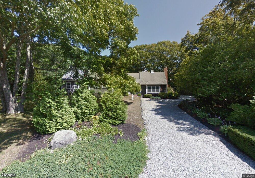
23 Captain Curtis Way Orleans, MA 02653
Estimated Value: $1,275,000 - $1,488,000
4
Beds
5
Baths
2,875
Sq Ft
$486/Sq Ft
Est. Value
About This Home
This home is located at 23 Captain Curtis Way, Orleans, MA 02653 and is currently estimated at $1,396,704, approximately $485 per square foot. 23 Captain Curtis Way is a home located in Barnstable County with nearby schools including Orleans Elementary School, Nauset Regional Middle School, and Nauset Regional High School.
Ownership History
Date
Name
Owned For
Owner Type
Purchase Details
Closed on
Dec 5, 2013
Sold by
Bruemmer Paul T and Bruemmer Kimberly W
Bought by
Kimberly W Brummer Lt
Current Estimated Value
Purchase Details
Closed on
Nov 1, 1991
Sold by
Haymes David C and Haymes Mabel L
Bought by
Bruemmer Paul T and Breummer Kimberly W
Home Financials for this Owner
Home Financials are based on the most recent Mortgage that was taken out on this home.
Original Mortgage
$105,000
Interest Rate
8.9%
Mortgage Type
Purchase Money Mortgage
Create a Home Valuation Report for This Property
The Home Valuation Report is an in-depth analysis detailing your home's value as well as a comparison with similar homes in the area
Home Values in the Area
Average Home Value in this Area
Purchase History
| Date | Buyer | Sale Price | Title Company |
|---|---|---|---|
| Kimberly W Brummer Lt | -- | -- | |
| Bruemmer Paul T | $145,000 | -- |
Source: Public Records
Mortgage History
| Date | Status | Borrower | Loan Amount |
|---|---|---|---|
| Previous Owner | Bruemmer Paul T | $105,000 |
Source: Public Records
Tax History Compared to Growth
Tax History
| Year | Tax Paid | Tax Assessment Tax Assessment Total Assessment is a certain percentage of the fair market value that is determined by local assessors to be the total taxable value of land and additions on the property. | Land | Improvement |
|---|---|---|---|---|
| 2025 | $6,647 | $1,065,300 | $287,600 | $777,700 |
| 2024 | $6,343 | $989,600 | $281,900 | $707,700 |
| 2023 | $5,705 | $915,700 | $261,100 | $654,600 |
| 2022 | $4,952 | $687,800 | $237,300 | $450,500 |
| 2021 | $0 | $604,700 | $228,800 | $375,900 |
| 2020 | $4,595 | $607,800 | $239,200 | $368,600 |
| 2019 | $4,245 | $573,700 | $212,300 | $361,400 |
| 2018 | $4,084 | $545,000 | $208,200 | $336,800 |
| 2017 | $3,847 | $529,300 | $208,200 | $321,100 |
| 2016 | $3,367 | $521,200 | $206,500 | $314,700 |
| 2015 | $3,228 | $502,800 | $192,800 | $310,000 |
Source: Public Records
Map
Nearby Homes
- 6 Hathorne Ln
- 53 Great Oak Rd
- 18 Cole Place
- 3 Bramblewood Ln
- 2 Seaview Rd
- 216 Main St
- 110 Beach Rd
- 320 State Hwy
- 6 Snow Way
- 150 Old State Hwy Unit Compound
- 46 Freeman Ln
- 20 Kittiwake Ln
- 785 State Hwy Unit 9
- 25 Twin Rocks Dr
- 993 Intonti Way
- 995 Intonti Way
- 13 S Orleans Rd Unit 28
- 30 Cove Rd
- 1061 State Hwy Unit 4
- 66 Tides End Ln
- 19 Captain Curtis Way
- 46 Cranberry Ln
- 20 Captain Curtis Way
- 24 Captain Curtis Way
- 25 Captain Curtis Way
- 79 Captain Curtis Way
- 16 Captain Curtis Way
- 87 Captain Curtis Way
- 85 Captain Curtis Way
- 26 Captain Curtis Way
- 77 Captain Curtis Way
- 85 Capt Curtis Way
- 80 Captain Curtis Way
- 29 Captain Curtis Way
- 10 Cranberry Ln
- 14 Captain Curtis Way
- 35 Captain Curtis Way
- 10 Sand Hill Ln
- 74 Captain Curtis Way
- 30 Captain Curtis Way