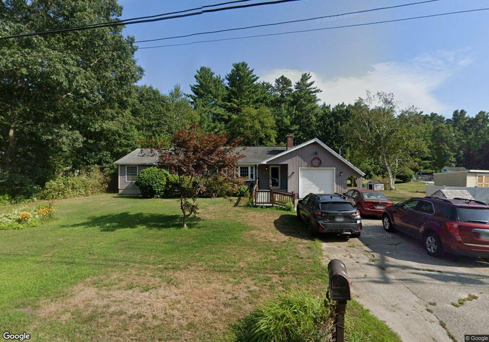
23 Corning Rd Litchfield, NH 03052
Estimated Value: $517,290 - $591,000
4
Beds
2
Baths
2,090
Sq Ft
$262/Sq Ft
Est. Value
About This Home
This home is located at 23 Corning Rd, Litchfield, NH 03052 and is currently estimated at $547,823, approximately $262 per square foot. 23 Corning Rd is a home with nearby schools including Griffin Memorial School, Litchfield Middle School, and Campbell High School.
Ownership History
Date
Name
Owned For
Owner Type
Purchase Details
Closed on
May 20, 2024
Sold by
Merrill Mary J and Merrill Thomas A
Bought by
Merrill Ft and Faneuf-Merrill
Current Estimated Value
Purchase Details
Closed on
Oct 30, 2001
Sold by
Edgar Stacey J and Edgar James W
Bought by
Merrill Mary Jane and Merrill Thomas A
Purchase Details
Closed on
Aug 1, 1997
Sold by
Carleton Stephen P and Carleton Kathleen A
Bought by
Edgar Stacey J and Edgar James W
Create a Home Valuation Report for This Property
The Home Valuation Report is an in-depth analysis detailing your home's value as well as a comparison with similar homes in the area
Home Values in the Area
Average Home Value in this Area
Purchase History
| Date | Buyer | Sale Price | Title Company |
|---|---|---|---|
| Merrill Ft | -- | None Available | |
| Merrill Ft | -- | None Available | |
| Merrill Mary Jane | $164,900 | -- | |
| Edgar Stacey J | $109,700 | -- | |
| Merrill Mary Jane | $164,900 | -- | |
| Edgar Stacey J | $109,700 | -- |
Source: Public Records
Mortgage History
| Date | Status | Borrower | Loan Amount |
|---|---|---|---|
| Previous Owner | Edgar Stacey J | $200,000 | |
| Previous Owner | Edgar Stacey J | $70,000 | |
| Previous Owner | Edgar Stacey J | $19,000 |
Source: Public Records
Tax History Compared to Growth
Tax History
| Year | Tax Paid | Tax Assessment Tax Assessment Total Assessment is a certain percentage of the fair market value that is determined by local assessors to be the total taxable value of land and additions on the property. | Land | Improvement |
|---|---|---|---|---|
| 2024 | $6,824 | $328,400 | $148,000 | $180,400 |
| 2023 | $6,877 | $328,400 | $148,000 | $180,400 |
| 2022 | $6,055 | $318,200 | $148,000 | $170,200 |
| 2021 | $5,868 | $318,200 | $148,000 | $170,200 |
| 2020 | $5,912 | $318,200 | $148,000 | $170,200 |
| 2019 | $5,901 | $249,500 | $118,000 | $131,500 |
| 2017 | $5,790 | $246,500 | $118,000 | $128,500 |
| 2016 | $5,705 | $246,500 | $118,000 | $128,500 |
| 2015 | $5,024 | $246,500 | $118,000 | $128,500 |
| 2014 | $5,007 | $241,900 | $115,500 | $126,400 |
| 2013 | $5,001 | $243,100 | $115,500 | $127,600 |
Source: Public Records
Map
Nearby Homes
- 17 Winter Cir
- 924 Brent St
- 3-C Mustang Dr Unit MODEL
- 190 Litchfield Rd
- 707 Brent St
- 9 Mustang Dr Unit END UNIT-D
- 9 Mustang Dr Unit C
- 9 Mustang Dr Unit B
- 7 Mustang Dr Unit B
- 7 Mustang Dr Unit END UNIT-A
- 7 Mustang Dr Unit C
- 3 Mustang Dr Unit B
- 305 Trolley St
- 14 Bernards Rd
- 395 Brent St
- 2 Galloway Rd Unit 38
- 5 Crosswoods Path Blvd Unit B4
- 490 Charles Bancroft Hwy
- 4243 Brown Ave
- 25 Chatfield Dr