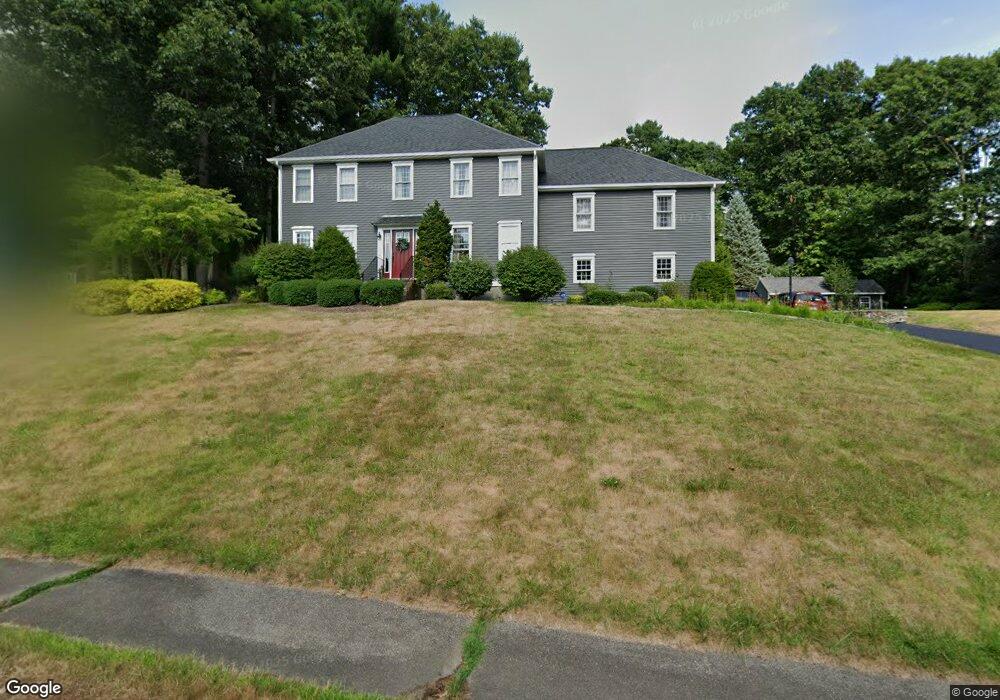
23 Patricia Dr Grafton, MA 01519
Estimated Value: $743,000 - $922,000
4
Beds
3
Baths
2,440
Sq Ft
$342/Sq Ft
Est. Value
About This Home
This home is located at 23 Patricia Dr, Grafton, MA 01519 and is currently estimated at $835,232, approximately $342 per square foot. 23 Patricia Dr is a home located in Worcester County with nearby schools including Grafton High School, Silver Spruce Montessori School, and Assumption School.
Ownership History
Date
Name
Owned For
Owner Type
Purchase Details
Closed on
Apr 17, 2019
Sold by
Najemy Paul J and Najemy Elaine L
Bought by
Lincoln Jonathan and Lincoln Christine M
Current Estimated Value
Home Financials for this Owner
Home Financials are based on the most recent Mortgage that was taken out on this home.
Original Mortgage
$404,000
Outstanding Balance
$353,735
Interest Rate
4.1%
Mortgage Type
New Conventional
Estimated Equity
$481,497
Purchase Details
Closed on
Mar 9, 1998
Sold by
Art Lot Acres Dev
Bought by
Najemy Paul J and Najemy Elaine J
Create a Home Valuation Report for This Property
The Home Valuation Report is an in-depth analysis detailing your home's value as well as a comparison with similar homes in the area
Home Values in the Area
Average Home Value in this Area
Purchase History
| Date | Buyer | Sale Price | Title Company |
|---|---|---|---|
| Lincoln Jonathan | $505,000 | -- | |
| Najemy Paul J | $270,024 | -- | |
| Najemy Paul J | $270,024 | -- |
Source: Public Records
Mortgage History
| Date | Status | Borrower | Loan Amount |
|---|---|---|---|
| Open | Lincoln Jonathan | $404,000 | |
| Closed | Lincoln Jonathan | $404,000 | |
| Previous Owner | Najemy Paul J | $50,000 | |
| Previous Owner | Najemy Paul J | $343,000 |
Source: Public Records
Tax History Compared to Growth
Tax History
| Year | Tax Paid | Tax Assessment Tax Assessment Total Assessment is a certain percentage of the fair market value that is determined by local assessors to be the total taxable value of land and additions on the property. | Land | Improvement |
|---|---|---|---|---|
| 2025 | $10,258 | $735,900 | $184,800 | $551,100 |
| 2024 | $10,189 | $712,000 | $185,200 | $526,800 |
| 2023 | $9,357 | $595,600 | $185,200 | $410,400 |
| 2022 | $8,930 | $529,000 | $159,000 | $370,000 |
| 2021 | $8,681 | $505,300 | $144,600 | $360,700 |
| 2020 | $8,283 | $502,000 | $144,600 | $357,400 |
| 2019 | $8,285 | $497,300 | $140,400 | $356,900 |
| 2018 | $7,837 | $472,400 | $139,400 | $333,000 |
| 2017 | $7,439 | $453,600 | $129,100 | $324,500 |
| 2016 | $7,325 | $437,300 | $132,800 | $304,500 |
| 2015 | $7,262 | $440,100 | $132,800 | $307,300 |
| 2014 | $6,626 | $434,200 | $141,400 | $292,800 |
Source: Public Records
Map
Nearby Homes
- 8 Danielle Dr
- 43 Barbara Jean St
- 18 Barbara Jean St
- 19 Cortland Way
- 81 Millbury St
- 144 Pleasant St
- 73 Potter Hill Rd
- 75 Potter Hill Rd
- 13 Pullard Rd Unit 38
- 18 Pullard Rd
- 42 Gordon Cir Unit 42
- 24 Coventry Rd
- 151 Providence Rd Unit 24
- 151 Providence Rd Unit 15
- 81 Ariel Cir
- 8 Hudson Ave
- 8 Autumn Gate Cir
- 49 Brigham Hill Rd
- Lot 1 Cooper Rd
- 30 Nottingham Rd
- 21 Patricia Dr
- 51 Blanchard Rd
- 20 Patricia Dr
- 47 Blanchard Rd
- 53 Blanchard Rd
- 19 Danielle Dr
- 18 Patricia Dr
- 19 Patricia Dr
- 21 Danielle Dr
- 1 Alana Dr Unit 1
- 45 Blanchard Rd
- 52 Blanchard Rd
- 50 Blanchard Rd
- 54 Blanchard Rd
- 23 Danielle Dr
- 17 Patricia Dr
- 16 Patricia Dr
- 43 Blanchard Rd
- 11 Danielle Dr
- 22 Danielle Dr