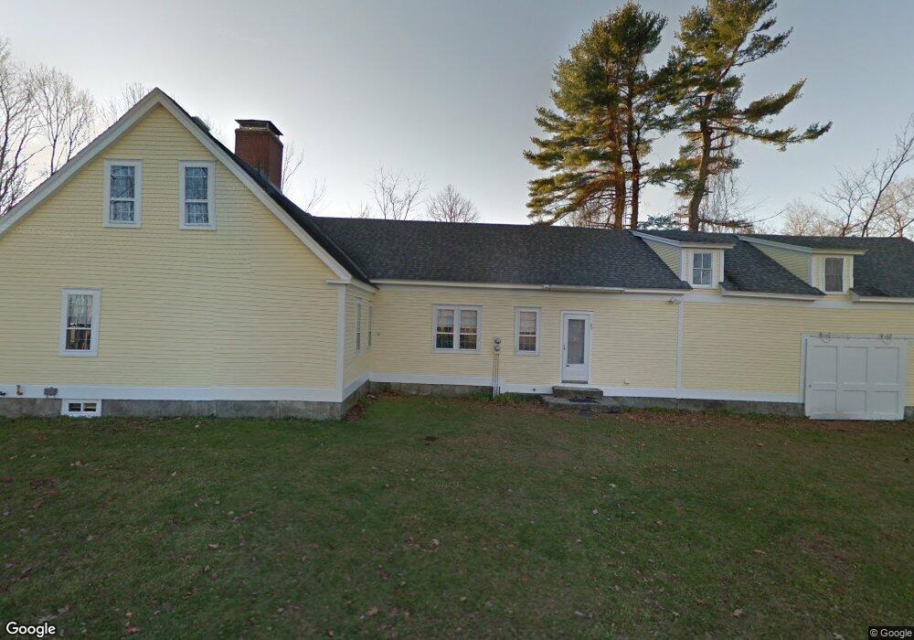
23 Roberts Rd Goffstown, NH 03045
Estimated Value: $548,000 - $1,017,808
3
Beds
2
Baths
1,828
Sq Ft
$422/Sq Ft
Est. Value
About This Home
This home is located at 23 Roberts Rd, Goffstown, NH 03045 and is currently estimated at $770,702, approximately $421 per square foot. 23 Roberts Rd is a home with nearby schools including Mountain View Middle School, Goffstown High School, and Namaste Montessori School.
Ownership History
Date
Name
Owned For
Owner Type
Purchase Details
Closed on
Nov 22, 2019
Sold by
Roberts Elizabeth H
Bought by
Elizabeth H Roberts Ret
Current Estimated Value
Purchase Details
Closed on
Nov 21, 2019
Sold by
Hazel S Roberts 2000 T
Bought by
Roberts William B and Roberts Elizabeth H
Purchase Details
Closed on
Nov 4, 2019
Sold by
Raymond L Roberts Ret and Roberts
Bought by
William B Roberts Ret and Roberts
Create a Home Valuation Report for This Property
The Home Valuation Report is an in-depth analysis detailing your home's value as well as a comparison with similar homes in the area
Home Values in the Area
Average Home Value in this Area
Purchase History
| Date | Buyer | Sale Price | Title Company |
|---|---|---|---|
| Elizabeth H Roberts Ret | -- | -- | |
| William B Roberts Ret | -- | -- | |
| Roberts William B | -- | -- | |
| William B Roberts Ret | $544,133 | -- | |
| William B Roberts Ret | $544,133 | -- | |
| Elizabeth H Roberts Ret | $544,133 | -- |
Source: Public Records
Tax History Compared to Growth
Tax History
| Year | Tax Paid | Tax Assessment Tax Assessment Total Assessment is a certain percentage of the fair market value that is determined by local assessors to be the total taxable value of land and additions on the property. | Land | Improvement |
|---|---|---|---|---|
| 2024 | $12,440 | $608,600 | $273,500 | $335,100 |
| 2023 | $11,593 | $614,700 | $279,600 | $335,100 |
| 2022 | $10,961 | $416,600 | $189,400 | $227,200 |
| 2021 | $10,132 | $408,200 | $189,400 | $218,800 |
| 2020 | $9,826 | $395,900 | $193,500 | $202,400 |
| 2019 | $7,568 | $307,900 | $193,500 | $114,400 |
| 2018 | $5,727 | $307,900 | $193,500 | $114,400 |
| 2017 | $7,225 | $263,500 | $163,400 | $100,100 |
| 2016 | $6,980 | $264,100 | $164,000 | $100,100 |
| 2015 | $7,229 | $256,700 | $157,000 | $99,700 |
| 2014 | $6,931 | $256,700 | $157,000 | $99,700 |
Source: Public Records
Map
Nearby Homes
- 3 Tanager Rd
- 0 Mast Rd Unit 49 5054665
- 14 Angel Point Cir Unit B
- 3A Dearborn Cir
- 3B Dearborn Cir
- 3D Dearborn Cir
- 2A Dearborn Cir
- 4 Arabian Ct Unit B
- 5 Mustang Ct
- 93 Jason Dr
- 1 Oakwood Ln Unit 2
- 11 Timberwood Dr Unit 206
- 4 Chip St
- 28 Joffre St
- 175 Saint Anselm Dr
- 35 Foch St
- 27 Birkdale Rd Unit LOTS 170/171
- 11-1 Chatel Rd
- 914 Back Mountain Rd
- 24 Whippoorwill Ln