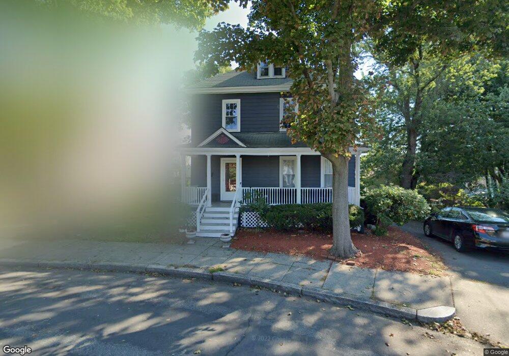
23 Thornton Park Winthrop, MA 02152
Downtown Winthrop NeighborhoodEstimated Value: $849,000 - $1,046,000
5
Beds
2
Baths
2,186
Sq Ft
$427/Sq Ft
Est. Value
About This Home
This home is located at 23 Thornton Park, Winthrop, MA 02152 and is currently estimated at $933,480, approximately $427 per square foot. 23 Thornton Park is a home located in Suffolk County with nearby schools including William P. Gorman/Fort Banks Elementary School, Arthur T. Cummings Elementary School, and Winthrop Middle School.
Ownership History
Date
Name
Owned For
Owner Type
Purchase Details
Closed on
May 14, 2010
Sold by
Keough Patricia H
Bought by
Keough Robert D and Ssemanda Maria
Current Estimated Value
Home Financials for this Owner
Home Financials are based on the most recent Mortgage that was taken out on this home.
Original Mortgage
$351,037
Outstanding Balance
$240,410
Interest Rate
5.5%
Mortgage Type
FHA
Estimated Equity
$693,070
Create a Home Valuation Report for This Property
The Home Valuation Report is an in-depth analysis detailing your home's value as well as a comparison with similar homes in the area
Home Values in the Area
Average Home Value in this Area
Purchase History
| Date | Buyer | Sale Price | Title Company |
|---|---|---|---|
| Keough Robert D | $375,000 | -- |
Source: Public Records
Mortgage History
| Date | Status | Borrower | Loan Amount |
|---|---|---|---|
| Open | Keough Robert D | $351,037 |
Source: Public Records
Tax History Compared to Growth
Tax History
| Year | Tax Paid | Tax Assessment Tax Assessment Total Assessment is a certain percentage of the fair market value that is determined by local assessors to be the total taxable value of land and additions on the property. | Land | Improvement |
|---|---|---|---|---|
| 2025 | $8,220 | $796,500 | $449,700 | $346,800 |
| 2024 | $8,459 | $811,800 | $432,200 | $379,600 |
| 2023 | $7,755 | $724,800 | $395,600 | $329,200 |
| 2022 | $7,489 | $636,800 | $352,900 | $283,900 |
| 2021 | $7,466 | $588,800 | $315,100 | $273,700 |
| 2020 | $7,431 | $588,800 | $315,100 | $273,700 |
| 2019 | $7,266 | $551,300 | $290,400 | $260,900 |
| 2018 | $7,043 | $497,400 | $249,300 | $248,100 |
| 2017 | $6,737 | $467,500 | $237,800 | $229,700 |
| 2016 | $6,624 | $431,000 | $206,800 | $224,200 |
| 2015 | $6,014 | $419,400 | $200,700 | $218,700 |
| 2014 | $5,529 | $354,900 | $154,500 | $200,400 |
Source: Public Records
Map
Nearby Homes
- 28 Thornton Park
- 3 Buckthorn Terrace Unit 2
- 174 Winthrop St Unit 2
- 92 Plummer Ave
- 34 Fremont St
- 142 Pleasant St Unit 12
- 142 Pleasant St Unit 2
- 220 Woodside Ave Unit 1
- 279 Shirley St Unit 2
- 16 Woodside Park
- 28 Pearl Ave Unit 3
- 10 Somerset Ave Unit 405
- 10 Somerset Ave Unit 403
- 10 Somerset Ave Unit 404
- 10 Somerset Ave Unit 408
- 10 Somerset Ave Unit 201
- 10 Somerset Ave Unit 211
- 10 Somerset Ave Unit 206
- 51 Cutler St Unit 3
- 35 Somerset Ave Unit 6
- 17 Thornton Park
- 29 Thornton Park
- 29 Thornton Park Unit 1
- 15 Thornton Park
- 10 Willow Terrace
- 46 Washington Ave
- 46 Washington Ave Unit 1
- 13 Willow Terrace
- 35 Thornton Park
- 56 Washington Ave
- 56 Washington Ave Unit 3
- 56 Washington Ave Unit 2
- 40 Washington Ave Unit 7
- 40 Washington Ave
- 40 Washington Ave Unit 3
- 52 Washington Ave Unit 2
- 41 Thornton Park
- 9 Willow Terrace
- 16 Thornton Park
- 22 Willow Ave