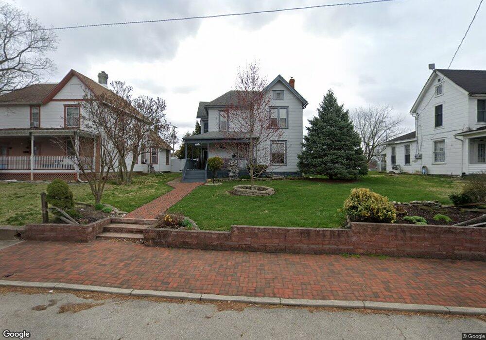
230 Forrest Ave Springfield, OH 45505
Estimated Value: $124,458 - $201,000
4
Beds
2
Baths
2,484
Sq Ft
$64/Sq Ft
Est. Value
About This Home
This home is located at 230 Forrest Ave, Springfield, OH 45505 and is currently estimated at $158,115, approximately $63 per square foot. 230 Forrest Ave is a home located in Clark County with nearby schools including Kenwood Elementary School, Schaefer Middle School, and Springfield High School.
Ownership History
Date
Name
Owned For
Owner Type
Purchase Details
Closed on
Mar 6, 1996
Sold by
Callicoat Clinton R
Bought by
Phares Charles H and Adams Kathy
Current Estimated Value
Home Financials for this Owner
Home Financials are based on the most recent Mortgage that was taken out on this home.
Original Mortgage
$54,900
Outstanding Balance
$1,088
Interest Rate
7.05%
Mortgage Type
FHA
Estimated Equity
$157,027
Purchase Details
Closed on
Jun 16, 1994
Sold by
Miller Harold W
Bought by
Callicoat Clinton R
Home Financials for this Owner
Home Financials are based on the most recent Mortgage that was taken out on this home.
Original Mortgage
$27,850
Interest Rate
8.58%
Mortgage Type
New Conventional
Create a Home Valuation Report for This Property
The Home Valuation Report is an in-depth analysis detailing your home's value as well as a comparison with similar homes in the area
Home Values in the Area
Average Home Value in this Area
Purchase History
| Date | Buyer | Sale Price | Title Company |
|---|---|---|---|
| Phares Charles H | $56,000 | -- | |
| Callicoat Clinton R | $29,700 | -- |
Source: Public Records
Mortgage History
| Date | Status | Borrower | Loan Amount |
|---|---|---|---|
| Open | Phares Charles H | $54,900 | |
| Previous Owner | Callicoat Clinton R | $27,850 |
Source: Public Records
Tax History
| Year | Tax Paid | Tax Assessment Tax Assessment Total Assessment is a certain percentage of the fair market value that is determined by local assessors to be the total taxable value of land and additions on the property. | Land | Improvement |
|---|---|---|---|---|
| 2025 | $1,290 | $39,100 | $4,780 | $34,320 |
| 2024 | $1,257 | $26,030 | $3,580 | $22,450 |
| 2023 | $1,257 | $26,030 | $3,580 | $22,450 |
| 2022 | $1,287 | $26,030 | $3,580 | $22,450 |
| 2021 | $1,344 | $25,080 | $3,410 | $21,670 |
| 2020 | $1,347 | $25,080 | $3,410 | $21,670 |
| 2019 | $1,350 | $25,080 | $3,410 | $21,670 |
| 2018 | $1,114 | $19,860 | $3,410 | $16,450 |
| 2017 | $1,113 | $19,860 | $3,413 | $16,447 |
| 2016 | $1,115 | $19,860 | $3,413 | $16,447 |
| 2015 | $1,137 | $19,860 | $3,413 | $16,447 |
| 2014 | $1,132 | $19,860 | $3,413 | $16,447 |
| 2013 | $1,120 | $19,860 | $3,413 | $16,447 |
Source: Public Records
Map
Nearby Homes
- 1215 E High St
- 321 Glenn Ave
- 360 S Greenmount Ave
- 1569-1571 Mound St
- 14 N Freeman St
- 453 E Pleasant St
- 1609 Irwin Ave
- 1701 Lexington Ave
- 1703 Highland Ave
- 1621 Morgan St
- 1664 Warder St
- 1318 Maryland Ave
- 908 Pine St
- 1602 Prospect St
- 802 Warder St
- 705 York St
- 535 S Belmont Ave
- 1024 Elder St
- 1721 Prospect St
- 250 S Douglas Ave Unit 254
- 224 Forrest Ave
- 236 Forrest Ave
- 240 Forrest Ave
- 218 Forrest Ave
- 231 S Greenmount Ave Unit 233
- 227 S Greenmount Ave
- 235 S Greenmount Ave
- 225 S Greenmount Ave
- 1307 E High St
- 223 Forrest Ave
- 241 S Greenmount Ave
- 1224 Mound St
- 1231 E High St Unit B
- 1231 E High St
- 1313 Mound St
- 1218 Mound St
- 1217 E High St
- 1327 Mound St Unit 1329
- 1321 Mound St
- 1321 Mound St Unit 1323
Your Personal Tour Guide
Ask me questions while you tour the home.