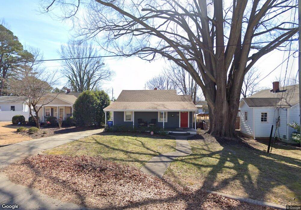
230 Georgetown Rd Raleigh, NC 27608
Hi-mount NeighborhoodEstimated Value: $606,229 - $703,000
2
Beds
2
Baths
1,120
Sq Ft
$582/Sq Ft
Est. Value
About This Home
This home is located at 230 Georgetown Rd, Raleigh, NC 27608 and is currently estimated at $651,307, approximately $581 per square foot. 230 Georgetown Rd is a home located in Wake County with nearby schools including Underwood Magnet Elementary School, Oberlin Middle School, and Broughton Magnet High School.
Ownership History
Date
Name
Owned For
Owner Type
Purchase Details
Closed on
Mar 19, 2010
Sold by
The Cave Family Trust and Mattocks Karen
Bought by
Johnson Steven Scott
Current Estimated Value
Home Financials for this Owner
Home Financials are based on the most recent Mortgage that was taken out on this home.
Original Mortgage
$158,400
Outstanding Balance
$104,729
Interest Rate
5.01%
Mortgage Type
New Conventional
Estimated Equity
$546,578
Purchase Details
Closed on
Jun 26, 2009
Sold by
Cave Melany L
Bought by
The Cave Family Trust and Dunn Gloria
Purchase Details
Closed on
May 3, 2007
Sold by
Lumsden Dan and Cave Melany L
Bought by
Lumsden Dan and Cave Melany L
Home Financials for this Owner
Home Financials are based on the most recent Mortgage that was taken out on this home.
Original Mortgage
$208,000
Interest Rate
6.1%
Mortgage Type
New Conventional
Purchase Details
Closed on
May 14, 2004
Sold by
Highsmith Herbert Theophilus
Bought by
Lumsden Dan
Home Financials for this Owner
Home Financials are based on the most recent Mortgage that was taken out on this home.
Original Mortgage
$162,000
Interest Rate
5.77%
Mortgage Type
Adjustable Rate Mortgage/ARM
Purchase Details
Closed on
Sep 26, 2001
Sold by
Carter Mary Margaret
Bought by
Highsmith Herbert Theophilus
Home Financials for this Owner
Home Financials are based on the most recent Mortgage that was taken out on this home.
Original Mortgage
$150,750
Interest Rate
6.89%
Purchase Details
Closed on
Sep 15, 2000
Sold by
Sannipoli Charles Andrew and Sannipoli Andrea R
Bought by
Carter Mary Margaret
Home Financials for this Owner
Home Financials are based on the most recent Mortgage that was taken out on this home.
Original Mortgage
$158,000
Interest Rate
8.17%
Purchase Details
Closed on
Aug 14, 1998
Sold by
Sannipoli Charles J
Bought by
Sannipoli Charles Andrew
Create a Home Valuation Report for This Property
The Home Valuation Report is an in-depth analysis detailing your home's value as well as a comparison with similar homes in the area
Home Values in the Area
Average Home Value in this Area
Purchase History
| Date | Buyer | Sale Price | Title Company |
|---|---|---|---|
| Johnson Steven Scott | $198,000 | Stronghold Land Title Corp | |
| The Cave Family Trust | -- | None Available | |
| Cave Melany L | -- | None Available | |
| Lumsden Dan | -- | None Available | |
| Lumsden Dan | $202,500 | None Available | |
| Highsmith Herbert Theophilus | $167,500 | -- | |
| Carter Mary Margaret | $158,000 | -- | |
| Sannipoli Charles Andrew | -- | -- |
Source: Public Records
Mortgage History
| Date | Status | Borrower | Loan Amount |
|---|---|---|---|
| Open | Johnson Steven Scott | $158,400 | |
| Previous Owner | Lumsden Dan | $208,000 | |
| Previous Owner | Lumsden Dan | $162,000 | |
| Previous Owner | Lumsden Dan | $40,500 | |
| Previous Owner | Highsmith Herbert Theophilus | $150,750 | |
| Previous Owner | Carter Mary Margaret | $158,000 |
Source: Public Records
Tax History Compared to Growth
Tax History
| Year | Tax Paid | Tax Assessment Tax Assessment Total Assessment is a certain percentage of the fair market value that is determined by local assessors to be the total taxable value of land and additions on the property. | Land | Improvement |
|---|---|---|---|---|
| 2025 | $5,019 | $573,216 | $450,000 | $123,216 |
| 2024 | $4,998 | $573,216 | $450,000 | $123,216 |
| 2023 | $3,857 | $352,046 | $289,750 | $62,296 |
| 2022 | $3,584 | $352,046 | $289,750 | $62,296 |
| 2021 | $3,445 | $352,046 | $289,750 | $62,296 |
| 2020 | $3,383 | $352,046 | $289,750 | $62,296 |
| 2019 | $2,724 | $233,306 | $175,500 | $57,806 |
| 2018 | $2,569 | $233,306 | $175,500 | $57,806 |
| 2017 | $2,447 | $233,306 | $175,500 | $57,806 |
| 2016 | $2,397 | $233,306 | $175,500 | $57,806 |
| 2015 | $2,533 | $242,695 | $126,360 | $116,335 |
| 2014 | -- | $242,695 | $126,360 | $116,335 |
Source: Public Records
Map
Nearby Homes
- 626 E Whitaker Mill Rd
- 202 Georgetown Rd
- 1807 Ridley St
- 1806 Pershing Rd
- 400 Bryan Pointe Dr Unit 104
- 1610 Draper View Loop Unit 101
- 1802 Pershing Rd
- 1804 Pershing Rd
- 1800 Pershing Rd
- 711 New Rd
- 606 Highpark Ln
- 540 Ledbetter Ct
- 1521 1/2 Sunrise Ave
- 1521 Havenmont Ct
- 1523 Sunrise Ave
- 1523 1/2 Sunrise Ave
- 1521 Sunrise Ave
- 1533 Urban Trace Ln
- 1525 Havenmont Ct
- 1523 Havenmont Ct
- 228 Georgetown Rd
- 232 Georgetown Rd
- 226 Georgetown Rd
- 1613 Center Rd
- 1611 Center Rd
- 224 Georgetown Rd
- 1701 Center Rd
- 227 Georgetown Rd
- 1703 Center Rd
- 222 Georgetown Rd
- 1705 Center Rd
- 1501 Canter Rd
- 1425 Canter Rd
- 225 Georgetown Rd
- 220 Georgetown Rd
- 223 Georgetown Rd
- 1707 Center Rd
- 1705 Pershing Rd
- 1705 Pershing Rd Unit Lot 1
- 301 Georgetown Rd