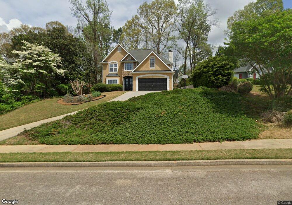
230 Kensington Trace Unit II Stockbridge, GA 30281
Estimated Value: $317,767 - $337,000
4
Beds
3
Baths
2,289
Sq Ft
$142/Sq Ft
Est. Value
About This Home
This home is located at 230 Kensington Trace Unit II, Stockbridge, GA 30281 and is currently estimated at $325,942, approximately $142 per square foot. 230 Kensington Trace Unit II is a home located in Henry County with nearby schools including Flippen Elementary School, Eagle's Landing Middle School, and Eagle's Landing High School.
Ownership History
Date
Name
Owned For
Owner Type
Purchase Details
Closed on
Sep 3, 2014
Sold by
Bland Indira
Bought by
Bland Bobby
Current Estimated Value
Home Financials for this Owner
Home Financials are based on the most recent Mortgage that was taken out on this home.
Original Mortgage
$124,359
Outstanding Balance
$96,186
Interest Rate
4.5%
Mortgage Type
FHA
Estimated Equity
$229,756
Purchase Details
Closed on
Jan 31, 2001
Sold by
Dietz Hank F and Dietz Susie C
Bought by
Bland Bobby and Bland Indira
Home Financials for this Owner
Home Financials are based on the most recent Mortgage that was taken out on this home.
Original Mortgage
$156,000
Interest Rate
7.18%
Mortgage Type
FHA
Purchase Details
Closed on
Aug 28, 1997
Sold by
Kenny Johnson Homes Inc
Bought by
Dietz Hank F
Home Financials for this Owner
Home Financials are based on the most recent Mortgage that was taken out on this home.
Original Mortgage
$122,000
Interest Rate
7.62%
Mortgage Type
New Conventional
Create a Home Valuation Report for This Property
The Home Valuation Report is an in-depth analysis detailing your home's value as well as a comparison with similar homes in the area
Home Values in the Area
Average Home Value in this Area
Purchase History
| Date | Buyer | Sale Price | Title Company |
|---|---|---|---|
| Bland Bobby | -- | -- | |
| Bland Bobby | $158,000 | -- | |
| Dietz Hank F | $142,000 | -- |
Source: Public Records
Mortgage History
| Date | Status | Borrower | Loan Amount |
|---|---|---|---|
| Open | Bland Bobby | $124,359 | |
| Previous Owner | Bland Bobby | $156,000 | |
| Previous Owner | Dietz Hank F | $122,000 |
Source: Public Records
Tax History Compared to Growth
Tax History
| Year | Tax Paid | Tax Assessment Tax Assessment Total Assessment is a certain percentage of the fair market value that is determined by local assessors to be the total taxable value of land and additions on the property. | Land | Improvement |
|---|---|---|---|---|
| 2025 | $4,058 | $120,960 | $16,000 | $104,960 |
| 2024 | $4,058 | $123,320 | $16,000 | $107,320 |
| 2023 | $3,799 | $127,200 | $18,000 | $109,200 |
| 2022 | $3,249 | $98,080 | $14,000 | $84,080 |
| 2021 | $2,894 | $83,080 | $14,000 | $69,080 |
| 2020 | $2,714 | $75,440 | $12,000 | $63,440 |
| 2019 | $2,500 | $69,800 | $10,000 | $59,800 |
| 2018 | $2,352 | $63,720 | $10,000 | $53,720 |
| 2016 | $2,056 | $56,000 | $8,000 | $48,000 |
| 2015 | $2,006 | $53,480 | $8,000 | $45,480 |
| 2014 | $1,869 | $49,600 | $8,000 | $41,600 |
Source: Public Records
Map
Nearby Homes
- 228 Kensington Trace
- 169 Parkside Dr
- 214 Kensington Trace
- 209 Kensington Trace
- 104 Riverside Close
- 200 Kensington Trace
- 241 Legends Trace
- 805 Cog Hill
- 601 Sawgrass Walk
- 129 Breton Highlands
- 205 Legends Trace
- 418 Abbey Springs Way
- 941 Arbor Way
- 834 Chalet Hills
- 1016 Collingtree Ct
- 816 Cog Hill
- 900 Ellesmere Point
- 907 Ellesmere Point
- 232 Kensington Trace Unit 2
- 0 Amherst Terrace Unit 7338379
- 0 Amherst Terrace Unit 8198805
- 0 Amherst Terrace
- 405 Woodton Knoll
- 407 Woodton Knoll Unit 17
- 403 Woodton Knoll
- 403 Woodton Knoll Unit 3
- 226 Kensington Trace Unit III
- 300 Amherst Terrace
- 234 Kensington Trace
- 409 Woodton Knoll Unit 3
- 345 Royal Crescent Way
- 401 Woodton Knoll Unit 3
- 224 Kensington Trace Unit 224
- 224 Kensington Trace
- 224 Kensington Trace Unit 1
- 0 Woodton Knoll Unit 7060838
- 0 Woodton Knoll
- 301 Amherst Terrace