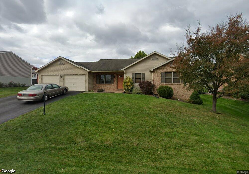
230 Stanford Rd Hagerstown, MD 21742
South End NeighborhoodEstimated Value: $340,000 - $431,000
--
Bed
2
Baths
1,387
Sq Ft
$268/Sq Ft
Est. Value
About This Home
This home is located at 230 Stanford Rd, Hagerstown, MD 21742 and is currently estimated at $372,288, approximately $268 per square foot. 230 Stanford Rd is a home located in Washington County with nearby schools including Ruth Ann Monroe Primary School, Eastern Elementary School, and E. Russell Hicks Middle School.
Ownership History
Date
Name
Owned For
Owner Type
Purchase Details
Closed on
Oct 1, 2025
Sold by
Johnson Steven Lee and Johnson Pamela K
Bought by
Johnson Steven L and Johnson Pamela K
Current Estimated Value
Purchase Details
Closed on
Nov 23, 2004
Sold by
Home Construction Corp
Bought by
Johnson Steven L and Johnson Pamela K
Purchase Details
Closed on
Nov 12, 2004
Sold by
Home Construction Corp
Bought by
Johnson Steven L and Johnson Pamela K
Create a Home Valuation Report for This Property
The Home Valuation Report is an in-depth analysis detailing your home's value as well as a comparison with similar homes in the area
Home Values in the Area
Average Home Value in this Area
Purchase History
| Date | Buyer | Sale Price | Title Company |
|---|---|---|---|
| Johnson Steven L | -- | None Listed On Document | |
| Johnson Steven L | $197,574 | -- | |
| Johnson Steven L | $197,574 | -- |
Source: Public Records
Mortgage History
| Date | Status | Borrower | Loan Amount |
|---|---|---|---|
| Closed | Johnson Steven L | -- |
Source: Public Records
Tax History Compared to Growth
Tax History
| Year | Tax Paid | Tax Assessment Tax Assessment Total Assessment is a certain percentage of the fair market value that is determined by local assessors to be the total taxable value of land and additions on the property. | Land | Improvement |
|---|---|---|---|---|
| 2025 | $2,665 | $325,667 | $0 | $0 |
| 2024 | $2,665 | $288,200 | $66,500 | $221,700 |
| 2023 | $2,527 | $265,167 | $0 | $0 |
| 2022 | $2,394 | $242,133 | $0 | $0 |
| 2021 | $2,246 | $219,100 | $66,500 | $152,600 |
| 2020 | $2,246 | $212,867 | $0 | $0 |
| 2019 | $2,190 | $206,633 | $0 | $0 |
| 2018 | $2,124 | $200,400 | $66,500 | $133,900 |
| 2017 | $2,057 | $194,033 | $0 | $0 |
| 2016 | -- | $187,667 | $0 | $0 |
| 2015 | $2,074 | $181,300 | $0 | $0 |
| 2014 | $2,074 | $181,300 | $0 | $0 |
Source: Public Records
Map
Nearby Homes
- 1230 Mount Aetna Rd
- 631 Cornell Ave
- 501 Cornell Ave
- 134 Catawba Place
- 1522 Dual Hwy
- 27 Lehigh Ave
- 19 Catawba Place
- 21 Harvard Rd
- 1 Dartmouth Dr
- 1619 Dual Hwy
- 1631 Edgewood Place Unit 103
- 15 Brightwood Dr
- 20112 Oneals Place
- 37 A & B S Colonial Dr
- 1747 Edgewood Hill Cir Unit 201
- 1745 Edgewood Hill Cir Unit 3
- 21 Bittersweet Dr
- 20207 Huntington Ct
- 1900 Maplewood Dr
- 151 Brynwood St
- 226 Stanford Rd
- 234 Stanford Rd
- 231 Montclair Ct
- 227 Montclair Ct
- 235 Montclair Ct
- 238 Stanford Rd
- 222 Stanford Rd
- 229 Stanford Rd
- 233 Stanford Rd
- 223 Montclair Ct
- 225 Stanford Rd
- 241 Montclair Ct
- 221 Stanford Rd
- 237 Stanford Rd
- 218 Stanford Rd
- 242 Stanford Rd
- 217 Montclair Ct
- 228 Montclair Ct
- 236 Montclair Ct
- 232 Montclair Ct