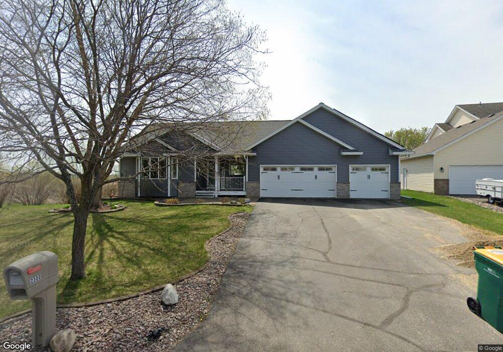
2300 121st Cir NW Coon Rapids, MN 55448
Estimated Value: $403,337 - $432,000
3
Beds
3
Baths
1,160
Sq Ft
$362/Sq Ft
Est. Value
About This Home
This home is located at 2300 121st Cir NW, Coon Rapids, MN 55448 and is currently estimated at $420,084, approximately $362 per square foot. 2300 121st Cir NW is a home located in Anoka County with nearby schools including Lucile Bruner Elementary School, Hoover Elementary School, and Laughlin Junior/Senior High School.
Ownership History
Date
Name
Owned For
Owner Type
Purchase Details
Closed on
Sep 15, 2008
Sold by
Ostlund Donna M and Ostlund Alan M
Bought by
Blosberg Cody W
Current Estimated Value
Home Financials for this Owner
Home Financials are based on the most recent Mortgage that was taken out on this home.
Original Mortgage
$180,700
Outstanding Balance
$120,478
Interest Rate
6.57%
Mortgage Type
New Conventional
Estimated Equity
$299,606
Purchase Details
Closed on
May 30, 2002
Sold by
Shade Tree Construction Inc
Bought by
Ostlund Alan M and Ostlund Donna M
Create a Home Valuation Report for This Property
The Home Valuation Report is an in-depth analysis detailing your home's value as well as a comparison with similar homes in the area
Home Values in the Area
Average Home Value in this Area
Purchase History
| Date | Buyer | Sale Price | Title Company |
|---|---|---|---|
| Blosberg Cody W | $225,900 | -- | |
| Ostlund Alan M | $204,647 | -- | |
| Shade Tree Construction Inc | $55,900 | -- |
Source: Public Records
Mortgage History
| Date | Status | Borrower | Loan Amount |
|---|---|---|---|
| Open | Blosberg Cody W | $180,700 |
Source: Public Records
Tax History Compared to Growth
Tax History
| Year | Tax Paid | Tax Assessment Tax Assessment Total Assessment is a certain percentage of the fair market value that is determined by local assessors to be the total taxable value of land and additions on the property. | Land | Improvement |
|---|---|---|---|---|
| 2025 | $4,112 | $383,700 | $98,900 | $284,800 |
| 2024 | $4,112 | $388,400 | $109,300 | $279,100 |
| 2023 | $3,708 | $378,900 | $94,300 | $284,600 |
| 2022 | $3,434 | $376,200 | $80,500 | $295,700 |
| 2021 | $3,441 | $313,900 | $70,800 | $243,100 |
| 2020 | $3,526 | $305,300 | $75,600 | $229,700 |
| 2019 | $3,324 | $299,800 | $80,400 | $219,400 |
| 2018 | $3,060 | $276,000 | $0 | $0 |
| 2017 | $2,683 | $248,400 | $0 | $0 |
| 2016 | $2,703 | $214,200 | $0 | $0 |
| 2015 | $2,969 | $214,200 | $56,100 | $158,100 |
| 2014 | -- | $195,400 | $55,300 | $140,100 |
Source: Public Records
Map
Nearby Homes
- 12019 Zion St NW
- 2068 124th Ln NW
- 2147 125th Ln NW
- 11749 Crooked Lake Blvd NW
- 1727 121st Ln NW
- 2675 128th Ave NW
- 12365 Jay St NW
- 12760 Raven St NW
- 3074 121st Ave NW
- 11444 Hanson Blvd NW
- 11409 Quinn St NW
- 11424 Hanson Blvd NW
- 1930 127th Cir NW
- 3020 117th Ave NW
- 2862 116th Ave NW
- 12010 Eagle St NW
- 12189 Lily St NW
- 1660 Northdale Blvd NW
- 12554 Grouse St NW
- 12888 Nightingale St NW
- 2306 121st Cir NW
- 2307 121st Cir NW
- 12123 Thrush St NW
- 12140 Thrush St NW
- 2323 121st Cir NW
- 2318 121st Cir NW
- 12133 Thrush St NW
- 12154 Thrush St NW
- 2339 121st Cir NW
- 2324 121st Cir NW
- 12147 Thrush St NW
- 12168 Thrush St NW
- 2355 121st Cir NW
- 2330 121st Cir NW
- 12161 Thrush St NW
- 2348 121st Cir NW
- 2342 121st Cir NW
- 12175 Thrush St NW
- 12188 Thrush St NW
- 12193 Thrush St NW