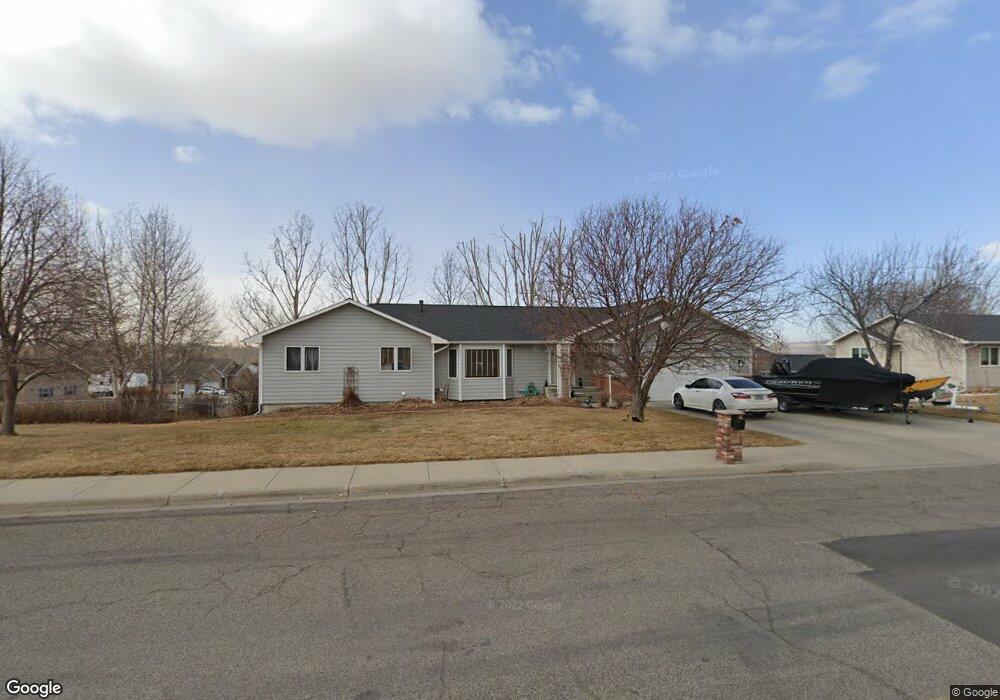
2306 St Andrews Dr Billings, MT 59105
Billings Heights NeighborhoodEstimated Value: $480,000 - $552,000
5
Beds
3
Baths
1,648
Sq Ft
$308/Sq Ft
Est. Value
About This Home
This home is located at 2306 St Andrews Dr, Billings, MT 59105 and is currently estimated at $507,791, approximately $308 per square foot. 2306 St Andrews Dr is a home located in Yellowstone County with nearby schools including Sandstone School, Castle Rock Junior High School, and Skyview High School.
Ownership History
Date
Name
Owned For
Owner Type
Purchase Details
Closed on
May 27, 2009
Sold by
Kondracki Stanley A and Vandaveer Judith K
Bought by
Robertson Ronald A and Robertson Royal R
Current Estimated Value
Home Financials for this Owner
Home Financials are based on the most recent Mortgage that was taken out on this home.
Original Mortgage
$250,381
Outstanding Balance
$158,450
Interest Rate
4.8%
Mortgage Type
FHA
Estimated Equity
$349,341
Create a Home Valuation Report for This Property
The Home Valuation Report is an in-depth analysis detailing your home's value as well as a comparison with similar homes in the area
Home Values in the Area
Average Home Value in this Area
Purchase History
| Date | Buyer | Sale Price | Title Company |
|---|---|---|---|
| Robertson Ronald A | -- | None Available |
Source: Public Records
Mortgage History
| Date | Status | Borrower | Loan Amount |
|---|---|---|---|
| Open | Robertson Ronald A | $250,381 |
Source: Public Records
Tax History Compared to Growth
Tax History
| Year | Tax Paid | Tax Assessment Tax Assessment Total Assessment is a certain percentage of the fair market value that is determined by local assessors to be the total taxable value of land and additions on the property. | Land | Improvement |
|---|---|---|---|---|
| 2025 | $4,358 | $509,700 | $72,592 | $437,108 |
| 2024 | $4,358 | $445,600 | $65,957 | $379,643 |
| 2023 | $4,373 | $445,600 | $65,957 | $379,643 |
| 2022 | $3,660 | $324,200 | $0 | $0 |
| 2021 | $3,457 | $324,200 | $0 | $0 |
| 2020 | $3,526 | $318,000 | $0 | $0 |
| 2019 | $3,365 | $318,000 | $0 | $0 |
| 2018 | $3,276 | $303,700 | $0 | $0 |
| 2017 | $3,182 | $303,700 | $0 | $0 |
| 2016 | $3,042 | $294,200 | $0 | $0 |
| 2015 | $2,973 | $294,200 | $0 | $0 |
| 2014 | $2,570 | $133,825 | $0 | $0 |
Source: Public Records
Map
Nearby Homes
- 2143 Interlachen Dr
- 2115 Saint Andrews Dr
- 2049 Saint Andrews Dr
- 2029 Ridgeview Dr
- 2435 Lake Heights Dr
- 2500 Keel Dr
- 2515 Constellation Trail
- 0 Greenbriar Block 12 Lot 5 Rd Unit 352965
- Lot 1, Block 1 Greenbriar Rd
- 419 Montecito Ave
- 425 Montecito Ave
- 1949 St Andrews Dr
- 2164 Greenbriar Rd
- 418 Montecito Ave
- TBD Gayle Block 17 Lot 8 Dr
- TBD Gayle Block 17 Lot 7 Dr
- 443 Montecito Ave
- 0 Winged Foot Dr
- TBD Gayle Block 17 Lot 4 Dr
- 2030 Gayle Dr
- Lot 4A Block 45 Annandale
- 101 Annandale Rd
- 2312 St Andrews Dr
- 2312 Saint Andrews Dr
- 104 Merion Rd
- 2232 St Andrews Dr
- 2243 St Andrews Dr
- 2232 Saint Andrews Dr
- 4 Annandale Rd
- Lot 29 Block 34 Annandale
- 100 Annandale Rd
- 113 Annandale Rd
- 2235 St Andrews Dr
- 114 Annandale Rd
- 43 Lakeview Dr
- 110 Merion Rd
- 2318 St Andrews Dr
- 2318 Saint Andrews Dr
- 2238 Ridgeview Dr
- 2220 St Andrews Dr