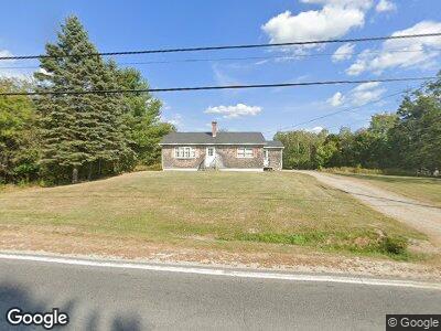
231 N Main St Milbridge, ME 04658
Estimated Value: $259,000 - $479,000
3
Beds
3
Baths
2,240
Sq Ft
$169/Sq Ft
Est. Value
About This Home
This home is located at 231 N Main St, Milbridge, ME 04658 and is currently estimated at $379,286, approximately $169 per square foot. 231 N Main St is a home located in Washington County.
Create a Home Valuation Report for This Property
The Home Valuation Report is an in-depth analysis detailing your home's value as well as a comparison with similar homes in the area
Home Values in the Area
Average Home Value in this Area
Mortgage History
| Date | Status | Borrower | Loan Amount |
|---|---|---|---|
| Closed | Schevenieus Karen S | $75,000 | |
| Closed | Openshaw James M | $110,000 | |
| Closed | Openshaw James M | $153,000 | |
| Closed | Serrano Restituto | $35,000 |
Source: Public Records
Tax History Compared to Growth
Tax History
| Year | Tax Paid | Tax Assessment Tax Assessment Total Assessment is a certain percentage of the fair market value that is determined by local assessors to be the total taxable value of land and additions on the property. | Land | Improvement |
|---|---|---|---|---|
| 2022 | $3,899 | $256,500 | $15,600 | $240,900 |
| 2021 | $4,214 | $256,500 | $15,600 | $240,900 |
| 2020 | $3,881 | $256,500 | $15,600 | $240,900 |
| 2019 | $4,219 | $257,600 | $15,600 | $242,000 |
| 2018 | $4,173 | $257,600 | $15,600 | $242,000 |
| 2017 | $4,315 | $257,600 | $15,600 | $242,000 |
| 2016 | $4,196 | $266,400 | $16,500 | $249,900 |
| 2015 | $4,212 | $275,300 | $17,400 | $257,900 |
| 2014 | $4,295 | $275,300 | $17,400 | $257,900 |
Source: Public Records
Map
Nearby Homes
- lot 125 Route 1
- 100 N Main St
- 152 Kansas Rd
- 0 Kansas Rd
- 33 N Main St
- 14 Spruce St
- 22 Bridge St
- 12-29-07 Route 1
- Lot #118 Kansas Rd
- 20 Cottage St
- 39 Ficketts Point Rd
- 85 Ficketts Point Rd
- 452 Milbridge Rd
- 158 Wyman Rd
- 378 Back Bay Rd
- 372 Milbridge Rd
- 207 Rays Point Rd
- M2L175A Rays Point Rd
- Lot 178K Rays Point Rd
- 449 Wyman Rd