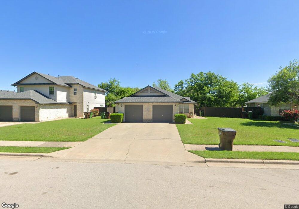
2313 Leslie Ct Unit A Round Rock, TX 78681
Round Rock West NeighborhoodEstimated Value: $381,013 - $456,000
Studio
2
Baths
2,076
Sq Ft
$204/Sq Ft
Est. Value
About This Home
This home is located at 2313 Leslie Ct Unit A, Round Rock, TX 78681 and is currently estimated at $423,753, approximately $204 per square foot. 2313 Leslie Ct Unit A is a home located in Williamson County with nearby schools including Bluebonnet Elementary School, Chisholm Trail Middle School, and Round Rock High School.
Ownership History
Date
Name
Owned For
Owner Type
Purchase Details
Closed on
May 20, 2015
Sold by
Strebler Gardiner Heidi M and Gardiner Zachary A
Bought by
Hall Nikki
Current Estimated Value
Home Financials for this Owner
Home Financials are based on the most recent Mortgage that was taken out on this home.
Original Mortgage
$184,594
Outstanding Balance
$142,205
Interest Rate
3.68%
Mortgage Type
Purchase Money Mortgage
Estimated Equity
$281,548
Create a Home Valuation Report for This Property
The Home Valuation Report is an in-depth analysis detailing your home's value as well as a comparison with similar homes in the area
Home Values in the Area
Average Home Value in this Area
Purchase History
| Date | Buyer | Sale Price | Title Company |
|---|---|---|---|
| Hall Nikki | -- | Austin Title Company |
Source: Public Records
Mortgage History
| Date | Status | Borrower | Loan Amount |
|---|---|---|---|
| Open | Hall Nikki | $184,594 |
Source: Public Records
Tax History
| Year | Tax Paid | Tax Assessment Tax Assessment Total Assessment is a certain percentage of the fair market value that is determined by local assessors to be the total taxable value of land and additions on the property. | Land | Improvement |
|---|---|---|---|---|
| 2025 | $7,936 | $420,645 | $69,644 | $351,001 |
| 2024 | $7,936 | $448,001 | $71,000 | $377,001 |
| 2023 | $7,660 | $436,732 | $77,000 | $359,732 |
| 2022 | $8,413 | $443,638 | $68,000 | $375,638 |
| 2021 | $7,750 | $345,252 | $55,000 | $290,252 |
| 2020 | $6,508 | $288,276 | $52,327 | $235,949 |
| 2019 | $6,891 | $298,503 | $48,150 | $250,353 |
| 2018 | $6,320 | $273,735 | $48,150 | $225,585 |
| 2017 | $5,869 | $249,120 | $45,000 | $204,120 |
| 2016 | $5,836 | $247,708 | $45,000 | $202,708 |
| 2015 | $3,231 | $236,228 | $35,000 | $201,228 |
| 2014 | $3,231 | $137,334 | $0 | $0 |
Source: Public Records
Map
Nearby Homes
- 1800 Tamra Ct
- 900 Cactus Dr
- 1325 Old Austin Rock Rd
- 1702 Wagon Gap Dr
- 1602 Wildwood Dr
- 621 Buckskin Dr
- 1204 Lime Rock Dr
- 1600 E Messick Loop
- 1609 Woodhill Dr
- 1701 Cedar Creek Cove
- 1611 E Messick Loop
- 523 Chisholm Valley Dr
- 1602 Rock Creek Dr
- 2104 Old West Place
- 1406 Oakridge Dr
- 411 Buckboard Blvd
- 500 Hesters Crossing Rd Unit 411
- 500 Hesters Crossing Rd Unit 310
- 1503 Roundup Trail
- 1200 Creekview Dr
- 2309 Leslie Ct Unit A
- 2317 Leslie Ct Unit A
- 2108 Laura Ct
- 2110 Laura Ct
- 2305 Leslie Ct Unit A
- 2106 Laura Ct
- 2112 Laura Ct
- 2114 Laura Ct
- 2321 Leslie Ct Unit A
- 2301 Leslie Ct Unit A
- 2308 Leslie Ct Unit A
- 2104 Laura Ct
- 2312 Leslie Ct Unit A
- 2304 Leslie Ct Unit A
- 2116 Laura Ct
- 2320 Leslie Ct Unit A
- 2316 Leslie Ct Unit A
- 2102 Laura Ct
- 2300 Leslie Ct Unit A
- 2107 Laura Ct
Your Personal Tour Guide
Ask me questions while you tour the home.