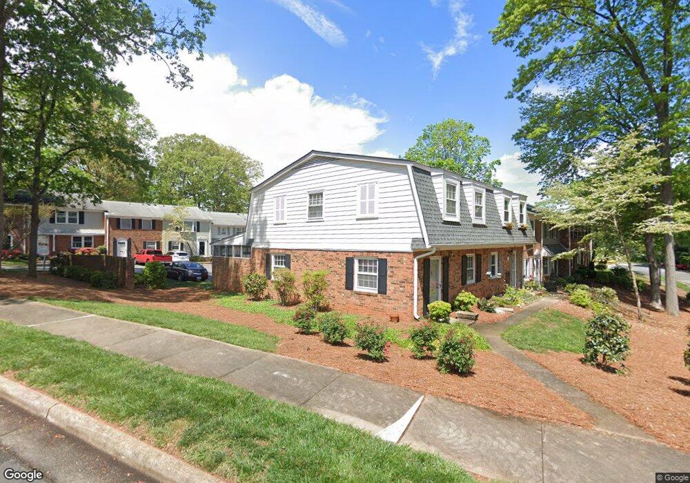
2315 Patriot Way Unit D Greensboro, NC 27408
Estimated Value: $218,000 - $230,000
3
Beds
3
Baths
1,452
Sq Ft
$155/Sq Ft
Est. Value
About This Home
This home is located at 2315 Patriot Way Unit D, Greensboro, NC 27408 and is currently estimated at $224,874, approximately $154 per square foot. 2315 Patriot Way Unit D is a home located in Guilford County with nearby schools including James Y Joyner Elementary School, Mendenhall Middle School, and Page High School.
Ownership History
Date
Name
Owned For
Owner Type
Purchase Details
Closed on
May 10, 2019
Sold by
Leonard Thomas J and Leonard Karen S
Bought by
Douglas Anthony
Current Estimated Value
Home Financials for this Owner
Home Financials are based on the most recent Mortgage that was taken out on this home.
Original Mortgage
$120,175
Outstanding Balance
$105,227
Interest Rate
4%
Mortgage Type
New Conventional
Estimated Equity
$119,647
Purchase Details
Closed on
May 8, 2009
Sold by
Garmon Jerry B and Garmon Patricia Davis
Bought by
Leonard Thomas J and Leonard Karen S
Create a Home Valuation Report for This Property
The Home Valuation Report is an in-depth analysis detailing your home's value as well as a comparison with similar homes in the area
Home Values in the Area
Average Home Value in this Area
Purchase History
| Date | Buyer | Sale Price | Title Company |
|---|---|---|---|
| Douglas Anthony | $126,500 | None Available | |
| Leonard Thomas J | $100,000 | None Available |
Source: Public Records
Mortgage History
| Date | Status | Borrower | Loan Amount |
|---|---|---|---|
| Open | Douglas Anthony | $120,175 |
Source: Public Records
Tax History Compared to Growth
Tax History
| Year | Tax Paid | Tax Assessment Tax Assessment Total Assessment is a certain percentage of the fair market value that is determined by local assessors to be the total taxable value of land and additions on the property. | Land | Improvement |
|---|---|---|---|---|
| 2025 | $2,336 | $166,500 | $40,000 | $126,500 |
| 2024 | $2,336 | $166,500 | $40,000 | $126,500 |
| 2023 | $2,336 | $166,500 | $40,000 | $126,500 |
| 2022 | $2,269 | $166,500 | $40,000 | $126,500 |
| 2021 | $1,516 | $108,800 | $24,000 | $84,800 |
| 2020 | $1,516 | $108,800 | $24,000 | $84,800 |
| 2019 | $1,516 | $95,600 | $0 | $0 |
| 2018 | $1,293 | $95,600 | $0 | $0 |
| 2017 | $1,293 | $95,600 | $0 | $0 |
| 2016 | $1,222 | $88,300 | $0 | $0 |
| 2015 | $1,230 | $88,300 | $0 | $0 |
| 2014 | $1,238 | $88,300 | $0 | $0 |
Source: Public Records
Map
Nearby Homes
- 2317 Patriot Way
- 3003 Overton Dr Unit D
- 2212 Oak Hill Dr
- 3405 Overton Dr
- 2610 Stratford Dr
- 2302 Running Brook Dr
- 2626 Robin Hood Dr
- 2719 Stratford Dr
- 3101 Canterbury St
- 2722 Stratford Dr
- 3406 Wilshire Dr
- 2200 Hathaway Dr
- 1502 Benjamin Pkwy Unit B
- 1508 Benjamin Pkwy Unit C
- 2702 Hill n Dale Dr
- 2732 Stratford Dr
- 3801 Pershing Ct
- 1815 W Cone Blvd
- 2806 Robin Hood Dr
- 2408 Gracewood Ct
- 2315 Patriot Way Unit F
- 2315 Patriot Way
- 2315 Patriot Way Unit C
- 2315 Patriot Way Unit B
- 2315 Patriot Way Unit A
- 2315 Patriot Way Unit E
- 2317 Patriot Way Unit A
- 2317 Patriot Way Unit B
- 2317 Patriot Way Unit C
- 2317 Patriot Way Unit D
- 2317 Patriot Way Unit F
- 2317 Patriot Way Unit E
- 3001 Patriot Ct Unit A
- 3001 Patriot Ct Unit B
- 3001 Patriot Ct Unit D
- 3001 Patriot Ct
- 3001 Patriot Ct Unit F
- 3003 Branchwood Dr
- 3001 Branchwood Dr
- 2319 Patriot Way Unit F