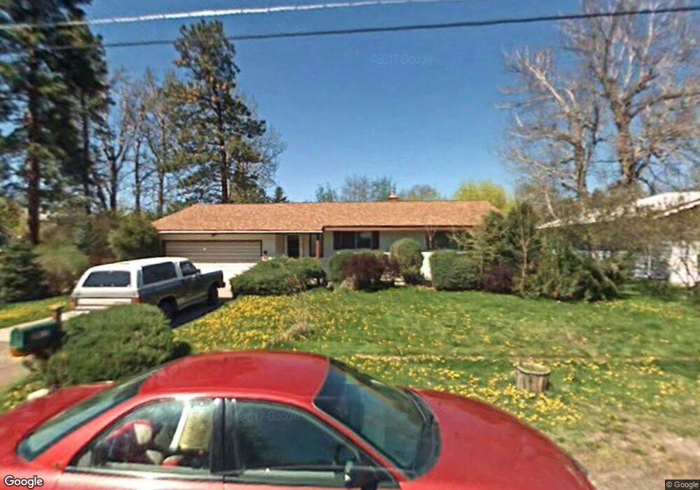
2317 Raymond Ave Missoula, MT 59802
Upper Rattlesnake NeighborhoodEstimated Value: $657,000 - $698,000
4
Beds
3
Baths
1,274
Sq Ft
$534/Sq Ft
Est. Value
About This Home
This home is located at 2317 Raymond Ave, Missoula, MT 59802 and is currently estimated at $679,823, approximately $533 per square foot. 2317 Raymond Ave is a home located in Missoula County with nearby schools including Rattlesnake Elementary School, Washington Middle School, and Hellgate High School.
Ownership History
Date
Name
Owned For
Owner Type
Purchase Details
Closed on
Jul 20, 2001
Sold by
Bumbeck John M and Bumbeck Marlene T
Bought by
Hunter Debora and Podner Craig
Current Estimated Value
Home Financials for this Owner
Home Financials are based on the most recent Mortgage that was taken out on this home.
Original Mortgage
$120,000
Outstanding Balance
$46,480
Interest Rate
7.21%
Estimated Equity
$633,343
Create a Home Valuation Report for This Property
The Home Valuation Report is an in-depth analysis detailing your home's value as well as a comparison with similar homes in the area
Home Values in the Area
Average Home Value in this Area
Purchase History
| Date | Buyer | Sale Price | Title Company |
|---|---|---|---|
| Hunter Debora | -- | -- |
Source: Public Records
Mortgage History
| Date | Status | Borrower | Loan Amount |
|---|---|---|---|
| Open | Hunter Debora | $120,000 |
Source: Public Records
Tax History Compared to Growth
Tax History
| Year | Tax Paid | Tax Assessment Tax Assessment Total Assessment is a certain percentage of the fair market value that is determined by local assessors to be the total taxable value of land and additions on the property. | Land | Improvement |
|---|---|---|---|---|
| 2025 | $6,115 | $693,900 | $346,565 | $347,335 |
| 2024 | $5,527 | $454,200 | $132,508 | $321,692 |
| 2023 | $5,690 | $454,200 | $132,508 | $321,692 |
| 2022 | $5,498 | $379,100 | $0 | $0 |
| 2021 | $4,605 | $379,100 | $0 | $0 |
| 2020 | $4,743 | $332,700 | $0 | $0 |
| 2019 | $4,739 | $332,700 | $0 | $0 |
| 2018 | $4,257 | $286,800 | $0 | $0 |
| 2017 | $4,202 | $286,800 | $0 | $0 |
| 2016 | $3,693 | $258,500 | $0 | $0 |
| 2015 | $3,458 | $258,500 | $0 | $0 |
| 2014 | $3,246 | $134,938 | $0 | $0 |
Source: Public Records
Map
Nearby Homes
- 2215 Raymond Ave
- 2411 Raymond Ave
- 1227 Basecamp Dr Unit A
- 1250 Basecamp Dr Unit C
- 1250 Basecamp Dr Unit F
- 2606 Sycamore St
- 2201 Greenough Ct W
- 521 Arbor Dr
- 1811 Elison Ln
- 1306 Lily Ct
- 1625 Sunflower Dr
- 1132 Jackson St
- 1655 Sunflower Dr
- 45 Brookside Way
- 19 Columbine Rd
- 7 Brookside Way
- 838 Locust St
- 11 Contour Rd
- 13 Contour Rd
- 2722 Contour Rd
- 2321 Raymond Ave
- 2307 Raymond Ave
- 2320 Wylie Ave
- 2314 Wylie Ave
- 2324 Wylie Ave
- 2325 Raymond Ave
- 2310 Wylie Ave
- 2303 Raymond Ave
- 2316 Raymond Ave
- 2312 Raymond Ave
- 2308 Raymond Ave
- 2320 Raymond Ave
- 2300 Wylie Ave
- 2400 Wylie Ave
- 2405 Raymond Ave
- 2304 Raymond Ave
- Lot 10 Lolo St
- 2404 Raymond Ave
- 2331 Gilbert Ave
- 2408 Wylie Ave