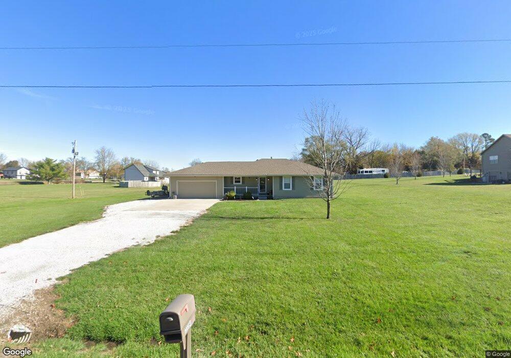
23184 155th St Leavenworth, KS 66048
Estimated Value: $341,940 - $419,000
3
Beds
2
Baths
1,388
Sq Ft
$281/Sq Ft
Est. Value
About This Home
This home is located at 23184 155th St, Leavenworth, KS 66048 and is currently estimated at $389,485, approximately $280 per square foot. 23184 155th St is a home located in Leavenworth County with nearby schools including Lansing Elementary School, Lansing Middle 6-8, and Lansing High 9-12.
Ownership History
Date
Name
Owned For
Owner Type
Purchase Details
Closed on
Apr 9, 2021
Sold by
Anderson Benjamin R and Anderson Hillary E
Bought by
First City Investments Llc
Current Estimated Value
Purchase Details
Closed on
Nov 16, 2011
Sold by
Citimortgage Inc
Bought by
Anderson Benjamin R and Anderson Hillary E
Home Financials for this Owner
Home Financials are based on the most recent Mortgage that was taken out on this home.
Original Mortgage
$100,000
Interest Rate
4.14%
Mortgage Type
New Conventional
Create a Home Valuation Report for This Property
The Home Valuation Report is an in-depth analysis detailing your home's value as well as a comparison with similar homes in the area
Home Values in the Area
Average Home Value in this Area
Purchase History
| Date | Buyer | Sale Price | Title Company |
|---|---|---|---|
| First City Investments Llc | -- | None Listed On Document | |
| Anderson Benjamin R | $125,000 | First American Title |
Source: Public Records
Mortgage History
| Date | Status | Borrower | Loan Amount |
|---|---|---|---|
| Previous Owner | Anderson Benjamin R | $100,000 |
Source: Public Records
Tax History Compared to Growth
Tax History
| Year | Tax Paid | Tax Assessment Tax Assessment Total Assessment is a certain percentage of the fair market value that is determined by local assessors to be the total taxable value of land and additions on the property. | Land | Improvement |
|---|---|---|---|---|
| 2025 | $3,572 | $33,928 | $6,545 | $27,383 |
| 2024 | $3,333 | $32,622 | $6,174 | $26,448 |
| 2023 | $3,333 | $31,672 | $6,174 | $25,498 |
| 2022 | $3,071 | $28,145 | $5,293 | $22,852 |
| 2021 | $2,670 | $24,207 | $4,402 | $19,805 |
| 2020 | $2,477 | $22,114 | $4,240 | $17,874 |
| 2019 | $2,356 | $21,183 | $3,895 | $17,288 |
| 2018 | $2,133 | $19,238 | $2,975 | $16,263 |
| 2017 | $2,016 | $18,149 | $2,768 | $15,381 |
| 2016 | $1,960 | $17,744 | $2,745 | $14,999 |
| 2015 | $1,888 | $17,135 | $2,745 | $14,390 |
| 2014 | $1,663 | $15,416 | $2,745 | $12,671 |
Source: Public Records
Map
Nearby Homes
- 15280 Roger Rd
- 22617 155th St
- 15038 Fairmount Rd
- 14934 Fairmount Rd
- 5025 146th St
- 5023 146th St
- 5005 146th St
- 5020 146th St
- 5018 146th St
- 14165 Ashbury Ct
- 5001 N 145th St
- 6508 141st St
- 4551 N 145th St
- 23802 140th St
- Lot 2 139th St
- 4576 Aspen Dr
- 4552 Aspen Dr
- 4615 N 144th Terrace
- 14463 Aurora Ln
- 14616 Aspen Cir