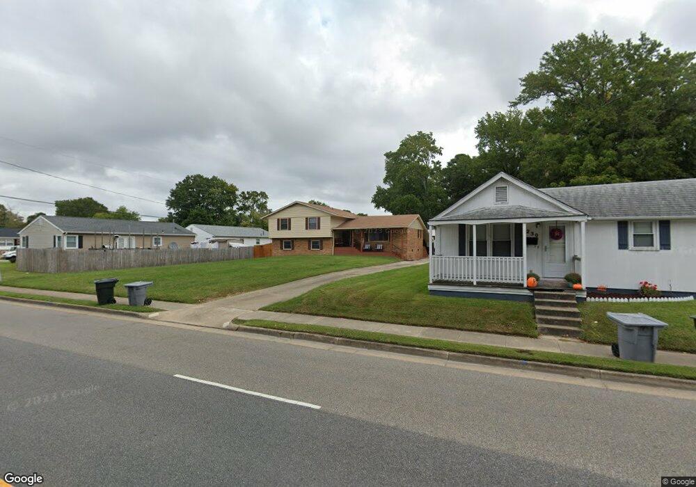
232 Woodland Rd Hampton, VA 23669
Buckroe Beach NeighborhoodEstimated Value: $356,000 - $407,000
5
Beds
3
Baths
2,477
Sq Ft
$155/Sq Ft
Est. Value
About This Home
This home is located at 232 Woodland Rd, Hampton, VA 23669 and is currently estimated at $384,164, approximately $155 per square foot. 232 Woodland Rd is a home located in Hampton City with nearby schools including Capt. John Smith Elementary School, Benjamin Syms Middle School, and Phoebus High School.
Ownership History
Date
Name
Owned For
Owner Type
Purchase Details
Closed on
Jun 29, 2020
Sold by
Norville Roger
Bought by
Tarver Randy L and Tarvar Shuntay Z
Current Estimated Value
Home Financials for this Owner
Home Financials are based on the most recent Mortgage that was taken out on this home.
Original Mortgage
$239,750
Outstanding Balance
$212,594
Interest Rate
3.1%
Mortgage Type
New Conventional
Estimated Equity
$171,570
Purchase Details
Closed on
Jun 9, 2015
Sold by
Hasan Adil S
Bought by
Norville Roger
Home Financials for this Owner
Home Financials are based on the most recent Mortgage that was taken out on this home.
Original Mortgage
$210,000
Interest Rate
3.83%
Mortgage Type
VA
Create a Home Valuation Report for This Property
The Home Valuation Report is an in-depth analysis detailing your home's value as well as a comparison with similar homes in the area
Home Values in the Area
Average Home Value in this Area
Purchase History
| Date | Buyer | Sale Price | Title Company |
|---|---|---|---|
| Tarver Randy L | $239,750 | Liberty Title & Escrow | |
| Norville Roger | $210,000 | -- |
Source: Public Records
Mortgage History
| Date | Status | Borrower | Loan Amount |
|---|---|---|---|
| Open | Tarver Randy L | $239,750 | |
| Previous Owner | Norville Roger | $210,000 |
Source: Public Records
Tax History Compared to Growth
Tax History
| Year | Tax Paid | Tax Assessment Tax Assessment Total Assessment is a certain percentage of the fair market value that is determined by local assessors to be the total taxable value of land and additions on the property. | Land | Improvement |
|---|---|---|---|---|
| 2025 | $4,322 | $375,800 | $64,400 | $311,400 |
| 2024 | $4,322 | $375,800 | $64,400 | $311,400 |
| 2023 | $3,588 | $309,300 | $60,000 | $249,300 |
| 2022 | $3,606 | $305,600 | $60,000 | $245,600 |
| 2021 | $3,111 | $240,400 | $48,000 | $192,400 |
| 2020 | $2,614 | $210,800 | $38,700 | $172,100 |
| 2019 | $2,614 | $210,800 | $38,700 | $172,100 |
| 2018 | $1,251 | $205,800 | $38,700 | $167,100 |
| 2017 | $94 | $0 | $0 | $0 |
| 2016 | $2,646 | $205,800 | $0 | $0 |
| 2015 | $2,408 | $0 | $0 | $0 |
| 2014 | -- | $192,800 | $38,700 | $154,100 |
Source: Public Records
Map
Nearby Homes
- 1422 Woodcrest Dr
- 1482 Morgan Dr
- 1428 Woodcrest Dr
- 1304 Woodcrest Dr
- 1427 Oakcrest Dr
- 105 Ireland St
- 168 Woodland Rd
- 10 Theodore St
- 124 Southerland Dr
- 1852 Kensington Dr
- 30 Whipple Dr
- 1415 Edson Terrace
- 1340 Coral Place
- 706 Grimes Rd
- 1802 Moger Dr
- 105 Prentiss Ln
- LOT 17 Prentiss Ln
- 8 N Cypress St
- 113 Southerland Dr
- 1358 Coral Place
- 1406 Antoinette Cir
- 1408 Antoinette Cir
- 1404 Antoinette Cir
- 1410 Antoinette Cir
- 1402 Antoinette Cir
- 226 Woodland Rd
- 228 Woodland Rd
- 1412 Antoinette Cir
- 1407 Antoinette Cir
- 1405 Antoinette Cir
- 1400 Antoinette Cir
- 1409 Antoinette Cir
- 230 Woodland Rd
- 224 Woodland Rd
- 1403 Antoinette Cir
- 1411 Antoinette Cir
- 220 Woodland Rd
- 1414 Antoinette Cir
- 1401 Antoinette Cir
- 1406 Woodcrest Dr