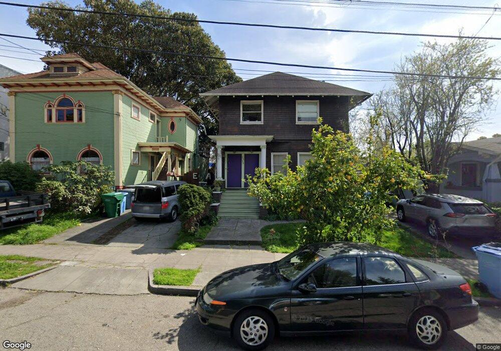
2320 Howe St Berkeley, CA 94705
South Berkeley NeighborhoodEstimated Value: $1,127,000 - $1,697,000
3
Beds
2
Baths
1,932
Sq Ft
$773/Sq Ft
Est. Value
About This Home
This home is located at 2320 Howe St, Berkeley, CA 94705 and is currently estimated at $1,493,413, approximately $772 per square foot. 2320 Howe St is a home located in Alameda County with nearby schools including Emerson Elementary School, Malcolm X Elementary School, and John Muir Elementary School.
Ownership History
Date
Name
Owned For
Owner Type
Purchase Details
Closed on
Jan 24, 1995
Sold by
Fingado John H and Elisabeth H Fingado Trust
Bought by
Adams Edward E B
Current Estimated Value
Home Financials for this Owner
Home Financials are based on the most recent Mortgage that was taken out on this home.
Original Mortgage
$144,750
Interest Rate
9.28%
Create a Home Valuation Report for This Property
The Home Valuation Report is an in-depth analysis detailing your home's value as well as a comparison with similar homes in the area
Home Values in the Area
Average Home Value in this Area
Purchase History
| Date | Buyer | Sale Price | Title Company |
|---|---|---|---|
| Adams Edward E B | $196,000 | Placer Title Company |
Source: Public Records
Mortgage History
| Date | Status | Borrower | Loan Amount |
|---|---|---|---|
| Closed | Adams Edward E B | $144,750 |
Source: Public Records
Tax History
| Year | Tax Paid | Tax Assessment Tax Assessment Total Assessment is a certain percentage of the fair market value that is determined by local assessors to be the total taxable value of land and additions on the property. | Land | Improvement |
|---|---|---|---|---|
| 2025 | $8,445 | $312,965 | $100,776 | $219,189 |
| 2024 | $8,445 | $306,691 | $98,800 | $214,891 |
| 2023 | $8,192 | $307,543 | $96,864 | $210,679 |
| 2022 | $8,441 | $294,513 | $94,965 | $206,548 |
| 2021 | $8,416 | $288,602 | $93,103 | $202,499 |
| 2020 | $7,909 | $292,571 | $92,148 | $200,423 |
| 2019 | $7,506 | $286,835 | $90,342 | $196,493 |
| 2018 | $7,308 | $281,211 | $88,570 | $192,641 |
| 2017 | $7,034 | $275,698 | $86,834 | $188,864 |
| 2016 | $6,697 | $270,294 | $85,132 | $185,162 |
| 2015 | $6,568 | $266,234 | $83,853 | $182,381 |
| 2014 | $6,402 | $261,020 | $82,211 | $178,809 |
Source: Public Records
Map
Nearby Homes
- 2917 Telegraph Ave
- 2243 Ashby Ave
- 2935 Florence St
- 2923 Wheeler St
- 2319 Ward St
- 3046 Deakin St
- 2702 Dana St
- 2110 Ashby Ave
- 2477 Prince St
- 6446 Colby St
- 2124 Prince St
- 2057 Emerson St
- 2643 Stuart St
- 6445 Irwin Ct
- 629 66th St
- 2550 Dana St Unit 2F
- 2535 Chilton Way
- 556 Alcatraz Ave
- 360 Alcatraz Ave
- 6555 Shattuck Ave
Your Personal Tour Guide
Ask me questions while you tour the home.