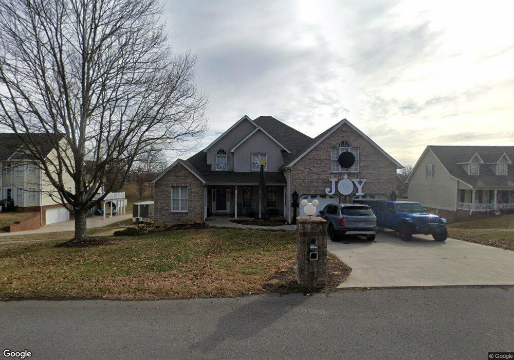
233 Brown Cir Blountville, TN 37617
Estimated Value: $502,000 - $829,000
4
Beds
5
Baths
3,702
Sq Ft
$191/Sq Ft
Est. Value
About This Home
This home is located at 233 Brown Cir, Blountville, TN 37617 and is currently estimated at $707,674, approximately $191 per square foot. 233 Brown Cir is a home located in Sullivan County with nearby schools including Holston Elementary School, Sullivan Central Middle School, and Tri-Cities Christian Academy.
Ownership History
Date
Name
Owned For
Owner Type
Purchase Details
Closed on
Dec 22, 2003
Sold by
Stidham Tommy L and Stidham Twila J
Bought by
Browder Michael E
Current Estimated Value
Home Financials for this Owner
Home Financials are based on the most recent Mortgage that was taken out on this home.
Original Mortgage
$266,400
Outstanding Balance
$133,918
Interest Rate
6.05%
Estimated Equity
$573,756
Purchase Details
Closed on
Jan 17, 2001
Sold by
Greg Darnell
Bought by
Tommy Stidham
Create a Home Valuation Report for This Property
The Home Valuation Report is an in-depth analysis detailing your home's value as well as a comparison with similar homes in the area
Home Values in the Area
Average Home Value in this Area
Purchase History
| Date | Buyer | Sale Price | Title Company |
|---|---|---|---|
| Browder Michael E | $333,000 | -- | |
| Tommy Stidham | $254,900 | -- |
Source: Public Records
Mortgage History
| Date | Status | Borrower | Loan Amount |
|---|---|---|---|
| Open | Tommy Stidham | $266,400 |
Source: Public Records
Tax History Compared to Growth
Tax History
| Year | Tax Paid | Tax Assessment Tax Assessment Total Assessment is a certain percentage of the fair market value that is determined by local assessors to be the total taxable value of land and additions on the property. | Land | Improvement |
|---|---|---|---|---|
| 2024 | $2,702 | $108,250 | $7,275 | $100,975 |
| 2023 | $2,605 | $108,250 | $7,275 | $100,975 |
| 2022 | $2,605 | $108,250 | $7,275 | $100,975 |
| 2021 | $2,605 | $108,250 | $7,275 | $100,975 |
| 2020 | $2,556 | $108,250 | $7,275 | $100,975 |
| 2019 | $2,556 | $99,450 | $7,275 | $92,175 |
| 2018 | $2,536 | $99,450 | $7,275 | $92,175 |
| 2017 | $2,536 | $99,450 | $7,275 | $92,175 |
| 2016 | $2,457 | $95,400 | $7,275 | $88,125 |
| 2014 | $2,199 | $95,388 | $0 | $0 |
Source: Public Records
Map
Nearby Homes
- 239 Brown Cir
- 295 Brown Cir
- 129 Forest Ln N
- 156 Forest Ln N
- 205 Grande Harbor Way
- 191 Grande Harbor Way
- 148 Forest Ln S
- 164 Forest Ln N
- 290 Candy Creek Private Dr
- 205 Forest Ct
- Tbd Yoakley Rd
- 145 Grande Harbor Way
- 112 Cardinal Point
- 225 Forest Ln N
- 304 Rutledge Ln
- Tbd Old Muddy Creek Rd
- 780 Hamilton Rd Unit 6
- 780 Hamilton Rd Unit I-4
- 355 Holston Dr
- 999 Muddy Creek Rd
- 227 Brown Cir
- 9 Barefoot Landings Dr
- 3 Barefoot Landings Dr Unit LOT
- 101 Barefoot Landing Dr
- 101 Barefoot Landings Dr
- 109 Barefoot Landing Dr
- 109 Barefoot Landings Dr
- 221 Brown Cir
- 113 Barefoot Landings Dr
- 113 Barefoot Landing Dr
- 215 Brown Cir
- 117 Barefoot Landings Dr
- 117 Barefoot Landing Dr
- 100 Barefoot Landing Dr
- 100 Barefoot Landings Dr
- 104 Barefoot Landings Dr
- 4 Barefoot Landings Dr
- 6 Barefoot Landings Dr
- 104 Barefoot Landing Dr
- 4 Brown Cir