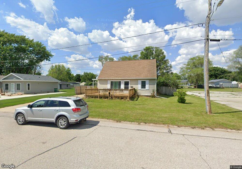
233 Collins Ave Evansdale, IA 50707
Estimated Value: $134,000 - $161,597
3
Beds
1
Bath
1,116
Sq Ft
$133/Sq Ft
Est. Value
About This Home
This home is located at 233 Collins Ave, Evansdale, IA 50707 and is currently estimated at $148,899, approximately $133 per square foot. 233 Collins Ave is a home located in Black Hawk County with nearby schools including Poyner Elementary School, Bunger Middle School, and East High School.
Ownership History
Date
Name
Owned For
Owner Type
Purchase Details
Closed on
Mar 1, 2021
Sold by
Evansdale Economic Development Corp
Bought by
Rosol Melissa K
Current Estimated Value
Purchase Details
Closed on
Nov 21, 2007
Sold by
Mustard Allan and Mustard Heather
Bought by
Rosol Ryan E and Rosol Melissa K
Home Financials for this Owner
Home Financials are based on the most recent Mortgage that was taken out on this home.
Original Mortgage
$83,000
Interest Rate
6.47%
Mortgage Type
New Conventional
Purchase Details
Closed on
Jul 31, 2007
Sold by
Sires Mary
Bought by
Mustard Allen and Mustard Heather
Home Financials for this Owner
Home Financials are based on the most recent Mortgage that was taken out on this home.
Original Mortgage
$93,500
Interest Rate
12.37%
Mortgage Type
Adjustable Rate Mortgage/ARM
Create a Home Valuation Report for This Property
The Home Valuation Report is an in-depth analysis detailing your home's value as well as a comparison with similar homes in the area
Home Values in the Area
Average Home Value in this Area
Purchase History
| Date | Buyer | Sale Price | Title Company |
|---|---|---|---|
| Rosol Melissa K | $22,500 | Title Services Corporation | |
| Rosol Ryan E | $93,000 | Black Hawk County Abstract & | |
| Mustard Allen | $99,000 | New Millennium Title Corp |
Source: Public Records
Mortgage History
| Date | Status | Borrower | Loan Amount |
|---|---|---|---|
| Previous Owner | Rosol Ryan E | $83,000 | |
| Previous Owner | Mustard Allen | $93,500 |
Source: Public Records
Tax History Compared to Growth
Tax History
| Year | Tax Paid | Tax Assessment Tax Assessment Total Assessment is a certain percentage of the fair market value that is determined by local assessors to be the total taxable value of land and additions on the property. | Land | Improvement |
|---|---|---|---|---|
| 2024 | $1,804 | $129,400 | $12,380 | $117,020 |
| 2023 | $1,432 | $129,400 | $12,380 | $117,020 |
| 2022 | $1,484 | $101,030 | $12,380 | $88,650 |
| 2021 | $1,472 | $105,150 | $16,500 | $88,650 |
| 2020 | $1,458 | $97,180 | $13,200 | $83,980 |
| 2019 | $1,458 | $97,180 | $13,200 | $83,980 |
| 2018 | $1,512 | $97,180 | $13,200 | $83,980 |
| 2017 | $1,512 | $97,180 | $13,200 | $83,980 |
| 2016 | $1,456 | $94,310 | $13,200 | $81,110 |
| 2015 | $1,456 | $94,310 | $13,200 | $81,110 |
| 2014 | $1,388 | $89,810 | $13,200 | $76,610 |
Source: Public Records
Map
Nearby Homes
- 901 Brookside Ave
- Lot 9 Fran St
- 1007 Schons St
- 1107 Central Ave
- Lot 29 Fran
- Lot 13 Fran
- 127 Doyle Ave
- 604 Ayers Ave
- 244 Wema Ave
- 755 Fox Ave
- 825 Jones Rd
- 1018 Fox Ave
- 730 Timber Oak Rd
- Lot 10 Timberline Dr
- Lot 7 Timberline Dr
- 421 Miner Dr
- 4577 Lafayette Rd
- 88 Eldene Ct
- 1705 Michigan Dr
- 1760 Michigan Dr
- 221 Collins Ave
- 219 Collins Ave
- 213 Collins Ave
- 840 Central Ave
- 828 Central Ave
- 234 Collins Ave
- 729 Boelling Ave
- 236 Collins Ave
- 242 Collins Ave
- 852 Central Ave
- 737 Boelling Ave
- 244 Collins Ave
- 816 Central Ave
- 618 Dodge St
- 800 Central Ave
- 810 Central Ave
- 0000 Colllins Ave
- 0 Collins Ave
- 620 Dodge St
- 817 Central Ave