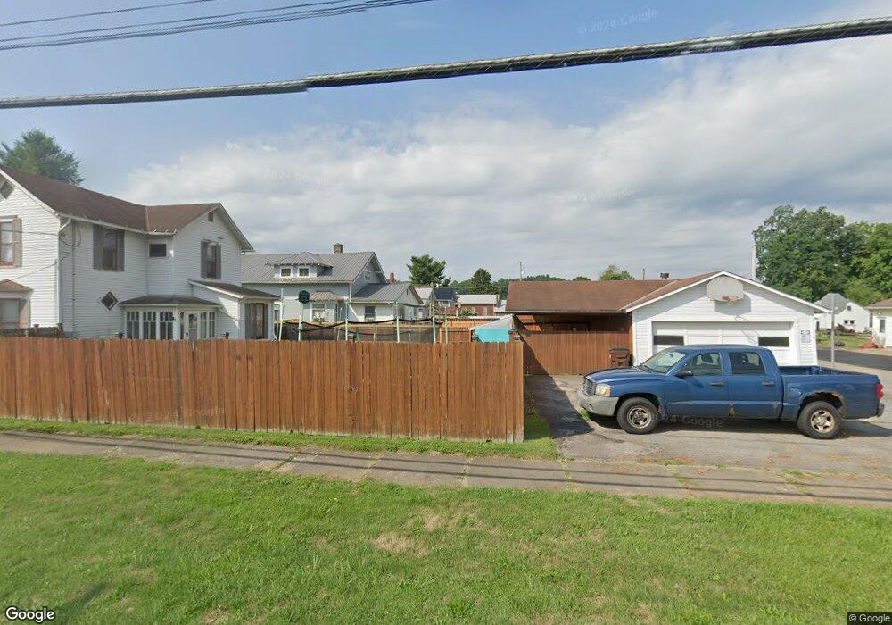
2332 Cr 2175 Perrysville, OH 44864
Estimated Value: $273,604 - $327,000
3
Beds
2
Baths
1,144
Sq Ft
$255/Sq Ft
Est. Value
About This Home
This home is located at 2332 Cr 2175, Perrysville, OH 44864 and is currently estimated at $291,401, approximately $254 per square foot. 2332 Cr 2175 is a home located in Ashland County with nearby schools including McMullen Elementary School, Budd Elementary School, and Loudonville High School.
Ownership History
Date
Name
Owned For
Owner Type
Purchase Details
Closed on
Apr 21, 2022
Sold by
Brown Kirt W
Bought by
Brown Kirt W and Brown Patricia M
Current Estimated Value
Purchase Details
Closed on
Aug 11, 2008
Bought by
Brown Kirt W
Purchase Details
Closed on
May 12, 2008
Sold by
Marksberry Douglas T
Purchase Details
Closed on
Oct 31, 2003
Sold by
Eastman Amos L
Bought by
Marksberry Douglas T
Purchase Details
Closed on
Oct 9, 2001
Sold by
Starkey Jack B
Bought by
Eastman Amos L
Purchase Details
Closed on
Jan 1, 1990
Bought by
Starkey Jack B
Create a Home Valuation Report for This Property
The Home Valuation Report is an in-depth analysis detailing your home's value as well as a comparison with similar homes in the area
Home Values in the Area
Average Home Value in this Area
Purchase History
| Date | Buyer | Sale Price | Title Company |
|---|---|---|---|
| Brown Kirt W | -- | New Title Company Name | |
| Brown Kirt W | $137,500 | -- | |
| -- | $110,000 | -- | |
| Marksberry Douglas T | $32,500 | -- | |
| Eastman Amos L | $30,000 | -- | |
| Starkey Jack B | $35,000 | -- |
Source: Public Records
Tax History Compared to Growth
Tax History
| Year | Tax Paid | Tax Assessment Tax Assessment Total Assessment is a certain percentage of the fair market value that is determined by local assessors to be the total taxable value of land and additions on the property. | Land | Improvement |
|---|---|---|---|---|
| 2024 | $2,613 | $66,000 | $19,870 | $46,130 |
| 2023 | $2,613 | $66,000 | $19,870 | $46,130 |
| 2022 | $2,072 | $45,530 | $13,710 | $31,820 |
| 2021 | $2,055 | $45,530 | $13,710 | $31,820 |
| 2020 | $1,937 | $45,530 | $13,710 | $31,820 |
| 2019 | $1,841 | $42,740 | $11,750 | $30,990 |
| 2018 | $1,853 | $42,740 | $11,750 | $30,990 |
| 2017 | $1,622 | $42,740 | $11,750 | $30,990 |
| 2016 | $1,582 | $37,170 | $10,220 | $26,950 |
| 2015 | $1,572 | $37,170 | $10,220 | $26,950 |
| 2013 | $1,663 | $38,830 | $9,710 | $29,120 |
Source: Public Records
Map
Nearby Homes
- 0 Township Road 925
- 609 Ohio 95
- 560 Township Road 2402
- 968 Township Road 2506
- 0 Ashland County Road 2175
- 0 Ashland County Road 2175
- 1048 Township Road 2156
- 820 County Road 30a
- 150 E Main St
- 1106 County Road 30a
- 1845 County Road 655
- 136 Bridge St
- 0 Applegate Rd
- 2428 Applegate Rd
- 0 Twp Rd 1806 Unit 11591470
- 0 County Road 917
- 1183 County Road 30a
- 68.40 Acres Trumpower Rd
- 0 Trumpower Rd
- 2332 County Road 2175
- 2330 County Road 2175
- 2330 County Road 2175
- 2344 County Road 2175
- 2314 County Road 2175
- 2339 County Road 2175
- 2329 County Road 2175
- 2313 County Road 2175
- 2309 County Road 2175
- 2313 Cr 2175
- 2313 County Road 2175
- 2356 County Road 2175
- 2297 Township Road 757
- 2295 Township Road 757
- 824 County Road 2404
- 2293 Ashland County Road 2175
- 2293 County Road 2175
- 2293 Cr-2175
- 794 County Road 2404
- 794 Cr 2404