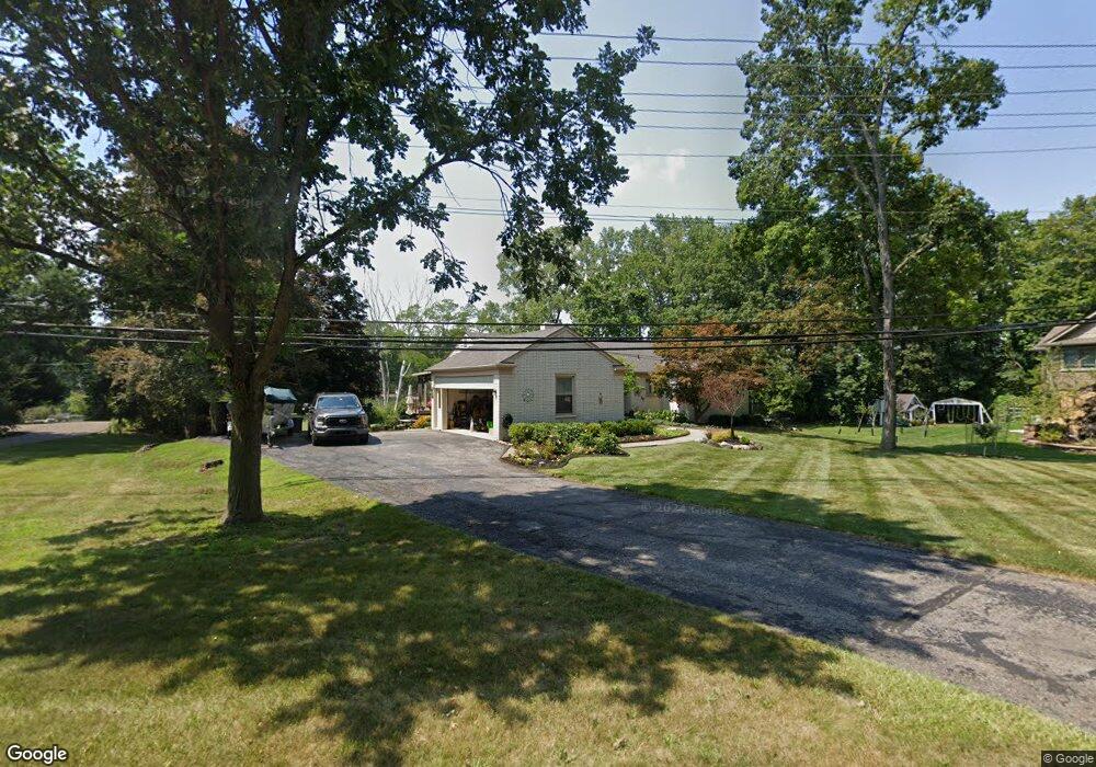
23326 Lowrie Dr Unit Bldg-Unit Grosse Ile, MI 48138
Estimated Value: $430,000 - $502,000
--
Bed
3
Baths
1,583
Sq Ft
$292/Sq Ft
Est. Value
About This Home
This home is located at 23326 Lowrie Dr Unit Bldg-Unit, Grosse Ile, MI 48138 and is currently estimated at $462,877, approximately $292 per square foot. 23326 Lowrie Dr Unit Bldg-Unit is a home located in Wayne County with nearby schools including St. Joseph Elementary School.
Ownership History
Date
Name
Owned For
Owner Type
Purchase Details
Closed on
Apr 30, 2020
Sold by
Sardanopoli Barbara and Sardanopoli Barbara Rlt
Bought by
Hayes Roger P and Hayes Donna J
Current Estimated Value
Home Financials for this Owner
Home Financials are based on the most recent Mortgage that was taken out on this home.
Original Mortgage
$308,750
Outstanding Balance
$274,615
Interest Rate
3.5%
Mortgage Type
New Conventional
Estimated Equity
$188,262
Purchase Details
Closed on
Dec 21, 2005
Sold by
Sardanopoli Armando and Sardanopoli Barbara
Bought by
Sardanopoli Barbara and The Barbara Sardanopoli Revocable Living
Create a Home Valuation Report for This Property
The Home Valuation Report is an in-depth analysis detailing your home's value as well as a comparison with similar homes in the area
Home Values in the Area
Average Home Value in this Area
Purchase History
| Date | Buyer | Sale Price | Title Company |
|---|---|---|---|
| Hayes Roger P | $325,000 | Michigan Title Ins Agcy Inc | |
| Sardanopoli Barbara | -- | None Available |
Source: Public Records
Mortgage History
| Date | Status | Borrower | Loan Amount |
|---|---|---|---|
| Open | Hayes Roger P | $308,750 |
Source: Public Records
Tax History Compared to Growth
Tax History
| Year | Tax Paid | Tax Assessment Tax Assessment Total Assessment is a certain percentage of the fair market value that is determined by local assessors to be the total taxable value of land and additions on the property. | Land | Improvement |
|---|---|---|---|---|
| 2025 | $2,686 | $195,900 | $0 | $0 |
| 2024 | $2,686 | $188,100 | $0 | $0 |
| 2023 | $3,072 | $177,300 | $0 | $0 |
| 2022 | $7,150 | $166,900 | $0 | $0 |
| 2021 | $6,840 | $155,200 | $0 | $0 |
| 2019 | $7,502 | $177,400 | $0 | $0 |
| 2018 | $3,226 | $175,300 | $0 | $0 |
| 2017 | $8,331 | $169,300 | $0 | $0 |
| 2016 | $7,373 | $159,900 | $0 | $0 |
| 2015 | $15,701 | $157,400 | $0 | $0 |
| 2013 | $15,210 | $157,300 | $0 | $0 |
| 2012 | $2,892 | $148,800 | $56,600 | $92,200 |
Source: Public Records
Map
Nearby Homes
- 0 Ferry Rd Unit 20250033371
- 9000 Ferry Rd
- 8855 Ferry Rd
- Lot 503 Gi Pkwy
- 00000 Magnolia Ln
- VACANT Oriole Ave
- 0 Golfview Unit 20251048698
- 8454 Grays Dr
- 24111 Meridian Rd Unit 120
- 8614 Island Blvd
- 9281 Island Dr
- 8232 Island Blvd
- 22133 Meridian Rd
- 0000 Marlborough Dr
- 8597 Mathias Dr Unit 43
- 000 Marlborough Dr
- 9614 Grosse Ile Pkwy
- 8095 Colony Dr Unit 23
- 25146 Dallas Dr
- 21819 Meridian Rd
- 23326 Lowrie Dr
- 23310 Lowrie Dr
- 23352 Lowrie Dr
- 9001 Ferry Rd
- 23301 Lowrie Dr
- 8941 Ferry Rd
- 23329 Lowrie Dr
- 23378 Lowrie Dr
- 8890 Thorntree Dr
- 0 Ferry Rd Unit 29122923
- 0 Ferry Rd
- 0 Ferry Rd Unit R214001115
- 0 Ferry Rd Unit R214066027
- 8879 Thorntree Dr
- 8940 Sarah Ln
- 8908 Sarah Ln
- 8908 Ferry Rd
- 23404 Lowrie Dr
- 8892 Sarah Ln
- 8864 Thorntree Dr