


Estimated payment $2,649/month
Total Views
447
3
Beds
2.5
Baths
1,636
Sq Ft
$226
Price per Sq Ft
Highlights
- Deck
- Wood Flooring
- L-Shaped Dining Room
- South Elgin High School Rated A-
- Main Floor Bedroom
- 4-minute walk to Willow Bay Park
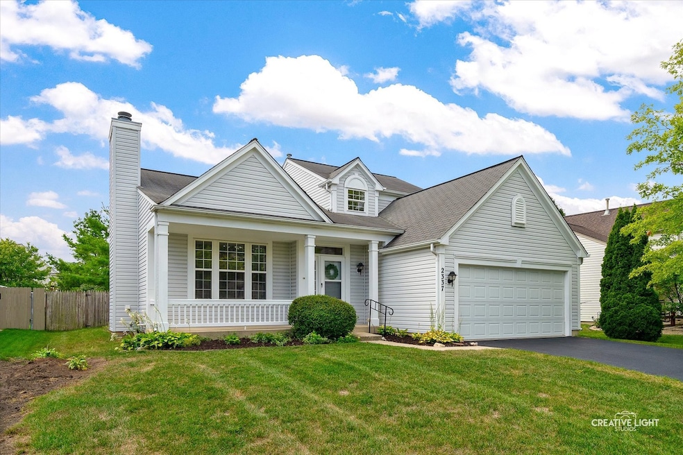
About This Home
Welcome Home! This Willow Bay home features a first-floor primary bedroom complete with a spacious walk-in closet and ensuite bathroom. Two additional bedrooms with Jack and Jill bath are located on the 2nd floor. The Living/Family Room features a gas fireplace and Vaulted Ceiling. The dining room leads to the kitchen with eating area, pantry, Stainless Steel appliances including a Bosch dishwasher. Sliding doors lead to the 3 season room which leads to the fenced backyard. The first floor also features a laundry room, powder room and door to the attached 2 car garage. A spacious unfinished basement with a crawlspace and sturdy concrete floor provides endless possibilities for future expansion, storage, or hobbies. This well maintained home is being sold AS-IS.
Home Details
Home Type
- Single Family
Est. Annual Taxes
- $7,684
Year Built
- Built in 1998
Lot Details
- 7,841 Sq Ft Lot
- Fenced
HOA Fees
- $14 Monthly HOA Fees
Parking
- 2 Car Garage
- Driveway
Home Design
- Asphalt Roof
- Concrete Perimeter Foundation
Interior Spaces
- 1,636 Sq Ft Home
- 2-Story Property
- Family Room
- Living Room with Fireplace
- L-Shaped Dining Room
- Partial Basement
Kitchen
- Range
- Microwave
- Dishwasher
- Stainless Steel Appliances
- Disposal
Flooring
- Wood
- Carpet
- Laminate
Bedrooms and Bathrooms
- 3 Bedrooms
- 3 Potential Bedrooms
- Main Floor Bedroom
- Walk-In Closet
- Bathroom on Main Level
Laundry
- Laundry Room
- Dryer
- Washer
Outdoor Features
- Deck
- Enclosed Patio or Porch
Schools
- Fox Meadow Elementary School
- Kenyon Woods Middle School
- South Elgin High School
Utilities
- Central Air
- Heating System Uses Natural Gas
Community Details
- Property managed by Willow Bay Single Family Lot
Listing and Financial Details
- Senior Tax Exemptions
- Homeowner Tax Exemptions
Map
Create a Home Valuation Report for This Property
The Home Valuation Report is an in-depth analysis detailing your home's value as well as a comparison with similar homes in the area
Home Values in the Area
Average Home Value in this Area
Tax History
| Year | Tax Paid | Tax Assessment Tax Assessment Total Assessment is a certain percentage of the fair market value that is determined by local assessors to be the total taxable value of land and additions on the property. | Land | Improvement |
|---|---|---|---|---|
| 2024 | $7,684 | $112,016 | $28,317 | $83,699 |
| 2023 | $7,263 | $101,198 | $25,582 | $75,616 |
| 2022 | $3,989 | $92,275 | $23,326 | $68,949 |
| 2021 | $4,105 | $86,270 | $21,808 | $64,462 |
| 2020 | $4,196 | $82,358 | $20,819 | $61,539 |
| 2019 | $4,297 | $78,451 | $19,831 | $58,620 |
| 2018 | $4,549 | $73,906 | $18,682 | $55,224 |
| 2017 | $4,732 | $69,867 | $17,661 | $52,206 |
| 2016 | $4,907 | $64,818 | $16,385 | $48,433 |
| 2015 | -- | $59,411 | $15,018 | $44,393 |
| 2014 | -- | $57,008 | $14,833 | $42,175 |
| 2013 | -- | $58,512 | $15,224 | $43,288 |
Source: Public Records
Property History
| Date | Event | Price | Change | Sq Ft Price |
|---|---|---|---|---|
| 09/04/2025 09/04/25 | Pending | -- | -- | -- |
| 09/03/2025 09/03/25 | Price Changed | $369,000 | 0.0% | $226 / Sq Ft |
| 09/03/2025 09/03/25 | For Sale | $369,000 | -- | $226 / Sq Ft |
Source: Midwest Real Estate Data (MRED)
Purchase History
| Date | Type | Sale Price | Title Company |
|---|---|---|---|
| Warranty Deed | $178,500 | First American Title Ins Co |
Source: Public Records
Mortgage History
| Date | Status | Loan Amount | Loan Type |
|---|---|---|---|
| Open | $224,000 | Unknown | |
| Closed | $48,500 | Credit Line Revolving | |
| Closed | $162,000 | Unknown | |
| Closed | $160,100 | Unknown | |
| Closed | $157,650 | Stand Alone First | |
| Closed | $158,000 | Unknown | |
| Closed | $160,000 | No Value Available |
Source: Public Records
Similar Homes in Elgin, IL
Source: Midwest Real Estate Data (MRED)
MLS Number: 12433469
APN: 06-28-406-005
Disclaimer: Certain information contained herein is derived from information provided by parties other than Homes.com. All information provided is deemed reliable, but is not guaranteed to be accurate and should be independently verified.
![]() Based on information submitted to the MLS GRID. All data is obtained from various sources and may not have been verified by broker or MLS GRID. Supplied Open House Information is subject to change without notice. All information should be independently reviewed and verified for accuracy. Properties may or may not be listed by the office/agent presenting the information. Some IDX listings have been excluded from this website.
Based on information submitted to the MLS GRID. All data is obtained from various sources and may not have been verified by broker or MLS GRID. Supplied Open House Information is subject to change without notice. All information should be independently reviewed and verified for accuracy. Properties may or may not be listed by the office/agent presenting the information. Some IDX listings have been excluded from this website.
The Digital Millennium Copyright Act of 1998, 17 U.S.C. § 512 (the “DMCA”) provides recourse for copyright owners who believe that material appearing on the Internet infringes their rights under U.S. copyright law. If you believe in good faith that any content or material made available in connection with our website or services infringes your copyright, you (or your agent) may send us a notice requesting that the content or material be removed, or access to it blocked.
Notices must be sent in writing by email to DMCAnotice@MLSGrid.com.
The DMCA requires that your notice of alleged copyright infringement include the following information:
(1) description of the copyrighted work that is the subject of claimed infringement;
(2) description of the alleged infringing content and information sufficient to permit us to locate the content;
(3) contact information for you, including your address, telephone number and email address;
(4) a statement by you that you have a good faith belief that the content in the manner complained of is not authorized by the copyright owner, or its agent, or by the operation of any law;
(5) a statement by you, signed under penalty of perjury, that the information in the notification is accurate and that you have the authority to enforce the copyrights that are claimed to be infringed; and
(6) a physical or electronic signature of the copyright owner or a person authorized to act on the copyright owner’s behalf. Failure to include all of the above information may result in the delay of the processing of your complaint.
Nearby Homes
- 2366 Nantucket Ln
- 2370 Nantucket Ln
- 2352 Cove Ct Unit 125B
- 830 Baltusrol Dr
- 1436 Marleigh Ln
- 763 Verde Vista Ct Unit 612C
- 761 Verde Vista Ct Unit 611F
- 27 Farmington Ct
- 2038 College Green Dr
- 1370 Marleigh Ln
- 765 Columbine Dr
- 883 Ravine Ct
- 1459 S Blackhawk Cir
- 9N564 Flora Dr
- 1458 Woodland Dr
- 962 Ascot Dr
- 1621 Saint Andrews Cir
- 2451 Rolling Ridge
- 1682 College Green Dr Unit 2
- 1077 Crane Point