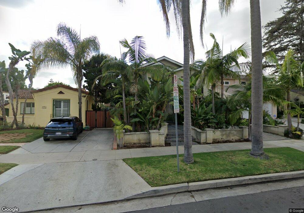
2339 Manning Ave Los Angeles, CA 90064
West Los Angeles NeighborhoodEstimated Value: $2,400,000 - $2,807,652
3
Beds
3
Baths
2,258
Sq Ft
$1,155/Sq Ft
Est. Value
About This Home
This home is located at 2339 Manning Ave, Los Angeles, CA 90064 and is currently estimated at $2,607,413, approximately $1,154 per square foot. 2339 Manning Ave is a home located in Los Angeles County with nearby schools including Daniel Webster Middle School, Westwood Charter School, and Ralph Waldo Emerson Community Charter Middle School.
Ownership History
Date
Name
Owned For
Owner Type
Purchase Details
Closed on
Oct 16, 2003
Sold by
Moradi Mehrdad Yousef
Bought by
Neydavoud Homayoun
Current Estimated Value
Home Financials for this Owner
Home Financials are based on the most recent Mortgage that was taken out on this home.
Original Mortgage
$650,000
Interest Rate
5%
Mortgage Type
Purchase Money Mortgage
Create a Home Valuation Report for This Property
The Home Valuation Report is an in-depth analysis detailing your home's value as well as a comparison with similar homes in the area
Home Values in the Area
Average Home Value in this Area
Purchase History
| Date | Buyer | Sale Price | Title Company |
|---|---|---|---|
| Neydavoud Homayoun | $830,000 | Equity Title Company |
Source: Public Records
Mortgage History
| Date | Status | Borrower | Loan Amount |
|---|---|---|---|
| Previous Owner | Neydavoud Homayoun | $650,000 |
Source: Public Records
Tax History Compared to Growth
Tax History
| Year | Tax Paid | Tax Assessment Tax Assessment Total Assessment is a certain percentage of the fair market value that is determined by local assessors to be the total taxable value of land and additions on the property. | Land | Improvement |
|---|---|---|---|---|
| 2025 | $17,420 | $1,451,481 | $944,065 | $507,416 |
| 2024 | $17,420 | $1,423,021 | $925,554 | $497,467 |
| 2023 | $17,085 | $1,395,119 | $907,406 | $487,713 |
| 2022 | $16,293 | $1,367,764 | $889,614 | $478,150 |
| 2021 | $16,082 | $1,340,946 | $872,171 | $468,775 |
| 2019 | $15,599 | $1,301,174 | $846,302 | $454,872 |
| 2018 | $15,491 | $1,275,661 | $829,708 | $445,953 |
| 2016 | $14,798 | $1,226,128 | $797,491 | $428,637 |
| 2015 | $14,581 | $1,207,711 | $785,512 | $422,199 |
| 2014 | $14,626 | $1,184,054 | $770,125 | $413,929 |
Source: Public Records
Map
Nearby Homes
- 2215 Prosser Ave
- 2203 Pelham Ave
- 10517 Blythe Ave
- 10509 Blythe Ave
- 10615 Esther Ave
- 10456 Almayo Ave
- 2147 Malcolm Ave
- 2323 S Beverly Glen Blvd Unit 9
- 2301 S Beverly Glen Blvd Unit 102
- 2030 Pelham Ave
- 2157 Linnington Ave
- 2234 Midvale Ave
- 10572 Putney Rd
- 2327 Midvale Ave
- 2520 Midvale Ave
- 2372 S Beverly Glen Blvd
- 10393 Almayo Ave
- 10915 Ayres Ave
- 2240 S Beverly Glen Blvd Unit 103
- 2175 S Beverly Glen Blvd Unit 403
- 2335 Manning Ave
- 2343 Manning Ave
- 2329 Manning Ave
- 2347 Manning Ave
- 2325 Manning Ave
- 2351 Manning Ave
- 2340 Pelham Ave
- 2336 Pelham Ave
- 2330 Pelham Ave
- 2346 Pelham Ave
- 2357 Manning Ave
- 2321 Manning Ave
- 2326 Pelham Ave
- 2350 Pelham Ave
- 2338 Manning Ave
- 2342 Manning Ave
- 2334 Manning Ave
- 2346 Manning Ave
- 2328 Manning Ave
- 2320 Pelham Ave