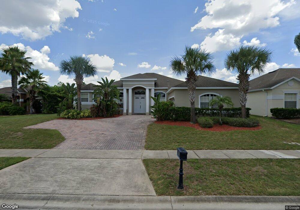
234 Birkdale St Davenport, FL 33897
Westside NeighborhoodEstimated Value: $527,283 - $585,000
4
Beds
3
Baths
2,764
Sq Ft
$199/Sq Ft
Est. Value
About This Home
This home is located at 234 Birkdale St, Davenport, FL 33897 and is currently estimated at $549,821, approximately $198 per square foot. 234 Birkdale St is a home located in Polk County with nearby schools including Citrus Ridge Academy: a Civics Academy, Davenport School Of The Arts, and Dundee Elementary Academy.
Ownership History
Date
Name
Owned For
Owner Type
Purchase Details
Closed on
Feb 13, 2006
Sold by
Lowe Keith and Lowe Anne Elizabeth
Bought by
Willow Manor Inc
Current Estimated Value
Purchase Details
Closed on
Aug 12, 2004
Sold by
Florida Homes & Investments Inc
Bought by
Lowe Keith and Lowe Anne Elizabeth
Purchase Details
Closed on
Aug 2, 2004
Sold by
Tousa Homes Inc
Bought by
Florida Homes& Investments Inc
Create a Home Valuation Report for This Property
The Home Valuation Report is an in-depth analysis detailing your home's value as well as a comparison with similar homes in the area
Home Values in the Area
Average Home Value in this Area
Purchase History
| Date | Buyer | Sale Price | Title Company |
|---|---|---|---|
| Willow Manor Inc | $495,000 | Celebration Title Co Llc | |
| Lowe Keith | $365,000 | Universal Land Title Inc | |
| Florida Homes& Investments Inc | $274,500 | Universal Land Title Inc |
Source: Public Records
Tax History Compared to Growth
Tax History
| Year | Tax Paid | Tax Assessment Tax Assessment Total Assessment is a certain percentage of the fair market value that is determined by local assessors to be the total taxable value of land and additions on the property. | Land | Improvement |
|---|---|---|---|---|
| 2025 | $6,372 | $429,407 | $155,000 | $274,407 |
| 2024 | $6,074 | $424,866 | -- | -- |
| 2023 | $6,074 | $386,242 | $0 | $0 |
| 2022 | $5,351 | $351,129 | $0 | $0 |
| 2021 | $4,968 | $319,208 | $113,000 | $206,208 |
| 2020 | $4,793 | $305,516 | $108,000 | $197,516 |
| 2018 | $4,677 | $287,880 | $103,000 | $184,880 |
| 2017 | $4,984 | $311,071 | $0 | $0 |
| 2016 | $4,909 | $302,333 | $0 | $0 |
| 2015 | $4,355 | $279,087 | $0 | $0 |
| 2014 | $4,250 | $253,715 | $0 | $0 |
Source: Public Records
Map
Nearby Homes
- 300 Kings Way
- 435 Gleneagles Dr
- 507 Gleneagles Dr
- 522 Birkdale St
- 454 Gleneagles Dr
- 254 Gleneagles Dr
- 139 Belfry Dr
- 1730 N Hampton Dr
- 511 Prestwick Dr
- 1719 N Hampton Dr
- 206 Herring St
- 252 Churchill Park Dr
- 416 Prestwick Dr
- 459 Belfry Dr
- 429 Belfry Dr
- 1506 N Hampton Dr
- 325 Prestwick Dr
- 1161 N Hampton Dr
- 1204 Blackheath Ct
- 238 N Hampton Dr
- 224 Birkdale St
- 214 Birkdale St
- 310 Kings Way
- 233 Birkdale St
- 223 Birkdale St
- 301 Birkdale St
- 213 Birkdale St
- 320 Kings Way
- 203 Birkdale St
- 341 Birkdale St
- 321 Birkdale St
- 142 Birkdale St
- 330 Kings Way
- 151 Birkdale St
- 331 Birkdale St
- 132 Birkdale St
- 340 Kings Way
- 141 Birkdale St
- 122 Birkdale St
- 131 Birkdale St