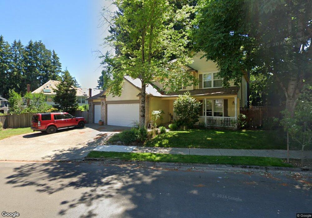
2345 Michael Dr West Linn, OR 97068
Willamette NeighborhoodEstimated Value: $805,000 - $937,000
4
Beds
3
Baths
2,578
Sq Ft
$335/Sq Ft
Est. Value
About This Home
This home is located at 2345 Michael Dr, West Linn, OR 97068 and is currently estimated at $864,497, approximately $335 per square foot. 2345 Michael Dr is a home located in Clackamas County with nearby schools including Willamette Primary School, Athey Creek Middle School, and West Linn High School.
Ownership History
Date
Name
Owned For
Owner Type
Purchase Details
Closed on
Jun 23, 2011
Sold by
Butts Matthew W and Butts Jennifer S
Bought by
Butts Matthew W and Matthew W Butts Revocable Living Trust
Current Estimated Value
Purchase Details
Closed on
May 27, 1997
Sold by
Renaissance Custom Homes Inc
Bought by
Butts Matthew W and Butts Jennifer S
Home Financials for this Owner
Home Financials are based on the most recent Mortgage that was taken out on this home.
Original Mortgage
$209,950
Outstanding Balance
$27,717
Interest Rate
8.13%
Estimated Equity
$836,780
Purchase Details
Closed on
Aug 27, 1996
Sold by
Renaissance Development Corp
Bought by
Renaissance Custom Homes Inc
Create a Home Valuation Report for This Property
The Home Valuation Report is an in-depth analysis detailing your home's value as well as a comparison with similar homes in the area
Home Values in the Area
Average Home Value in this Area
Purchase History
| Date | Buyer | Sale Price | Title Company |
|---|---|---|---|
| Butts Matthew W | -- | None Available | |
| Butts Matthew W | $279,950 | Oregon Title Insurance Co | |
| Renaissance Custom Homes Inc | $60,000 | Oregon Title Insurance Co |
Source: Public Records
Mortgage History
| Date | Status | Borrower | Loan Amount |
|---|---|---|---|
| Open | Butts Matthew W | $209,950 | |
| Closed | Butts Matthew W | $41,950 |
Source: Public Records
Tax History Compared to Growth
Tax History
| Year | Tax Paid | Tax Assessment Tax Assessment Total Assessment is a certain percentage of the fair market value that is determined by local assessors to be the total taxable value of land and additions on the property. | Land | Improvement |
|---|---|---|---|---|
| 2025 | $9,484 | $492,110 | -- | -- |
| 2024 | $9,129 | $477,777 | -- | -- |
| 2023 | $9,129 | $463,862 | $0 | $0 |
| 2022 | $8,616 | $450,352 | $0 | $0 |
| 2021 | $8,179 | $437,235 | $0 | $0 |
| 2020 | $8,235 | $424,500 | $0 | $0 |
| 2019 | $7,853 | $412,136 | $0 | $0 |
| 2018 | $7,502 | $400,132 | $0 | $0 |
| 2017 | $7,106 | $388,478 | $0 | $0 |
| 2016 | $6,914 | $377,163 | $0 | $0 |
| 2015 | $6,399 | $366,178 | $0 | $0 |
| 2014 | $6,117 | $355,513 | $0 | $0 |
Source: Public Records
Map
Nearby Homes
- 812 Wendy Ct
- 1160 Blankenship Rd
- 1101 Ryan Ct
- 2250 River Heights Cir
- 1075 Epperly Way
- 2420 Margery St
- 1765 Ostman Rd
- 640 Springtree Ln
- 975 Springtree Ln
- 880 Springtree Ln Unit 880
- 850 Springtree Ln Unit 850
- 1640 Village Park Place
- 1733 Jamie Cir
- 3565 Summerlinn Dr Unit 64
- 3395 Summerlinn Dr Unit 24
- 3135 Summerlinn Dr Unit 40
- 3850 Summerlinn Dr Unit 58
- 6840 Summerlinn Way Unit 93
- 6505 Summerlinn Way Unit 79
- 4650 Summerlinn Way
- 2293 Michael Dr
- 2308 Ostman Rd
- 2280 Ostman Rd
- 2340 Michael Dr
- 2330 Michael Dr
- 2350 Michael Dr
- 2279 Michael Dr
- 2348 Ostman Rd
- 2320 Michael Dr
- 2270 Ostman Rd
- 2310 Michael Dr
- 2288 Michael Dr
- 2370 Michael Dr
- 2265 Michael Dr
- 2260 Ostman Rd
- 2380 Michael Dr
- 2315 Ostman Rd
- 2276 Michael Dr
- 1115 Blankenship Rd
- 2335 Ostman Rd