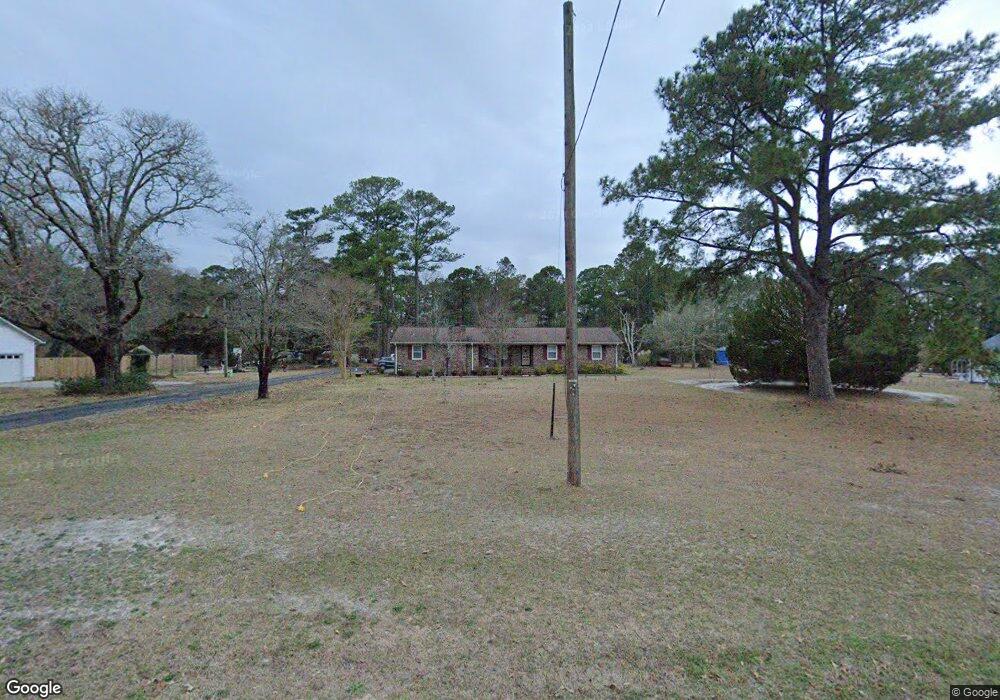
235 Hoover Rd Hampstead, NC 28443
Estimated Value: $300,582 - $357,000
3
Beds
2
Baths
1,502
Sq Ft
$218/Sq Ft
Est. Value
About This Home
This home is located at 235 Hoover Rd, Hampstead, NC 28443 and is currently estimated at $326,896, approximately $217 per square foot. 235 Hoover Rd is a home located in Pender County with nearby schools including South Topsail Elementary School, Topsail Middle School, and Topsail High School.
Ownership History
Date
Name
Owned For
Owner Type
Purchase Details
Closed on
Dec 27, 2007
Sold by
Sanders Billy A and Sanders Pamela K
Bought by
Sanders Billy A and Sanders Ann
Current Estimated Value
Home Financials for this Owner
Home Financials are based on the most recent Mortgage that was taken out on this home.
Original Mortgage
$147,000
Outstanding Balance
$93,031
Interest Rate
6.21%
Mortgage Type
Future Advance Clause Open End Mortgage
Estimated Equity
$233,865
Purchase Details
Closed on
Jul 14, 2003
Bought by
Sanders Billy A
Create a Home Valuation Report for This Property
The Home Valuation Report is an in-depth analysis detailing your home's value as well as a comparison with similar homes in the area
Home Values in the Area
Average Home Value in this Area
Purchase History
| Date | Buyer | Sale Price | Title Company |
|---|---|---|---|
| Sanders Billy A | -- | -- | |
| Sanders Billy A | -- | -- |
Source: Public Records
Mortgage History
| Date | Status | Borrower | Loan Amount |
|---|---|---|---|
| Open | Sanders Billy A | $147,000 |
Source: Public Records
Tax History Compared to Growth
Tax History
| Year | Tax Paid | Tax Assessment Tax Assessment Total Assessment is a certain percentage of the fair market value that is determined by local assessors to be the total taxable value of land and additions on the property. | Land | Improvement |
|---|---|---|---|---|
| 2024 | $1,614 | $152,846 | $38,758 | $114,088 |
| 2023 | $1,614 | $152,846 | $38,758 | $114,088 |
| 2022 | $1,492 | $152,846 | $38,758 | $114,088 |
| 2021 | $1,492 | $152,846 | $38,758 | $114,088 |
| 2020 | $1,047 | $147,351 | $38,758 | $108,593 |
| 2019 | $1,447 | $147,351 | $38,758 | $108,593 |
| 2018 | $1,336 | $127,952 | $26,022 | $101,930 |
| 2017 | $1,336 | $127,952 | $26,022 | $101,930 |
| 2016 | $1,324 | $127,952 | $26,022 | $101,930 |
| 2015 | $1,289 | $127,952 | $26,022 | $101,930 |
| 2014 | $1,030 | $127,952 | $26,022 | $101,930 |
| 2013 | -- | $127,952 | $26,022 | $101,930 |
| 2012 | -- | $127,952 | $26,022 | $101,930 |
Source: Public Records
Map
Nearby Homes
- 57 Downy Dr
- 148 Aspen Rd
- 11 Acacia Rd
- 97 Aspen Rd
- 23 Downy Dr
- 20 Aspen Rd
- 97 Violetear Ridge
- 106 Starling Dr
- 144 Violetear Ridge
- 83 Thrush Trail
- 203 Violetear Ridge
- 225 Factory Rd
- 116 Fresh Air Dr
- 371 Dan Owen Dr
- Madison Plan at The Sanctuary at Forest Sound
- Masonboro Plan at The Sanctuary at Forest Sound
- Otter Plan at The Sanctuary at Forest Sound
- 697 Poppleton Dr
- Rosebay Plan at Brookfield Branch
- Fern Plan at Brookfield Branch