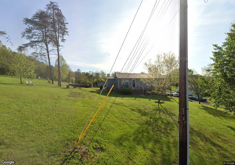
2363 Clint Cir Morristown, TN 37813
Estimated Value: $175,000 - $277,000
--
Bed
2
Baths
960
Sq Ft
$215/Sq Ft
Est. Value
About This Home
This home is located at 2363 Clint Cir, Morristown, TN 37813 and is currently estimated at $206,742, approximately $215 per square foot. 2363 Clint Cir is a home located in Hamblen County with nearby schools including Witt Elementary School, Lincoln Heights Middle School, and Morristown West High School.
Ownership History
Date
Name
Owned For
Owner Type
Purchase Details
Closed on
Sep 13, 2007
Sold by
Mike Gentry James
Bought by
Rasnic Brian C
Current Estimated Value
Home Financials for this Owner
Home Financials are based on the most recent Mortgage that was taken out on this home.
Original Mortgage
$92,270
Outstanding Balance
$58,419
Interest Rate
6.57%
Estimated Equity
$148,323
Purchase Details
Closed on
Aug 13, 2003
Sold by
Bryant Randy L
Bought by
Gentry James M
Home Financials for this Owner
Home Financials are based on the most recent Mortgage that was taken out on this home.
Original Mortgage
$56,900
Interest Rate
5.52%
Purchase Details
Closed on
Feb 8, 1989
Bought by
Bryant Randall
Purchase Details
Closed on
Aug 12, 1983
Bought by
Norton H V
Create a Home Valuation Report for This Property
The Home Valuation Report is an in-depth analysis detailing your home's value as well as a comparison with similar homes in the area
Home Values in the Area
Average Home Value in this Area
Purchase History
| Date | Buyer | Sale Price | Title Company |
|---|---|---|---|
| Rasnic Brian C | $93,000 | -- | |
| Gentry James M | $56,900 | -- | |
| Bryant Randall | $1,000 | -- | |
| Norton H V | -- | -- |
Source: Public Records
Mortgage History
| Date | Status | Borrower | Loan Amount |
|---|---|---|---|
| Open | Norton H V | $92,270 | |
| Previous Owner | Norton H V | $56,900 |
Source: Public Records
Tax History Compared to Growth
Tax History
| Year | Tax Paid | Tax Assessment Tax Assessment Total Assessment is a certain percentage of the fair market value that is determined by local assessors to be the total taxable value of land and additions on the property. | Land | Improvement |
|---|---|---|---|---|
| 2024 | $490 | $24,850 | $3,475 | $21,375 |
| 2023 | $490 | $24,850 | $0 | $0 |
| 2022 | $490 | $24,850 | $3,475 | $21,375 |
| 2021 | $490 | $24,850 | $3,475 | $21,375 |
| 2020 | $490 | $24,850 | $3,475 | $21,375 |
| 2019 | $472 | $22,150 | $3,075 | $19,075 |
| 2018 | $472 | $22,150 | $3,075 | $19,075 |
| 2017 | $472 | $22,150 | $3,075 | $19,075 |
| 2016 | $441 | $22,150 | $3,075 | $19,075 |
| 2015 | $410 | $22,150 | $3,075 | $19,075 |
| 2014 | -- | $22,150 | $3,075 | $19,075 |
| 2013 | -- | $23,000 | $0 | $0 |
Source: Public Records
Map
Nearby Homes
- 2895 Coffey Rd
- 1418 Mae Collins Rd
- 1160 Statem Gap Rd
- 2018 Southwood Cir
- 1049 Greenway Dr
- Darwin Plan at Southwood
- Robie Plan at Southwood
- Elston Plan at Southwood
- Belhaven Plan at Southwood
- Penwell Plan at Southwood
- Cali Plan at Southwood
- 3520 Sublett Rd
- 453 Statem Gap Rd
- 2262 Fernwood Church Rd
- 1708 Hindley Rd
- 440 S Fairmont Ave
- 203 Lincoln Ave
- 305-365 Barkley Landing Dr
- 837 Pauline Ave
- 731 Lennie Ave
- 2371 Clint Cir
- 2381 Clint Cir
- 1964 Roe Junction Rd
- 2391 Clint Cir
- 2370 Clint Cir
- 2392 Clint Cir
- 2040 Roe Junction Rd
- 2452 Clint Cir
- 2461 Clint Cir
- 2050 Roe Junction Rd
- 1936 Roe Junction Rd
- 2010 Roe Junction Rd
- 1996 Roe Junction Rd
- 2080 Roe Junction Rd
- 1910 Roe Junction Rd
- 2300 Roe Junction Rd
- 1985 Roe Junction Rd
- 1965 Roe Junction Rd
- 1865 Roe Junction Rd
- 1855 Roe Junction Rd