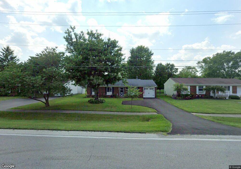
237 Hubbard Rd Galloway, OH 43119
Estimated Value: $234,000 - $260,000
3
Beds
1
Bath
1,120
Sq Ft
$218/Sq Ft
Est. Value
About This Home
This home is located at 237 Hubbard Rd, Galloway, OH 43119 and is currently estimated at $243,629, approximately $217 per square foot. 237 Hubbard Rd is a home located in Franklin County with nearby schools including Galloway Ridge Intermediate School, Alton Hall Elementary School, and Norton Middle School.
Ownership History
Date
Name
Owned For
Owner Type
Purchase Details
Closed on
Oct 27, 1994
Sold by
Sherwood Andrew B
Bought by
Weate Debra J
Current Estimated Value
Home Financials for this Owner
Home Financials are based on the most recent Mortgage that was taken out on this home.
Original Mortgage
$71,900
Interest Rate
8%
Mortgage Type
New Conventional
Purchase Details
Closed on
Aug 1, 1991
Purchase Details
Closed on
Jun 7, 1990
Create a Home Valuation Report for This Property
The Home Valuation Report is an in-depth analysis detailing your home's value as well as a comparison with similar homes in the area
Home Values in the Area
Average Home Value in this Area
Purchase History
| Date | Buyer | Sale Price | Title Company |
|---|---|---|---|
| Weate Debra J | $71,900 | -- | |
| -- | $59,400 | -- | |
| -- | -- | -- |
Source: Public Records
Mortgage History
| Date | Status | Borrower | Loan Amount |
|---|---|---|---|
| Closed | Weate Debra J | $71,900 |
Source: Public Records
Tax History
| Year | Tax Paid | Tax Assessment Tax Assessment Total Assessment is a certain percentage of the fair market value that is determined by local assessors to be the total taxable value of land and additions on the property. | Land | Improvement |
|---|---|---|---|---|
| 2025 | $2,430 | $63,810 | $20,790 | $43,020 |
| 2024 | $2,430 | $63,810 | $20,790 | $43,020 |
| 2023 | $2,346 | $63,805 | $20,790 | $43,015 |
| 2022 | $1,812 | $38,400 | $9,560 | $28,840 |
| 2021 | $2,385 | $38,400 | $9,560 | $28,840 |
| 2020 | $2,374 | $38,400 | $9,560 | $28,840 |
| 2019 | $2,277 | $32,170 | $7,980 | $24,190 |
| 2018 | $2,054 | $32,170 | $7,980 | $24,190 |
| 2017 | $2,146 | $32,170 | $7,980 | $24,190 |
| 2016 | $1,839 | $25,170 | $5,850 | $19,320 |
| 2015 | $1,839 | $25,170 | $5,850 | $19,320 |
| 2014 | $1,840 | $25,170 | $5,850 | $19,320 |
| 2013 | $1,011 | $27,930 | $6,475 | $21,455 |
Source: Public Records
Map
Nearby Homes
- 375 Darby Ct
- 716 Academy Dr
- 8652 Westpoint Dr
- 8458 Squad Dr
- 8873 Canoe Dr
- 914 Slagle Place
- 0 Dellinger Rd Unit 9 2030113
- 1276 Four Star Dr E
- 430 Trillium Dr
- 116 S Frey Ave
- 145 Center Ave Unit 149
- 41 N Hampton St
- 728 Murnan Rd
- 263 Merriman Dr
- 306 Madison Dr S
- 36 Putnam Ave
- 484 London Rd
- 6515 W Broad St
- 670 Hillsdale Dr
- 6489 W Broad St
- 229 Hubbard Rd
- 253 Hubbard Rd
- 8581 Canyon Cove Rd
- 8573 Canyon Cove Rd
- 230 Hubbard Rd
- 261 Hubbard Rd
- 8589 Canyon Cove Rd
- 8565 Canyon Cove Rd
- 8534 Conbrook Ct
- 269 Hubbard Rd
- 8527 Conbrook Ct
- 8597 Canyon Cove Rd
- 214 Hubbard Rd
- 260 Hubbard Rd
- 8557 Canyon Cove Rd
- 277 Hubbard Rd
- 8521 Conbrook Ct
- 183 Hubbard Rd
- 8532 Blue Lake Ave
- 268 Hubbard Rd
Your Personal Tour Guide
Ask me questions while you tour the home.