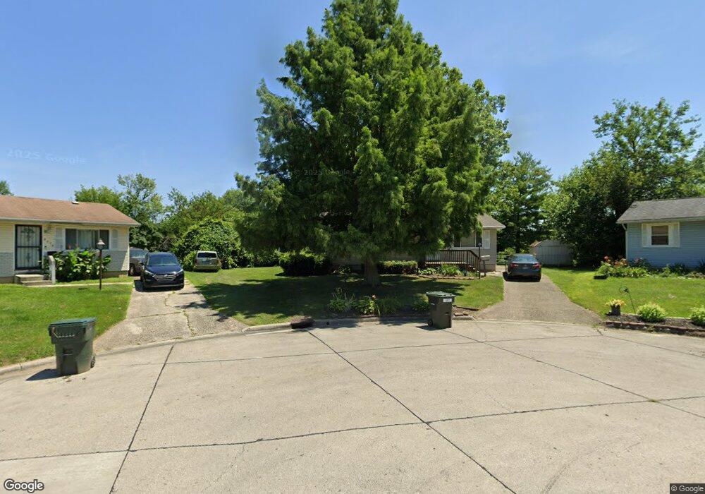
2371 Dunning Ct Columbus, OH 43219
Brittany Hills NeighborhoodEstimated Value: $138,000 - $168,000
3
Beds
1
Bath
960
Sq Ft
$159/Sq Ft
Est. Value
About This Home
This home is located at 2371 Dunning Ct, Columbus, OH 43219 and is currently estimated at $152,553, approximately $158 per square foot. 2371 Dunning Ct is a home located in Franklin County with nearby schools including South Mifflin Stem Academy (K-6), Linden-Mckinley Stem School On Arcadia, and Cesar Chavez College Preparatory School.
Ownership History
Date
Name
Owned For
Owner Type
Purchase Details
Closed on
Apr 14, 2003
Sold by
Darst Clyde F and Darst Carol L
Bought by
Gibson Roy and Gibson Leah
Current Estimated Value
Home Financials for this Owner
Home Financials are based on the most recent Mortgage that was taken out on this home.
Original Mortgage
$74,908
Outstanding Balance
$30,947
Interest Rate
5.71%
Mortgage Type
FHA
Estimated Equity
$121,606
Purchase Details
Closed on
Dec 28, 1983
Bought by
Darst Clyde F
Create a Home Valuation Report for This Property
The Home Valuation Report is an in-depth analysis detailing your home's value as well as a comparison with similar homes in the area
Home Values in the Area
Average Home Value in this Area
Purchase History
| Date | Buyer | Sale Price | Title Company |
|---|---|---|---|
| Gibson Roy | $75,500 | Lawyers Title | |
| Darst Clyde F | -- | -- |
Source: Public Records
Mortgage History
| Date | Status | Borrower | Loan Amount |
|---|---|---|---|
| Open | Gibson Roy | $74,908 |
Source: Public Records
Tax History
| Year | Tax Paid | Tax Assessment Tax Assessment Total Assessment is a certain percentage of the fair market value that is determined by local assessors to be the total taxable value of land and additions on the property. | Land | Improvement |
|---|---|---|---|---|
| 2025 | $1,630 | $46,130 | $11,760 | $34,370 |
| 2024 | $1,630 | $46,130 | $11,760 | $34,370 |
| 2023 | $1,638 | $46,130 | $11,760 | $34,370 |
| 2022 | $581 | $19,960 | $3,960 | $16,000 |
| 2021 | $582 | $19,960 | $3,960 | $16,000 |
| 2020 | $583 | $19,960 | $3,960 | $16,000 |
| 2019 | $416 | $15,610 | $3,150 | $12,460 |
| 2018 | $488 | $15,610 | $3,150 | $12,460 |
| 2017 | $516 | $15,610 | $3,150 | $12,460 |
| 2016 | $617 | $18,060 | $3,080 | $14,980 |
| 2015 | $560 | $18,060 | $3,080 | $14,980 |
| 2014 | $561 | $18,060 | $3,080 | $14,980 |
| 2013 | $337 | $20,090 | $3,430 | $16,660 |
Source: Public Records
Map
Nearby Homes
- 2350 Edenburgh Dr S
- 2321 Dunning Ct
- 0 Mock Rd
- 1816 Brentnell Ave
- 0 Danby Dr
- 2526 Queenswood Dr
- 2271 Century Dr
- 2282 Dawnlight Ave
- 1893 Jermain Dr
- 2169 Argyle Dr
- 2145 Argyle Dr
- 2789 Sparrow Hill Dr Unit 18
- 2144 Toni St
- 1991 Woodland Ave
- 2131 Argyle Dr
- 2310 Brentnell Ave
- 2803 Ballyvaughn Dr Unit 48
- 1582 Vendome Dr S
- 2459 Meredith Dr
- 2193 Rustic Ledge Dr
- 2365 Dunning Ct
- 1921 Edenburgh Dr E
- 1927 Edenburgh Dr E
- 1915 Edenburgh Dr E
- 2370 Dunning Ct
- 1935 Edenburgh Dr E
- 2361 Dunning Ct
- 2380 Edenburgh Dr S
- 2372 Edenburgh Dr S
- 1905 Edenburgh Dr E
- 2364 Edenburgh Dr S
- 2366 Dunning Ct
- 1945 Edenburgh Dr E
- 2353 Dunning Ct
- 2390 Edenburgh Dr S
- 2358 Edenburgh Dr S
- 2360 Dunning Ct
- 1951 Edenburgh Dr E
- 2354 Dunning Ct
- 2389 Delavan Dr
Your Personal Tour Guide
Ask me questions while you tour the home.