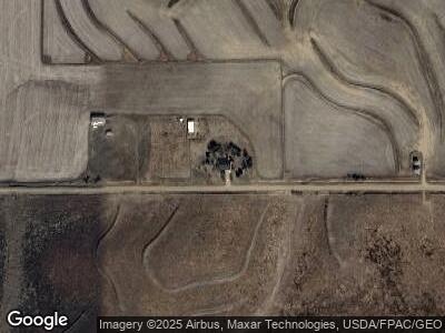
2377 220th St Bronson, IA 51007
Estimated Value: $419,375 - $513,000
3
Beds
2
Baths
2,475
Sq Ft
$189/Sq Ft
Est. Value
About This Home
This home is located at 2377 220th St, Bronson, IA 51007 and is currently estimated at $467,792, approximately $189 per square foot. 2377 220th St is a home located in Woodbury County with nearby schools including Bronson Elementary School and Lawton Junior/Senior High School.
Ownership History
Date
Name
Owned For
Owner Type
Purchase Details
Closed on
Apr 21, 2014
Sold by
Jensen John T and Jensen Mary S
Bought by
Todd Jason S
Current Estimated Value
Home Financials for this Owner
Home Financials are based on the most recent Mortgage that was taken out on this home.
Original Mortgage
$224,500
Interest Rate
4.41%
Mortgage Type
New Conventional
Create a Home Valuation Report for This Property
The Home Valuation Report is an in-depth analysis detailing your home's value as well as a comparison with similar homes in the area
Home Values in the Area
Average Home Value in this Area
Purchase History
| Date | Buyer | Sale Price | Title Company |
|---|---|---|---|
| Todd Jason S | $250,000 | None Available |
Source: Public Records
Mortgage History
| Date | Status | Borrower | Loan Amount |
|---|---|---|---|
| Open | Todd Jason S | $211,400 | |
| Closed | Todd Jason | $224,500 |
Source: Public Records
Tax History Compared to Growth
Tax History
| Year | Tax Paid | Tax Assessment Tax Assessment Total Assessment is a certain percentage of the fair market value that is determined by local assessors to be the total taxable value of land and additions on the property. | Land | Improvement |
|---|---|---|---|---|
| 2024 | $3,490 | $338,720 | $33,000 | $305,720 |
| 2023 | $3,390 | $338,720 | $33,000 | $305,720 |
| 2022 | $3,804 | $266,450 | $33,000 | $233,450 |
| 2021 | $3,804 | $266,450 | $33,000 | $233,450 |
| 2020 | $3,640 | $246,610 | $35,310 | $211,300 |
| 2019 | $3,596 | $246,610 | $35,310 | $211,300 |
| 2018 | $3,482 | $232,170 | $20,870 | $211,300 |
| 2017 | $3,652 | $232,170 | $20,870 | $211,300 |
| 2016 | $3,576 | $232,170 | $0 | $0 |
| 2015 | $3,322 | $216,980 | $19,500 | $197,480 |
| 2014 | $3,267 | $216,980 | $19,500 | $197,480 |
Source: Public Records
Map
Nearby Homes
- 2135 Hancock Ave
- 231 Maple St
- 97 W 2nd St
- 103 W Creek Dr
- 326 E Maple St
- 1661 Hancock Ave
- 503 S 3rd St
- 230 S 1st St
- 530 South St
- 402 Jackson St
- TBD Old Highway 141
- 1713 Old Highway 141
- 725 Carol Dr
- 425 Terrtam St
- TBD Clearview St
- TBD 230th St
- 805 Paige Place
- 820 Terrtam St
- 2741 Old Highway 141
- 3118 290th St
