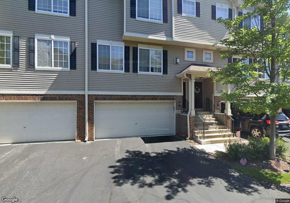
2377 Lundquist Dr Unit 3994 Aurora, IL 60503
Far Southeast NeighborhoodEstimated Value: $289,014 - $312,000
3
Beds
3
Baths
1,522
Sq Ft
$200/Sq Ft
Est. Value
About This Home
This home is located at 2377 Lundquist Dr Unit 3994, Aurora, IL 60503 and is currently estimated at $304,004, approximately $199 per square foot. 2377 Lundquist Dr Unit 3994 is a home located in Kendall County with nearby schools including The Wheatlands Elementary School, Bednarcik Jr. High School, and Oswego East High School.
Ownership History
Date
Name
Owned For
Owner Type
Purchase Details
Closed on
Jan 4, 2005
Sold by
The Ryland Group Inc
Bought by
Lafrancis William and Francis Linda
Current Estimated Value
Home Financials for this Owner
Home Financials are based on the most recent Mortgage that was taken out on this home.
Original Mortgage
$72,107
Outstanding Balance
$36,478
Interest Rate
5.78%
Mortgage Type
Purchase Money Mortgage
Estimated Equity
$267,526
Create a Home Valuation Report for This Property
The Home Valuation Report is an in-depth analysis detailing your home's value as well as a comparison with similar homes in the area
Home Values in the Area
Average Home Value in this Area
Purchase History
| Date | Buyer | Sale Price | Title Company |
|---|---|---|---|
| Lafrancis William | $179,000 | Ryland Title Company |
Source: Public Records
Mortgage History
| Date | Status | Borrower | Loan Amount |
|---|---|---|---|
| Open | Lafrancis William | $72,107 |
Source: Public Records
Tax History Compared to Growth
Tax History
| Year | Tax Paid | Tax Assessment Tax Assessment Total Assessment is a certain percentage of the fair market value that is determined by local assessors to be the total taxable value of land and additions on the property. | Land | Improvement |
|---|---|---|---|---|
| 2024 | $1,931 | $80,538 | $12,262 | $68,276 |
| 2023 | $2,188 | $70,647 | $10,756 | $59,891 |
| 2022 | $2,188 | $66,025 | $10,052 | $55,973 |
| 2021 | $2,272 | $61,705 | $9,394 | $52,311 |
| 2020 | $2,299 | $60,495 | $9,210 | $51,285 |
| 2019 | $2,353 | $57,140 | $9,210 | $47,930 |
| 2018 | $2,415 | $47,617 | $7,675 | $39,942 |
| 2017 | $2,480 | $43,887 | $7,074 | $36,813 |
| 2016 | $1,259 | $39,897 | $6,431 | $33,466 |
| 2015 | $1,320 | $34,693 | $5,592 | $29,101 |
| 2014 | -- | $32,729 | $5,275 | $27,454 |
| 2013 | -- | $33,059 | $5,328 | $27,731 |
Source: Public Records
Map
Nearby Homes
- 1906 Indian Hill Ln Unit 4223
- 1961 Wilson Creek Cir
- 1794 Fredericksburg Ln
- 2197 Wilson Creek Cir Unit 3
- 3302 Wildlight Rd
- 3328 Fulshear Cir
- 3237 Peyton Cir
- 1769 Baler Ave
- 3235 Kimblewick Cir
- 2566 Rourke Dr
- 2084 Canyon Creek Ct
- 2216 Summerlin Dr Unit 5
- 1611 Fredericksburg Ln Unit 1
- 2047 James Leigh Dr
- 2295 Twilight Dr
- 2326 Sunshine Ln Unit 1969
- 2060 Lyndhurst Ln
- 2310 Twilight Dr
- 2357 Twilight Dr
- 1722 Baler Ave
- 2375 Lundquist Dr Unit 3995
- 2381 Lundquist Dr Unit 3992
- 2379 Lundquist Dr Unit 3993
- 2373 Lundquist Dr Unit 3996
- 2383 Lundquist Dr Unit 3991
- 2363 Lundquist Dr Unit 3985
- 2369 Lundquist Dr Unit 3982
- 2365 Lundquist Dr Unit 3984
- 2367 Lundquist Dr Unit 3983
- 2361 Lundquist Dr Unit 3986
- 2361 Lundquist Dr Unit 2361
- 2371 Lundquist Dr Unit 3981
- 1952 Indian Hill Ln Unit 4001
- 1954 Indian Hill Ln Unit 4002
- 1956 Indian Hill Ln Unit 4003
- 1958 Indian Hill Ln Unit 4004
- 1956 Indian Hill Ln Unit 1956
- 1960 Indian Hill Ln Unit 4005
- 1942 Indian Hill Ln Unit 4232
- 1946 Indian Hill Ln Unit 4234