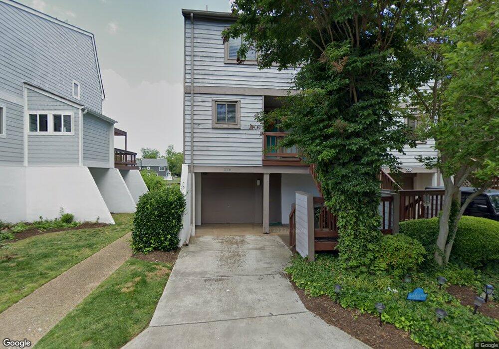
238 Mill Point Dr Hampton, VA 23669
Downtown Hampton NeighborhoodEstimated Value: $299,000 - $319,000
3
Beds
3
Baths
1,468
Sq Ft
$209/Sq Ft
Est. Value
About This Home
This home is located at 238 Mill Point Dr, Hampton, VA 23669 and is currently estimated at $306,940, approximately $209 per square foot. 238 Mill Point Dr is a home located in Hampton City with nearby schools including Capt. John Smith Elementary School, C. Alton Lindsay Middle School, and Phoebus High School.
Ownership History
Date
Name
Owned For
Owner Type
Purchase Details
Closed on
Jun 13, 2018
Sold by
Liu Ding-Jen
Bought by
Hopkins Everett and Hopkins Audrey
Current Estimated Value
Purchase Details
Closed on
Jun 18, 2002
Sold by
Porter Christiane
Bought by
Liu Ding-Jen
Home Financials for this Owner
Home Financials are based on the most recent Mortgage that was taken out on this home.
Original Mortgage
$108,000
Interest Rate
6.81%
Mortgage Type
New Conventional
Create a Home Valuation Report for This Property
The Home Valuation Report is an in-depth analysis detailing your home's value as well as a comparison with similar homes in the area
Home Values in the Area
Average Home Value in this Area
Purchase History
| Date | Buyer | Sale Price | Title Company |
|---|---|---|---|
| Hopkins Everett | $176,500 | Closing Edge Title Llc | |
| Liu Ding-Jen | $135,000 | -- |
Source: Public Records
Mortgage History
| Date | Status | Borrower | Loan Amount |
|---|---|---|---|
| Previous Owner | Liu Ding-Jen | $108,000 |
Source: Public Records
Tax History
| Year | Tax Paid | Tax Assessment Tax Assessment Total Assessment is a certain percentage of the fair market value that is determined by local assessors to be the total taxable value of land and additions on the property. | Land | Improvement |
|---|---|---|---|---|
| 2025 | $3,287 | $285,600 | $84,600 | $201,000 |
| 2024 | $3,022 | $262,800 | $71,600 | $191,200 |
| 2023 | $2,895 | $249,600 | $71,600 | $178,000 |
| 2022 | $2,626 | $222,500 | $71,600 | $150,900 |
| 2021 | $2,647 | $203,000 | $71,600 | $131,400 |
| 2020 | $2,411 | $194,400 | $71,600 | $122,800 |
| 2019 | $2,422 | $195,300 | $71,600 | $123,700 |
| 2018 | $2,496 | $193,700 | $71,600 | $122,100 |
| 2017 | $2,496 | $0 | $0 | $0 |
| 2016 | $2,496 | $193,700 | $0 | $0 |
| 2015 | $2,496 | $0 | $0 | $0 |
| 2014 | $2,486 | $193,700 | $71,600 | $122,100 |
Source: Public Records
Map
Nearby Homes
- 233 Mill Point Dr
- 301 Washington St
- 115 E Pembroke Ave
- 418 Wine St
- 329 Elm Ave
- 603 Washington St
- 606 Washington St
- 542 River St
- 314 Cooper St
- 311 Cooper St
- 720 River St
- 433 Cooper St
- 439 Cooper St
- 144 Meredith St
- 116 Linden Ave
- 27 Bacon St
- 221 Island Cove Ct Unit C
- 16 S Cypress St
- 138 Eberly Terrace
- 212 Dockside Dr Unit C
- 236 Mill Point Dr
- 240 Mill Point Dr
- 234 Mill Point Dr
- 242 Mill Point Dr
- 230 Mill Point Dr
- 244 Mill Point Dr
- 228 Mill Point Dr
- 246 Mill Point Dr
- 226 Mill Point Dr
- 248 Mill Point Dr
- 235 Mill Point Dr
- 237 Mill Point Dr
- 231 Mill Point Dr
- 196 Mill Point Dr
- 239 Mill Point Dr
- 250 Mill Point Dr
- 224 Mill Point Dr
- 229 Mill Point Dr
- 241 Mill Point Dr
- 252 Mill Point Dr
Your Personal Tour Guide
Ask me questions while you tour the home.