Estimated payment $3,086/month
Highlights
- 2.72 Acre Lot
- Wood Flooring
- 1 Car Direct Access Garage
- Secluded Lot
- Bonus Room
- Natural Light
About This Home
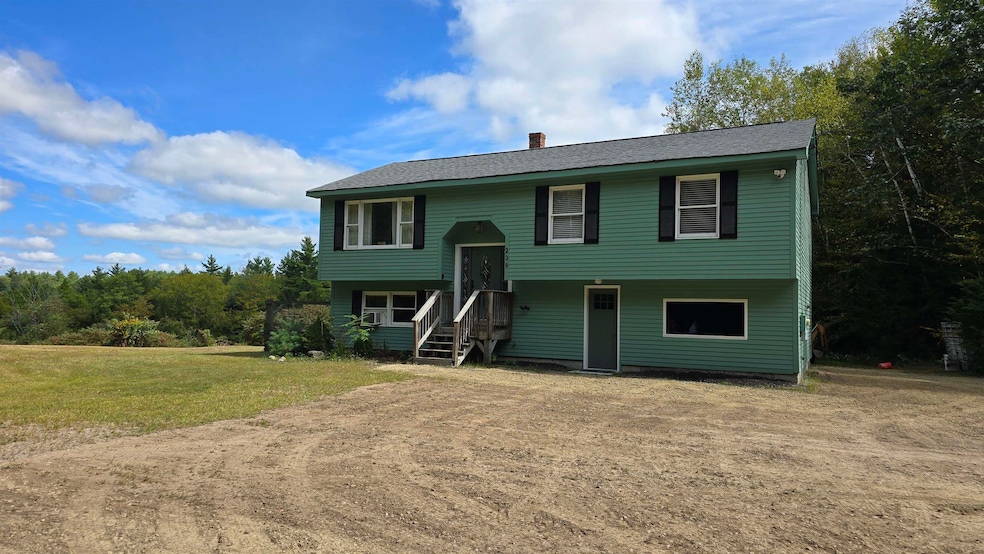
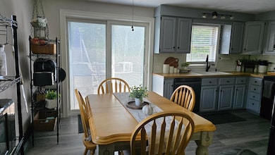
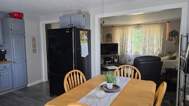
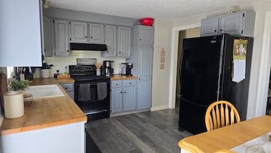
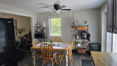
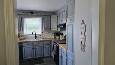
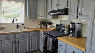
Welcome to Weare. A well-maintained split-entry property with 3 bedrooms/2 bathrooms is yours to call home! The bright, open-concept living room & kitchen provide functionality for comfortable living and entertaining friends & family. The space is enhanced by a large back deck off the kitchen, offering outdoor living while overlooking your own land. The basement is setup for independent living with dedicated entries. To complete the picture, the oversized outbuilding and 2+ acres offer a pastoral lifestyle, with an opportunity to enjoy the land as a small farm/stable or hobby/workshop. Delayed showings begin Friday Sept 19th.
Listing Agent
Keller Williams Realty-Metropolitan License #074585 Listed on: 09/17/2025

Home Details
Home Type
- Single Family
Est. Annual Taxes
- $5,409
Year Built
- Built in 1989
Lot Details
- 2.72 Acre Lot
- Secluded Lot
- Property is zoned RURAL
Parking
- 1 Car Direct Access Garage
- Gravel Driveway
- Dirt Driveway
- 1 to 5 Parking Spaces
Home Design
- Split Level Home
- Concrete Foundation
- Wood Frame Construction
- Wood Siding
Interior Spaces
- Property has 1 Level
- Natural Light
- Combination Dining and Living Room
- Bonus Room
- Finished Basement
- Walk-Out Basement
- Dishwasher
Flooring
- Wood
- Carpet
- Tile
Bedrooms and Bathrooms
- 3 Bedrooms
- Studio bedroom
Laundry
- Dryer
- Washer
Farming
- Agricultural
Utilities
- Drilled Well
- Cable TV Available
Listing and Financial Details
- Tax Block 343
- Assessor Parcel Number 411
Map
Home Values in the Area
Average Home Value in this Area
Tax History
| Year | Tax Paid | Tax Assessment Tax Assessment Total Assessment is a certain percentage of the fair market value that is determined by local assessors to be the total taxable value of land and additions on the property. | Land | Improvement |
|---|---|---|---|---|
| 2024 | $5,409 | $265,300 | $87,400 | $177,900 |
| 2023 | $4,998 | $265,300 | $87,400 | $177,900 |
| 2022 | $4,616 | $265,300 | $87,400 | $177,900 |
| 2021 | $4,563 | $265,300 | $87,400 | $177,900 |
| 2020 | $4,488 | $187,400 | $61,700 | $125,700 |
| 2019 | $4,443 | $187,400 | $61,700 | $125,700 |
| 2018 | $4,316 | $187,400 | $61,700 | $125,700 |
| 2016 | $4,192 | $187,400 | $61,700 | $125,700 |
| 2015 | $3,935 | $175,600 | $61,700 | $113,900 |
| 2014 | $3,900 | $175,600 | $61,700 | $113,900 |
| 2013 | $3,819 | $175,600 | $61,700 | $113,900 |
Property History
| Date | Event | Price | List to Sale | Price per Sq Ft |
|---|---|---|---|---|
| 11/11/2025 11/11/25 | Pending | -- | -- | -- |
| 10/07/2025 10/07/25 | Price Changed | $500,000 | -4.8% | $327 / Sq Ft |
| 09/17/2025 09/17/25 | For Sale | $525,000 | -- | $343 / Sq Ft |
Purchase History
| Date | Type | Sale Price | Title Company |
|---|---|---|---|
| Warranty Deed | $137,000 | -- |
Mortgage History
| Date | Status | Loan Amount | Loan Type |
|---|---|---|---|
| Open | $84,900 | Unknown | |
| Closed | $100,000 | Unknown | |
| Closed | $11,500 | Unknown | |
| Closed | $80,000 | No Value Available |
Source: PrimeMLS
MLS Number: 5061622
APN: WEAR-000411-000000-000343
Disclaimer: Certain information contained herein is derived from information provided by parties other than Homes.com. All information provided is deemed reliable, but is not guaranteed to be accurate and should be independently verified.
![]() Copyright 2025 PrimeMLS, Inc. All rights reserved. This information is deemed reliable, but not guaranteed. The data relating to real estate displayed on this display comes in part from the IDX Program of PrimeMLS. The information being provided is for consumers’ personal, non-commercial use and may not be used for any purpose other than to identify prospective properties consumers may be interested in purchasing.
Copyright 2025 PrimeMLS, Inc. All rights reserved. This information is deemed reliable, but not guaranteed. The data relating to real estate displayed on this display comes in part from the IDX Program of PrimeMLS. The information being provided is for consumers’ personal, non-commercial use and may not be used for any purpose other than to identify prospective properties consumers may be interested in purchasing.
- 196 Deering Center Rd
- 200 Mountain Rd
- 24 Etta Ln Unit 3
- Lot 1-50-1 Colburn Rd
- 624 S Stark Hwy
- 103 Renshaw Rd
- 77 Gould Rd
- 342 Weare Rd
- 93 Daniels Rd
- 116 Martin Rd
- 95 Wright Dr
- 252 Clark Hill Rd
- 242 Colby Rd
- 174 S Stark Hwy Unit 13
- 174 S Stark Hwy Unit 23
- 194 Buckley Rd Unit 2
- 194 Buckley Rd Unit 44
- 10 Sap House Rd
- 11 Ski Tow Rd
- 54 Briar Hill Rd