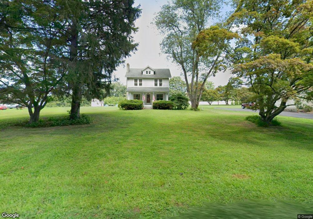
2389 Liberty Grove Rd Colora, MD 21917
Estimated Value: $264,081 - $311,000
--
Bed
1
Bath
1,696
Sq Ft
$175/Sq Ft
Est. Value
About This Home
This home is located at 2389 Liberty Grove Rd, Colora, MD 21917 and is currently estimated at $296,270, approximately $174 per square foot. 2389 Liberty Grove Rd is a home located in Cecil County with nearby schools including Rising Sun Elementary School, Rising Sun Middle School, and Rising Sun High School.
Ownership History
Date
Name
Owned For
Owner Type
Purchase Details
Closed on
May 13, 2004
Sold by
Pilkington Roy Charles and Pilkington Rebecca
Bought by
Pilkington Roy Charles
Current Estimated Value
Purchase Details
Closed on
Apr 30, 1993
Sold by
Liddell Rogers B
Bought by
Pilkington Roy Charles and Pilkington Rebecca
Home Financials for this Owner
Home Financials are based on the most recent Mortgage that was taken out on this home.
Original Mortgage
$57,000
Interest Rate
7.43%
Create a Home Valuation Report for This Property
The Home Valuation Report is an in-depth analysis detailing your home's value as well as a comparison with similar homes in the area
Home Values in the Area
Average Home Value in this Area
Purchase History
| Date | Buyer | Sale Price | Title Company |
|---|---|---|---|
| Pilkington Roy Charles | -- | -- | |
| Pilkington Roy Charles | $92,000 | -- |
Source: Public Records
Mortgage History
| Date | Status | Borrower | Loan Amount |
|---|---|---|---|
| Previous Owner | Pilkington Roy Charles | $57,000 | |
| Closed | Pilkington Roy Charles | -- |
Source: Public Records
Tax History Compared to Growth
Tax History
| Year | Tax Paid | Tax Assessment Tax Assessment Total Assessment is a certain percentage of the fair market value that is determined by local assessors to be the total taxable value of land and additions on the property. | Land | Improvement |
|---|---|---|---|---|
| 2025 | $2,208 | $196,300 | $67,300 | $129,000 |
| 2024 | $1,731 | $184,667 | $0 | $0 |
| 2023 | $1,271 | $173,033 | $0 | $0 |
| 2022 | $1,878 | $161,400 | $67,300 | $94,100 |
| 2021 | $1,840 | $157,767 | $0 | $0 |
| 2020 | $1,838 | $154,133 | $0 | $0 |
| 2019 | $1,796 | $150,500 | $67,300 | $83,200 |
| 2018 | $1,796 | $150,500 | $67,300 | $83,200 |
| 2017 | $1,796 | $150,500 | $0 | $0 |
| 2016 | $1,774 | $155,700 | $0 | $0 |
| 2015 | $1,774 | $155,433 | $0 | $0 |
| 2014 | $1,631 | $155,167 | $0 | $0 |
Source: Public Records
Map
Nearby Homes
- 12 Thruway Dr
- 0 Colora Rd
- 127 Barnes Corner Rd
- 192 Barnes Corner Rd
- 1741 Liberty Grove Rd
- 1964 Conowingo Rd
- 21 Country Ln
- 152 Hopewell Rd
- 1668 Colora Rd
- 1718 Jacob Tome Memorial Hwy
- 107 Britton Dr
- 202 W Main St
- 66 Spready Oak Rd
- 35 Coachman Dr
- TBD Pine Needle Ct
- 43 Pearl St
- TBD Rowland Dr
- 27 Haines Ave
- Sussex Plan at Liberty Grove
- Danville II Plan at Liberty Grove
- 2397 Liberty Grove Rd
- 2377 Liberty Grove Rd
- 2411 Liberty Grove Rd
- 2365 Liberty Grove Rd
- 2417 Liberty Grove Rd
- 2425 Liberty Grove Rd
- 2421 Liberty Grove Rd
- 2433 Liberty Grove Rd
- 2441 Liberty Grove Rd
- 13 Canterbury Ct
- 40 Sterling Nesbitt Ct
- 2447 Liberty Grove Rd
- 161 Macintosh Dr
- 25 Canterbury Ct
- 2325 Liberty Grove Rd
- 21 Macintosh Dr
- 32 Sterling Nesbitt Ct
- Sterling Nesbitt Ct
- 29 Macintosh Dr
- 2457 Liberty Grove Rd