Estimated Value: $448,215 - $493,000
3
Beds
2
Baths
1,727
Sq Ft
$269/Sq Ft
Est. Value
About This Home
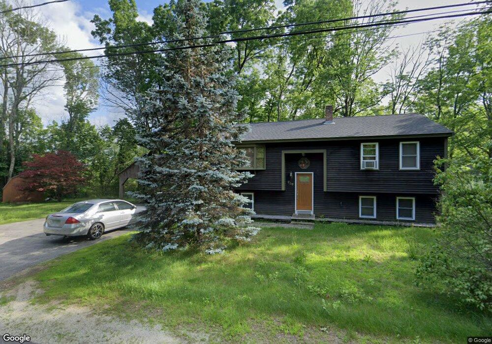
This home is located at 239 Dustin Tavern Rd, Weare, NH 03281 and is currently estimated at $464,304, approximately $268 per square foot. 239 Dustin Tavern Rd is a home with nearby schools including Center Woods Elementary School, Weare Middle School, and John Stark Regional High School.
Ownership History
Date
Name
Owned For
Owner Type
Purchase Details
Closed on
Jul 3, 2006
Sold by
Hummel Patricia F
Bought by
Boulanger Donald R and Boulanger Channon M
Current Estimated Value
Home Financials for this Owner
Home Financials are based on the most recent Mortgage that was taken out on this home.
Original Mortgage
$225,000
Outstanding Balance
$133,060
Interest Rate
6.58%
Mortgage Type
Purchase Money Mortgage
Estimated Equity
$331,244
Create a Home Valuation Report for This Property
The Home Valuation Report is an in-depth analysis detailing your home's value as well as a comparison with similar homes in the area
Home Values in the Area
Average Home Value in this Area
Purchase History
| Date | Buyer | Sale Price | Title Company |
|---|---|---|---|
| Boulanger Donald R | $234,900 | -- |
Source: Public Records
Mortgage History
| Date | Status | Borrower | Loan Amount |
|---|---|---|---|
| Open | Boulanger Donald R | $225,000 | |
| Previous Owner | Boulanger Donald R | $63,000 | |
| Previous Owner | Boulanger Donald R | $60,000 |
Source: Public Records
Tax History Compared to Growth
Tax History
| Year | Tax Paid | Tax Assessment Tax Assessment Total Assessment is a certain percentage of the fair market value that is determined by local assessors to be the total taxable value of land and additions on the property. | Land | Improvement |
|---|---|---|---|---|
| 2024 | $5,942 | $291,400 | $105,500 | $185,900 |
| 2023 | $5,490 | $291,400 | $105,500 | $185,900 |
| 2022 | $5,070 | $291,400 | $105,500 | $185,900 |
| 2021 | $5,012 | $291,400 | $105,500 | $185,900 |
| 2020 | $4,893 | $204,300 | $77,500 | $126,800 |
| 2019 | $4,844 | $204,300 | $77,500 | $126,800 |
| 2018 | $4,705 | $204,300 | $77,500 | $126,800 |
| 2016 | $4,570 | $204,300 | $77,500 | $126,800 |
| 2015 | $4,227 | $188,600 | $75,500 | $113,100 |
| 2014 | $4,171 | $187,800 | $75,500 | $112,300 |
| 2013 | $4,096 | $188,300 | $76,000 | $112,300 |
Source: Public Records
Map
Nearby Homes
- 179 Oak Hill Rd
- 103 Renshaw Rd
- 624 S Stark Hwy
- 77 Gould Rd
- 238 Old Francestown Rd
- 196 Deering Center Rd
- 93 Daniels Rd
- 450 Weare Rd
- 95 Wright Dr
- 174 S Stark Hwy Unit 13
- 174 S Stark Hwy Unit 1
- 174 S Stark Hwy Unit 23
- 342 Weare Rd
- 200 Mountain Rd
- 34 Lull Rd
- 10 Sap House Rd
- Lot 1-50-1 Colburn Rd
- 849 River Rd
- 0 Huntington Hill Rd Unit 69
- 54 Briar Hill Rd
- 11 Oak Hill Rd
- 3 Oak Hill Rd
- 240 Dustin Tavern Rd
- 17 Oak Hill Rd
- 2 Oak Hill Rd
- 1 Oak Hill Rd
- 260 Dustin Tavern Rd
- 257 Dustin Tavern Rd
- 264 Dustin Tavern Rd
- 3 Forest Rd
- 36 Oak Hill Rd
- 35 Oak Hill Rd
- 204 Dustin Tavern Rd
- 235 Ridgeview Rd
- 202 Dustin Tavern Rd
- 24 Forest Rd
- 54 Oak Hill Rd
- 223 Ridgeview Rd
- 57 Oak Hill Rd
- 37 Forest Rd