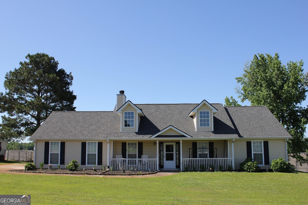
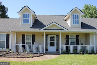


239 Ferguson Ave Locust Grove, GA 30248
Estimated payment $1,638/month
Highlights
- RV or Boat Storage in Community
- Ranch Style House
- No HOA
- Vaulted Ceiling
- Mud Room
- Breakfast Area or Nook
About This Home
*** $25,000 Price Cut *** Fantastic Ranch Home! New Paint in Kitchen and Bathrooms, New Flooring in Kitchen and Bathrooms. New HVAC in the Fall of 2023! New Roof in 2023! New Hot Water Heater in June 2025! All 1 level! 3 generous bedrooms and 2 full baths. As you walk up to the front door you will find a relaxing front porch. It's big enough for rockers or your desired outdoor furniture! Upon entering the home, you step into a large, vaulted ceiling family room with a fireplace. The family room is open to the eating area of the kitchen. This kitchen is spacious with a bay window; tons of cabinets and all of the appliances remain! The laundry room/mud room is right off of the kitchen. The washer and dryer stay! From the laundry room you walk out to the 2-car garage with garage door opener. There's also a nice size storage room in the garage with a window! The back yard is completely fenced in. There is also a wood storage shed in the rear of the backyard. Good sized yard of almost 3/4 acre. Seller is under a home warranty that can be transferred to buyer until it expires in November. Very convenient location! Just minutes from Tanger Outlet Mall, Restaurants, and I-75. New Publix and Longhorn Steakhouse coming soon that will be just a few minutes away!
Home Details
Home Type
- Single Family
Est. Annual Taxes
- $3,839
Year Built
- Built in 1999
Lot Details
- 0.68 Acre Lot
- Back Yard Fenced
- Level Lot
Parking
- Garage
Home Design
- Ranch Style House
- Slab Foundation
- Composition Roof
- Vinyl Siding
Interior Spaces
- 1,550 Sq Ft Home
- Vaulted Ceiling
- Ceiling Fan
- Factory Built Fireplace
- Window Treatments
- Mud Room
- Family Room
- Living Room with Fireplace
- Pull Down Stairs to Attic
- Fire and Smoke Detector
Kitchen
- Breakfast Area or Nook
- Oven or Range
- Microwave
- Dishwasher
Flooring
- Carpet
- Vinyl
Bedrooms and Bathrooms
- 3 Main Level Bedrooms
- Walk-In Closet
- 2 Full Bathrooms
- Double Vanity
Laundry
- Laundry in Mud Room
- Laundry Room
- Dryer
- Washer
Outdoor Features
- Patio
- Shed
- Outdoor Gas Grill
Schools
- Locust Grove Elementary And Middle School
- Locust Grove High School
Utilities
- Forced Air Heating and Cooling System
- Heating System Uses Natural Gas
- Gas Water Heater
- Septic Tank
- High Speed Internet
- Phone Available
- Satellite Dish
- Cable TV Available
Listing and Financial Details
- Tax Lot 36
Community Details
Overview
- No Home Owners Association
- Barnes Station Subdivision
Recreation
- RV or Boat Storage in Community
Map
Home Values in the Area
Average Home Value in this Area
Tax History
| Year | Tax Paid | Tax Assessment Tax Assessment Total Assessment is a certain percentage of the fair market value that is determined by local assessors to be the total taxable value of land and additions on the property. | Land | Improvement |
|---|---|---|---|---|
| 2025 | $499 | $104,360 | $14,000 | $90,360 |
| 2024 | $499 | $94,840 | $14,000 | $80,840 |
| 2023 | $613 | $106,920 | $14,000 | $92,920 |
| 2022 | $571 | $83,400 | $14,000 | $69,400 |
| 2021 | $1,506 | $68,400 | $14,000 | $54,400 |
| 2020 | $1,506 | $61,600 | $12,000 | $49,600 |
| 2019 | $1,341 | $53,720 | $12,000 | $41,720 |
| 2018 | $0 | $51,800 | $10,800 | $41,000 |
| 2016 | $1,556 | $46,600 | $10,000 | $36,600 |
| 2015 | -- | $43,440 | $10,000 | $33,440 |
| 2014 | $1,327 | $39,520 | $12,000 | $27,520 |
Property History
| Date | Event | Price | List to Sale | Price per Sq Ft |
|---|---|---|---|---|
| 11/15/2025 11/15/25 | Pending | -- | -- | -- |
| 11/07/2025 11/07/25 | Price Changed | $250,000 | -9.1% | $161 / Sq Ft |
| 10/14/2025 10/14/25 | Price Changed | $275,000 | -1.8% | $177 / Sq Ft |
| 07/16/2025 07/16/25 | Price Changed | $279,900 | -1.8% | $181 / Sq Ft |
| 06/21/2025 06/21/25 | For Sale | $284,900 | 0.0% | $184 / Sq Ft |
| 06/14/2025 06/14/25 | Pending | -- | -- | -- |
| 05/24/2025 05/24/25 | For Sale | $284,900 | -- | $184 / Sq Ft |
Purchase History
| Date | Type | Sale Price | Title Company |
|---|---|---|---|
| Deed | $140,000 | -- | |
| Deed | $105,600 | -- |
Mortgage History
| Date | Status | Loan Amount | Loan Type |
|---|---|---|---|
| Previous Owner | $106,590 | New Conventional |
Source: Georgia MLS
MLS Number: 10529429
APN: 130A-01-036-000
Disclaimer: Certain information contained herein is derived from information provided by parties other than Homes.com. All information provided is deemed reliable, but is not guaranteed to be accurate and should be independently verified.
![]() The data relating to real estate for sale on this web site comes in part from the Broker Reciprocity Program of Georgia MLS. Real estate listings held by brokerage firms other than Redfin are marked with the Broker Reciprocity logo and detailed information about them includes the name of the listing brokers. Information deemed reliable but not guaranteed. Copyright 2025 Georgia MLS. All rights reserved.
The data relating to real estate for sale on this web site comes in part from the Broker Reciprocity Program of Georgia MLS. Real estate listings held by brokerage firms other than Redfin are marked with the Broker Reciprocity logo and detailed information about them includes the name of the listing brokers. Information deemed reliable but not guaranteed. Copyright 2025 Georgia MLS. All rights reserved.
- 231 Ferguson Ave
- 150 Aster Ave
- Cali Plan at Cedar Ridge - Locust Grove Station
- Belfort Plan at Cedar Ridge - Locust Grove Station
- Galen Plan at Cedar Ridge - Locust Grove Station
- Hayden Plan at Cedar Ridge - Locust Grove Station
- Packard Plan at Cedar Ridge - Locust Grove Station
- Flora Plan at Cedar Ridge - Locust Grove Station
- Penwell Plan at Cedar Ridge - Locust Grove Station
- 143 Massey Ln
- 269 Baumgard Way
- 188 Sophie Cir
- 1064 Lear Dr
- 565 Carleton Place
- 501 Vervain Dr
- 134 Aster Ave
- 505 Vervain Dr
- 608 Lobelia Dr
- 198 Aster Ave
- 138 Aster Ave
