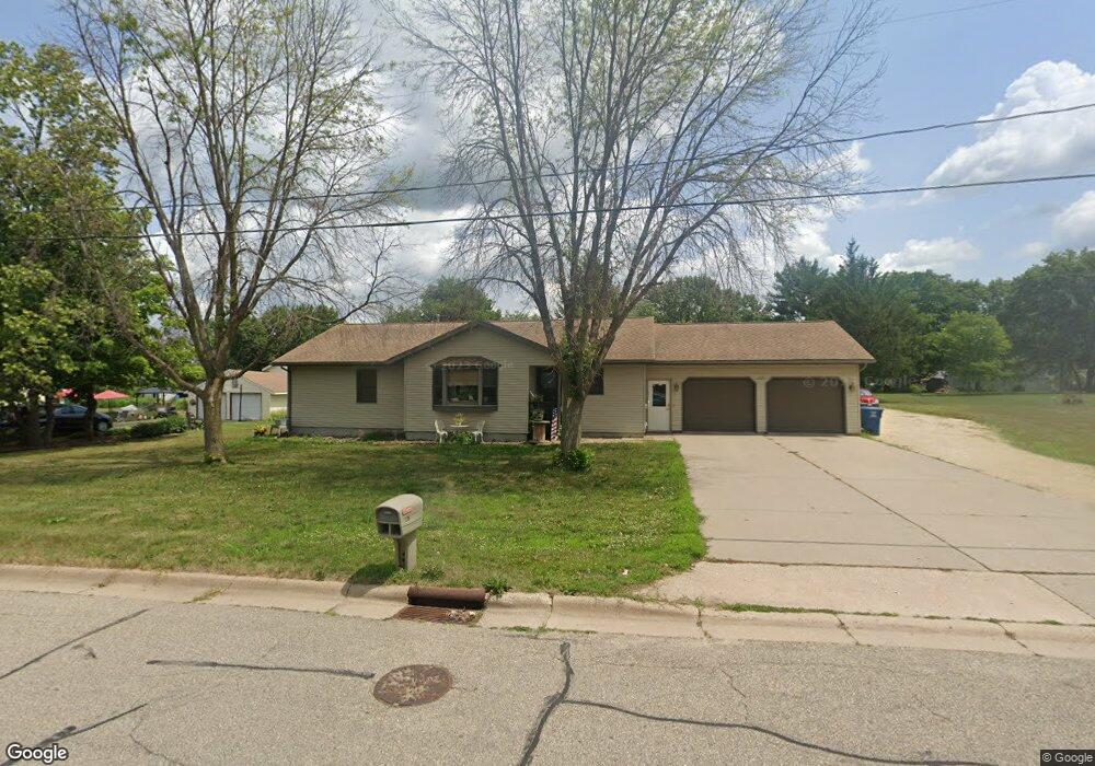
239 Spates Ave Red Wing, MN 55066
Estimated Value: $385,000 - $429,726
3
Beds
4
Baths
1,564
Sq Ft
$263/Sq Ft
Est. Value
About This Home
This home is located at 239 Spates Ave, Red Wing, MN 55066 and is currently estimated at $411,182, approximately $262 per square foot. 239 Spates Ave is a home located in Goodhue County with nearby schools including Burnside Elementary School, Sunnyside Elementary School, and Twin Bluff Middle School.
Ownership History
Date
Name
Owned For
Owner Type
Purchase Details
Closed on
Jun 11, 2021
Sold by
Boigenzahn Jeffery E and Boigenzahn Margo D
Bought by
Fleming Nathaniel G and Fleming Julie A
Current Estimated Value
Home Financials for this Owner
Home Financials are based on the most recent Mortgage that was taken out on this home.
Original Mortgage
$248,000
Outstanding Balance
$224,533
Interest Rate
2.9%
Mortgage Type
New Conventional
Estimated Equity
$186,649
Purchase Details
Closed on
Jan 19, 2016
Sold by
Boigenzahn Jeffery E and Boigenzahn Margo D
Bought by
Boigenzahn Jeffery E and Bolgenzahn Margo D
Create a Home Valuation Report for This Property
The Home Valuation Report is an in-depth analysis detailing your home's value as well as a comparison with similar homes in the area
Home Values in the Area
Average Home Value in this Area
Purchase History
| Date | Buyer | Sale Price | Title Company |
|---|---|---|---|
| Fleming Nathaniel G | $310,000 | Heritage Title | |
| Boigenzahn Jeffery E | -- | None Available | |
| Fleming Nathaniel Nathaniel | $310,000 | -- |
Source: Public Records
Mortgage History
| Date | Status | Borrower | Loan Amount |
|---|---|---|---|
| Open | Fleming Nathaniel G | $248,000 | |
| Closed | Fleming Nathaniel Nathaniel | $248,000 |
Source: Public Records
Tax History Compared to Growth
Tax History
| Year | Tax Paid | Tax Assessment Tax Assessment Total Assessment is a certain percentage of the fair market value that is determined by local assessors to be the total taxable value of land and additions on the property. | Land | Improvement |
|---|---|---|---|---|
| 2025 | $6,260 | $473,800 | $67,500 | $406,300 |
| 2024 | $6,260 | $466,100 | $67,500 | $398,600 |
| 2023 | $6,012 | $429,700 | $67,500 | $362,200 |
| 2022 | $4,506 | $390,600 | $67,500 | $323,100 |
| 2021 | $4,194 | $309,200 | $67,500 | $241,700 |
| 2020 | $4,164 | $293,200 | $67,500 | $225,700 |
| 2019 | $4,174 | $273,400 | $67,500 | $205,900 |
| 2018 | $3,398 | $276,900 | $67,500 | $209,400 |
| 2017 | $3,322 | $243,600 | $67,500 | $176,100 |
| 2016 | $3,056 | $241,400 | $67,500 | $173,900 |
| 2015 | $2,940 | $233,700 | $67,500 | $166,200 |
| 2014 | -- | $223,300 | $67,500 | $155,800 |
Source: Public Records
Map
Nearby Homes
- 168 Johnson Ave
- 135 Kingswood Dr
- 980 Aurora Cir
- 853 Aurora Cir
- 912 Aurora Cir
- 4739 Big Sky Ct
- 453 Spring Creek Rd S
- 4786 Mount Hood Ln
- 906 Snowbird Dr
- 921 Snowbird Dr
- 910 Snowbird Dr
- 914 Snowbird Dr
- 1056 Birch Ave
- 4958 Chalet Ct
- 4976 Chalet Ct
- 3557 Skyline Dr
- 3560 Graves Dr
- 131 Rose Ave
- 186 Sargent Dr
- 128 Charles Ave