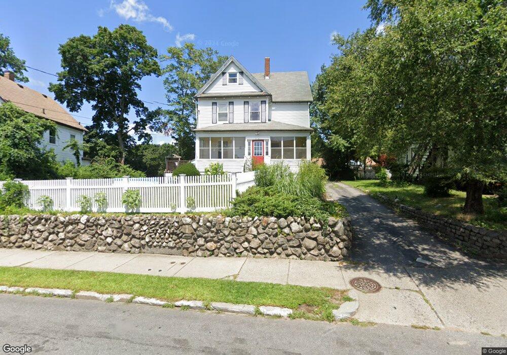
239 Webster St West Newton, MA 02465
West Newton NeighborhoodEstimated Value: $960,000 - $1,113,000
3
Beds
2
Baths
1,436
Sq Ft
$719/Sq Ft
Est. Value
About This Home
This home is located at 239 Webster St, West Newton, MA 02465 and is currently estimated at $1,032,578, approximately $719 per square foot. 239 Webster St is a home located in Middlesex County with nearby schools including C.C. Burr, F.A. Day Middle School, and Newton North High School.
Ownership History
Date
Name
Owned For
Owner Type
Purchase Details
Closed on
Jun 27, 2008
Sold by
Pelis James M and Pelis Jennifer
Bought by
Pelis Jennifer R
Current Estimated Value
Home Financials for this Owner
Home Financials are based on the most recent Mortgage that was taken out on this home.
Original Mortgage
$531,606
Outstanding Balance
$342,955
Interest Rate
6.07%
Mortgage Type
Purchase Money Mortgage
Estimated Equity
$689,623
Purchase Details
Closed on
Oct 1, 2003
Sold by
Cantor Debra S and Beede James L
Bought by
Pelis James M and Pelis Jennifer R
Home Financials for this Owner
Home Financials are based on the most recent Mortgage that was taken out on this home.
Original Mortgage
$322,700
Interest Rate
6.25%
Mortgage Type
Purchase Money Mortgage
Purchase Details
Closed on
Jul 15, 1998
Sold by
Hurwitz Marilyn L
Bought by
Cantor Debra S and Beede James L
Home Financials for this Owner
Home Financials are based on the most recent Mortgage that was taken out on this home.
Original Mortgage
$238,000
Interest Rate
6.98%
Mortgage Type
Purchase Money Mortgage
Create a Home Valuation Report for This Property
The Home Valuation Report is an in-depth analysis detailing your home's value as well as a comparison with similar homes in the area
Home Values in the Area
Average Home Value in this Area
Purchase History
| Date | Buyer | Sale Price | Title Company |
|---|---|---|---|
| Pelis Jennifer R | -- | -- | |
| Pelis James M | $470,000 | -- | |
| Cantor Debra S | $280,000 | -- |
Source: Public Records
Mortgage History
| Date | Status | Borrower | Loan Amount |
|---|---|---|---|
| Open | Pelis Jennifer R | $531,606 | |
| Previous Owner | Pelis James M | $322,700 | |
| Previous Owner | Cantor Debra S | $238,000 |
Source: Public Records
Tax History
| Year | Tax Paid | Tax Assessment Tax Assessment Total Assessment is a certain percentage of the fair market value that is determined by local assessors to be the total taxable value of land and additions on the property. | Land | Improvement |
|---|---|---|---|---|
| 2025 | $7,658 | $781,400 | $741,500 | $39,900 |
| 2024 | $7,404 | $758,600 | $719,900 | $38,700 |
| 2023 | $6,994 | $687,000 | $547,100 | $139,900 |
| 2022 | $6,692 | $636,100 | $506,600 | $129,500 |
| 2021 | $6,457 | $600,100 | $477,900 | $122,200 |
| 2020 | $6,265 | $600,100 | $477,900 | $122,200 |
| 2019 | $6,088 | $582,600 | $464,000 | $118,600 |
| 2018 | $5,796 | $535,700 | $420,800 | $114,900 |
| 2017 | $5,620 | $505,400 | $397,000 | $108,400 |
| 2016 | $5,375 | $472,300 | $371,000 | $101,300 |
| 2015 | $5,125 | $441,400 | $346,700 | $94,700 |
Source: Public Records
Map
Nearby Homes
- 8 Curve St
- 0 Duncan Rd Unit 72925240
- 7 Sharon Ave Unit 7
- 160 Pine St Unit 15
- 160 Pine St Unit 12
- 1917 Commonwealth Ave Unit 1917
- 194 Auburn St
- 194 Auburn St Unit 2
- 8 Elm St Unit 8
- 16 Elm St Unit 16
- 2 Elm St Unit 2
- 106 River St Unit 18
- 214 River St Unit 214
- 383 Cherry St Unit 383
- 14 Cottage Place Unit 14
- 226 Auburn St Unit 226
- 27 Tennyson Rd
- 101-103 Lexington St
- 7 Westland Terrace
- 232 Melrose St Unit 2
- 235 Webster St
- 245 Webster St
- 15 Larkin Rd
- 254-256 Webster St
- 231 Webster St
- 231 Webster St Unit 1
- 231 Webster St Unit 2
- 21 Larkin Rd
- 3 Crescent St
- 3 Crescent St
- 3 Crescent St
- 3A Crescent St
- 3 Crescent St
- 9 Larkin Rd
- 25 Larkin Rd
- 251 Webster St
- 251 Webster St Unit 1
- 251 Webster St Unit 2
- 3 Crescent St
- 250 Webster St
Your Personal Tour Guide
Ask me questions while you tour the home.