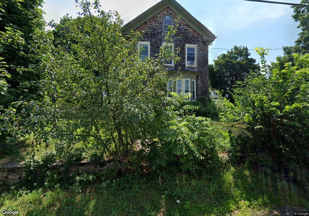
24 Atherton Ave Roslindale, MA 02131
Roslindale NeighborhoodEstimated Value: $924,874 - $1,130,000
2
Beds
2
Baths
2,196
Sq Ft
$447/Sq Ft
Est. Value
About This Home
This home is located at 24 Atherton Ave, Roslindale, MA 02131 and is currently estimated at $980,719, approximately $446 per square foot. 24 Atherton Ave is a home located in Suffolk County with nearby schools including Brooke Charter School Roslindale, Sacred Heart STEM School, and St. Clare High School.
Ownership History
Date
Name
Owned For
Owner Type
Purchase Details
Closed on
Mar 6, 2017
Sold by
Carroll Christopher B
Bought by
Carroll Jennifer L and Barron James D
Current Estimated Value
Purchase Details
Closed on
Aug 4, 2014
Sold by
Sheehan John M
Bought by
Sheehan Doris M
Purchase Details
Closed on
May 12, 2014
Sold by
Carroll Christopher B
Bought by
Sheehan John M
Purchase Details
Closed on
May 9, 2014
Sold by
Sheehan Doris M
Bought by
Carroll Christopher B
Purchase Details
Closed on
Oct 24, 2006
Sold by
Johnson Pearl W
Bought by
Carroll Christopher B
Create a Home Valuation Report for This Property
The Home Valuation Report is an in-depth analysis detailing your home's value as well as a comparison with similar homes in the area
Home Values in the Area
Average Home Value in this Area
Purchase History
| Date | Buyer | Sale Price | Title Company |
|---|---|---|---|
| Carroll Jennifer L | -- | -- | |
| Sheehan Doris M | -- | -- | |
| Sheehan John M | -- | -- | |
| Carroll Christopher B | $150,000 | -- | |
| Carroll Christopher B | -- | -- |
Source: Public Records
Tax History Compared to Growth
Tax History
| Year | Tax Paid | Tax Assessment Tax Assessment Total Assessment is a certain percentage of the fair market value that is determined by local assessors to be the total taxable value of land and additions on the property. | Land | Improvement |
|---|---|---|---|---|
| 2025 | $8,502 | $734,200 | $325,800 | $408,400 |
| 2024 | $7,602 | $697,400 | $290,200 | $407,200 |
| 2023 | $6,997 | $651,500 | $271,100 | $380,400 |
| 2022 | $6,565 | $603,400 | $251,100 | $352,300 |
| 2021 | $6,015 | $563,700 | $241,400 | $322,300 |
| 2020 | $5,506 | $521,400 | $233,900 | $287,500 |
| 2019 | $5,229 | $496,100 | $188,700 | $307,400 |
| 2018 | $5,826 | $555,900 | $188,700 | $367,200 |
| 2017 | $5,556 | $524,600 | $188,700 | $335,900 |
| 2016 | $5,294 | $481,300 | $188,700 | $292,600 |
| 2015 | $4,900 | $404,600 | $164,400 | $240,200 |
| 2014 | $4,655 | $370,000 | $169,100 | $200,900 |
Source: Public Records
Map
Nearby Homes
- 65 Birch St Unit 3
- 142 Birch St
- 142 Birch St Unit 1
- 142 Birch St Unit 2
- 80 Roslindale Ave Unit 3
- 112 Roslindale Ave Unit 2
- 55 Metropolitan Ave
- 25 Crandall St
- 69 Metropolitan Ave
- 67 Cummins Hwy Unit 101
- 142 Metropolitan Ave Unit A
- 250 Poplar St Unit 1
- 103 Belgrade Ave Unit 2
- 15 S Fairview St Unit 3
- 0 Averton St
- 34 Averton St
- 17 Metcalf St
- 108 Florence St Unit 3
- 108 Florence St Unit 1
- 108 Florence St Unit 4
- 22 Atherton Ave Unit 1
- 20 Atherton Ave Unit 2
- 20 Atherton Ave Unit 1
- 25 Cliftondale St Unit 27
- 11 Cliftondale St
- 11 Cliftondale St Unit 2
- 29 Cliftondale St Unit 31
- 41 Albano St
- 25 Atherton Ave
- 31 Cliftondale St
- 31 Cliftondale St
- 31 Cliftondale St Unit 31
- 18 Atherton Ave
- 18 Atherton Ave Unit 2
- 31 Albano St
- 16 Atherton Ave Unit 18
- 16 Atherton Ave Unit 18
- 16 Atherton Ave Unit 1
- 16 Atherton Ave Unit 16
- 45 Albano St